
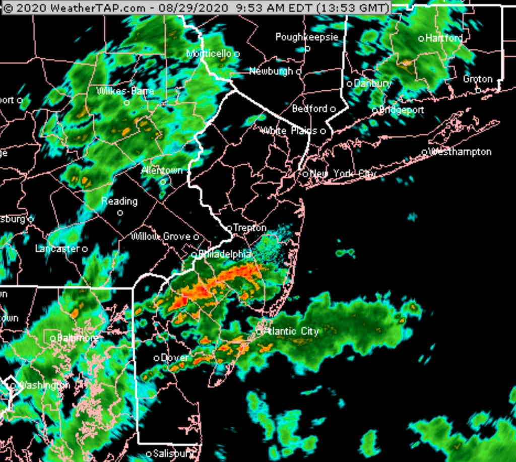
The heaviest rain is falling in the areas of the highest PWAT, as posted last night. Other areas have scattered showers.
The latest model blend (NBM) has the highest probability of rain today just to the south of Philadelphia, but all areas have elevated chances —
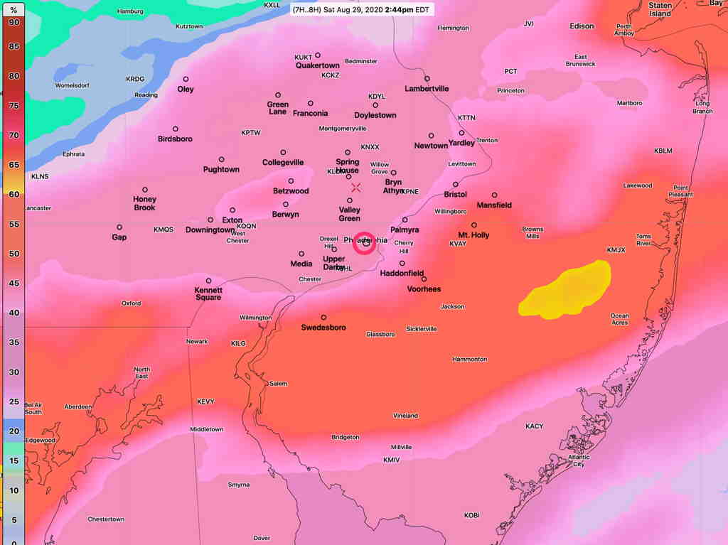
Note that these are 1-hour probabilities; anything greater than 25% is meaningful.
Still expecting some partial clearing and breaks in the overcast during the 2-5 PM time frame. However any breaks/sun may initiate thunderstorm development due to a highly unstable atmosphere.