Saturday will have some cloudiness in the early morning, then sunny and cold. High temps an unseasonable 38 (NBM) or 42 (EKDMOS). Fairly cold Saturday night with temps in the 20s.
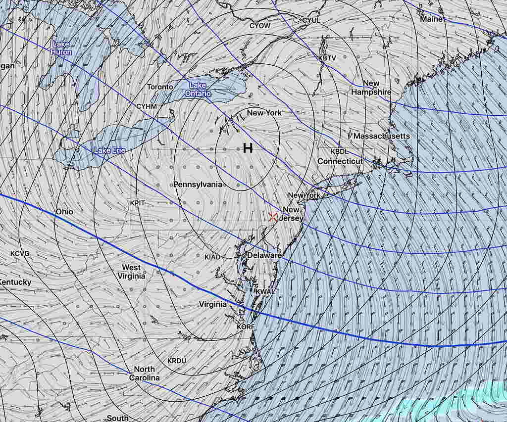
GFS Model forecast 7 PM Saturday. Click for larger image
Sunday may also start with some clouds in the morning, but sunshinse by late morning through much of the afternoon. High pressure moves to our east allowing a return flow of somewhat milder air. High 43 (NBM) or 47 (EKDMOS).
Rain on Monday.
A significant chill-down expected by the middle of next week as a highly amplified pattern develops over the US.
[su_note note_color=”#defcdc”]Mon 11:40 AM Update: This morning’s other models (WRF-NMM, WRF-ARW and the GFS) all show barely a coating to a fraction of an inch of snow accumulating by the end of this storm around midnight in the immediate PHL area and adjacent counties. The HIREF shows a stronger snow shower possible about 6 PM, not substantially adding to the total.
As I mentioned last night, the new GFS probably did the best with this storm overall. The much-touted European ECMWF seems to have over-forecast the snowfall here. [/su_note]
…from earlier this morning—
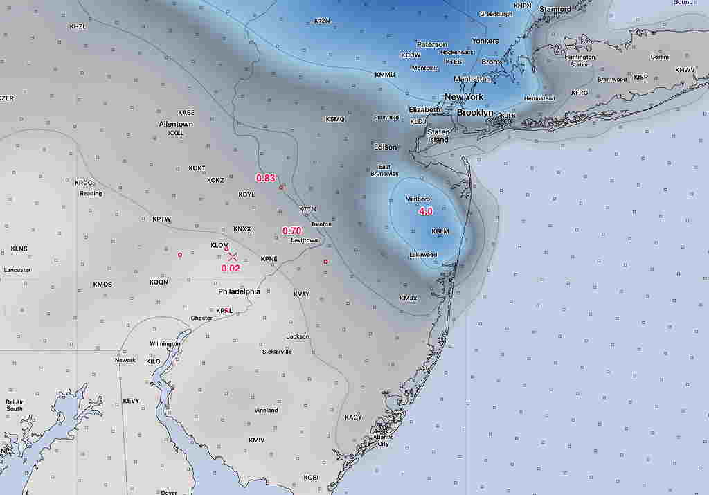
I was able to review the latest NAM, NAM-NEST and RAP. All are consistent with the coating to an inch for Philadelphia and surrounding counties. Below is the NAM snow depth forecast for late this evening—
NAM Snow Depth forecast (in inches) for midnight Monday. (click for larger image) Most areas much less than an inch around here.