WEATHER FORECAST FOR HALLOWEEN EVENING

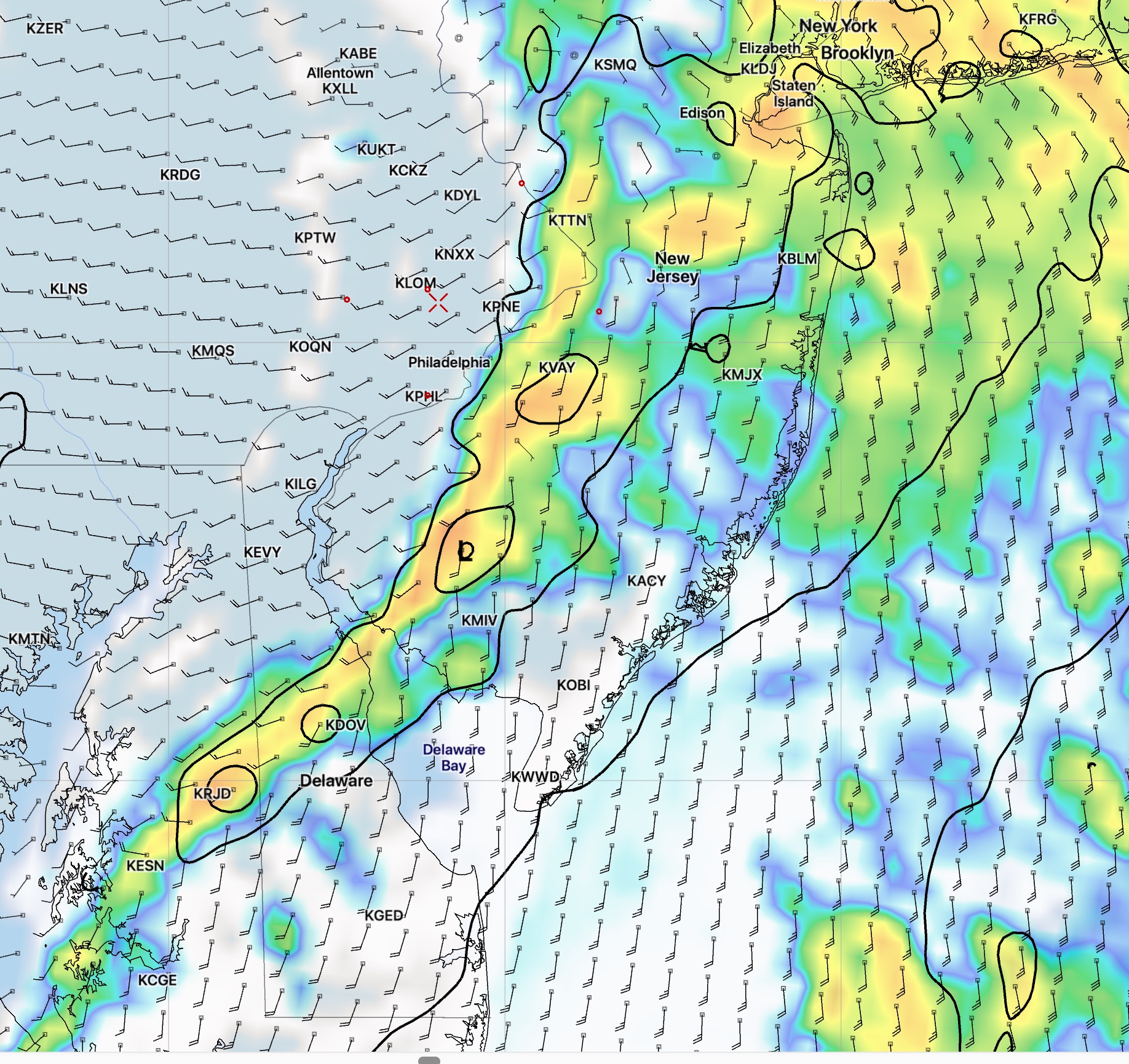
[su_note note_color=”#d9f2da”]Update Wed 10:40 PM: Forecast for a dry period Thursday evening is still on track, based on the latest NAM Nest high resolution model that just became available. Here’s the latest precipitation forecast for 8pm Thursday.

NAM Nest forecast

[/su_note]
From earlier this evening

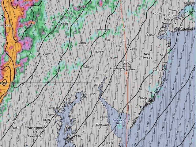
[su_note note_color=”#d9f2da”]Update Wed 8 PM: Today’s models are essentially unchanged. A break in the rain still expected between 6 and 10 pm Thursday evening. The models are showing windy conditions and mild temperatures[/su_note].

Earlier today…

[su_note note_color=”#d9f2da”]Update Wed 8 AM: Last night’s models continue to show a relative dry slot between 6 PM and 10 PM for Philadelphia and areas east for Halloween Trick or Treat.   It will be a small, tight window of opportunity, since it may be raining as late as 5-6 PM before the break in the rain occurs and the heavy rain moves in 10-11 PM.
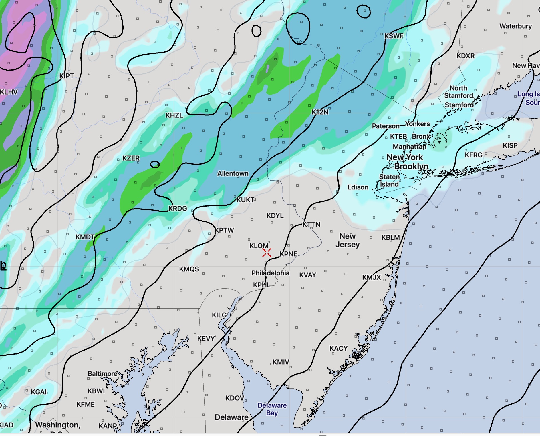
High Resolution WRF-ARW 1 hour precip forecast for 8 PM Thursday evening

[/su_note]

from Monday:

No doubt, everyone has heard that Thursday (Halloween) will be a wet day, but the question is, will it be raining during the Trick-or-Treat evening hours?

In the weather world, Thursday evening is the distant future, but I thought I’d chime in on the current model forecasts for Philadelphia on Thursday evening.

The models are in surprising agreement right now that the early evening hours will have a hiatus in the rain. 

A warm front moves through earlier in the day Thursday with rain and showers. Once the warm front passes, very mild temperatures (near 70) are possible late afternoon and early evening on Thursday.

Right now, Thursday evening appears to be in the relative dry slot after the warm front passes and before the cold front moves in about 11 PM.

For a change of pace, here’s the current CMC Canadian Global Model  forecast.  (The NAM and the GFS show similar forecasts for the early Thursday evening.)

CMC Global Forecast for 8 PM Thursday.

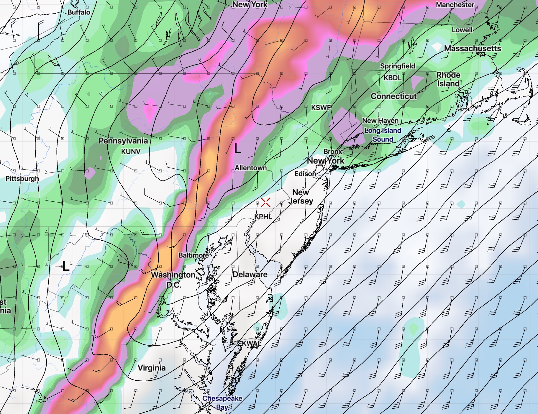
Again, a timing change of the frontal passage of just a few hours will render this optimistic forecast outlook meaningless.

SUNDAY WEATHER UPDATE

[su_note note_color=”#d9f2da”]Update: Sun AM  — The models still indicating a faster moving system.  Frontal passage about 12-1 PM  with high wind gusts.  Total rainfall (QPF) has fallen to about 0.5 inches or so, more far north and west.  Clouds break for some sun, possibly as early as 3-4 PM.   High temps near 74!  [/su_note]

[su_note note_color=”#d9f2da”]Update:  Simulated Radar, clouds and pressure for 2 PM  from this morning’s high resolution WRF-ARW model—

WRF-ARW high resolution simulated radar depiction for Sunday 2 PM showing rain east of Philadelphia

Rain ends and clouds clear early to mid afternoon.

[/su_note]


from last night:

As mentioned yesterday, only the statistical models suggested the possibility of light showers (that occurred) Saturday afternoon.  Looking back at this morning’s models, only the NAM Nest model showed the showers. I don’t think I would have changed the forecast based on that one model.  It’s interesting that the other models really didn’t pick that up.

Speaking of today’s models, the timing for tomorrow’s rain has changed somewhat— the rain moves in earlier on Sunday: 5-8 AM and tapers off between 2-4 PM. We may even see some sun late in the afternoon tomorrow.  Rain QPF is coming in lower at about 1 inch or less.

The GFS is still showing high wind gusts when the front moves through late morning into early afternoon.


The cold weather I mentioned in recent posts may be delayed until next weekend. Halloween is looking very wet.

WEEKEND WEATHER FORECAST

[su_note note_color=”#d9f2da”]Update Sat 7AM:  Addition to the forecast below— Sunday will be WINDY.  The GFS shows wind gusts of over 40 mph with the frontal approach late morning. [/su_note]

A moisture-laden low pressure system which formed in the Gulf of Mexico will approach the region over the weekend.  All the models, are in good agreement with this system.

A warm front associated with this system will approach on Saturday.

Saturday will begin will high to mid-level cloudiness, similar to what we had today—Friday, associated with this warm front.  Some sunshine will be possible through this thin but increasingly thick cloud layer.  Full cloudy conditions by Saturday mid afternoon.  High temp 68.

Some statistical models are maintaining a chance of showers with this front in the late afternoon Saturday, but the main models keep the showers to our far north and west.

The main low pressure system and it’s associated cold front move through on Sunday.  Rain starts early and ends later in the afternoon or evening. Heavy rain is predicted by most models, with QPF values between 1 and 1.5 inches.   It will be mild, with high temps near 71.