
[su_note note_color=”#d9f2da”]Update: Sun AM — The models still indicating a faster moving system. Frontal passage about 12-1 PM with high wind gusts. Total rainfall (QPF) has fallen to about 0.5 inches or so, more far north and west. Clouds break for some sun, possibly as early as 3-4 PM. High temps near 74! [/su_note]
[su_note note_color=”#d9f2da”]Update: Simulated Radar, clouds and pressure for 2 PM from this morning’s high resolution WRF-ARW model—
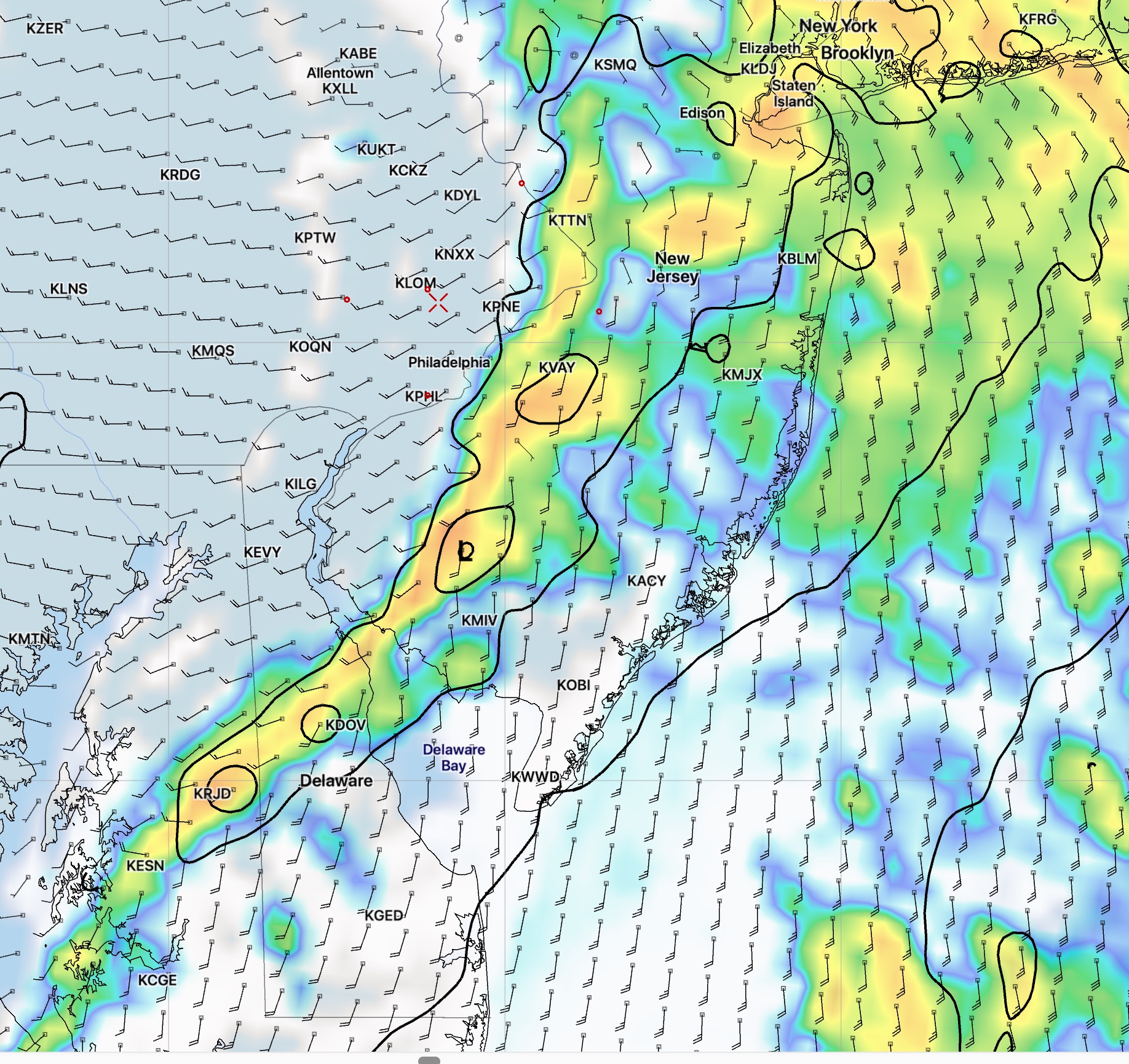
Rain ends and clouds clear early to mid afternoon.
[/su_note]
from last night:
As mentioned yesterday, only the statistical models suggested the possibility of light showers (that occurred) Saturday afternoon. Looking back at this morning’s models, only the NAM Nest model showed the showers. I don’t think I would have changed the forecast based on that one model. It’s interesting that the other models really didn’t pick that up.
Speaking of today’s models, the timing for tomorrow’s rain has changed somewhat— the rain moves in earlier on Sunday: 5-8 AM and tapers off between 2-4 PM. We may even see some sun late in the afternoon tomorrow. Rain QPF is coming in lower at about 1 inch or less.
The GFS is still showing high wind gusts when the front moves through late morning into early afternoon.
The cold weather I mentioned in recent posts may be delayed until next weekend. Halloween is looking very wet.