High pressure will gradually move off to the northeast over this weekend.
On Saturday, it will be mostly sunny in the morning. A flow of milder air will move in aloft on Saturday afternoon, causing some mid-level cloudiness during the afternoon hours. High temperatures 58-60. It will still be breezy.
Still cold Saturday night with lows in the mid 30s.
Sunday will be mostly sunny and milder. High temperatures 61-63.
[su_note note_color=”#d9f2da”]Forecast Update: Sunday will be sunny and milder. High temperatures 65-67[/su_note]
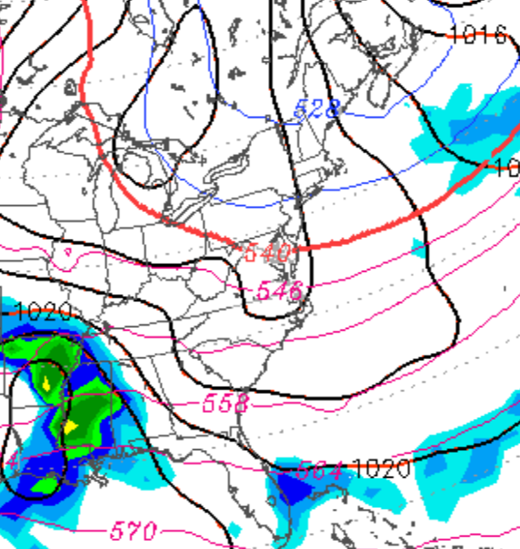
A persistent dip in the jet stream will be with us through this coming weekend. Temperatures in the 50s are to be expected, despite average highs for the period near 66!
No precipitation is currently expected. A dry, cool and sunny weekend, as it appears right now.
The southwesterly flow of above average temperatures will be with us on Saturday, with mostly sunny skies and temperature highs of 83-85..
Some cloudiness moves in late Saturday afternoon as a cold front drops down from the north.
Winds become easterly Saturday night and clouds and scattered light showers with drizzle are possible Sunday morning although the heavier rains don’t move in until later in the afternoon on Sunday.
There remains uncertainty about high temperatures on Sunday. The Model Output statistics have highs around 58, but the experimental models continue to show a wide range with highs likely being much cooler. (48-50 is possible) It becomes windy during the day.
Heavy rains and windy Sunday night into early Monday morning.