The models have been all over the place this winter —There’s been a general lack of continuity with forecasts. Just a few days ago, it appeared that we would not have any chance of snow through the end of February. How things have suddenly changed.
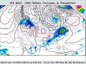
After a warmup on Thursday and early Friday, a frontal boundary moves through on Friday allowing cold air to return to our area. A low pressure system is may develop along the mid-Atlantic coast during the day and evening on Saturday resulting in a possible significant snowfall by Sunday morning. Currently, QPF values are as high as 0.60 inches water with this afternoon’s NAM, but that looks high.
It’s important to note that several forecasted potential storms have not panned out this winter. The GFS and the NAM have been slow to pick up this possibility, although the EMCWF (European) and Canadian models have been suggesting the possibility for a few days. There remains significant spread in timing, position and intensity among the models, so confidence in predicting any feature of this storm is below average at this time. Furthermore, the earlier GFS model had the rain-snow line right near PHL, while the latest NAM has trended much colder, implying more snow. Additionally, the storm is a fast mover, likely reducing precip totals.
I’ll keep my eye on things and will update over the next few days.

