
#Phillywx #Philadelphia #weather #PAwx
A very different rain storm than had been forecast two days ago.
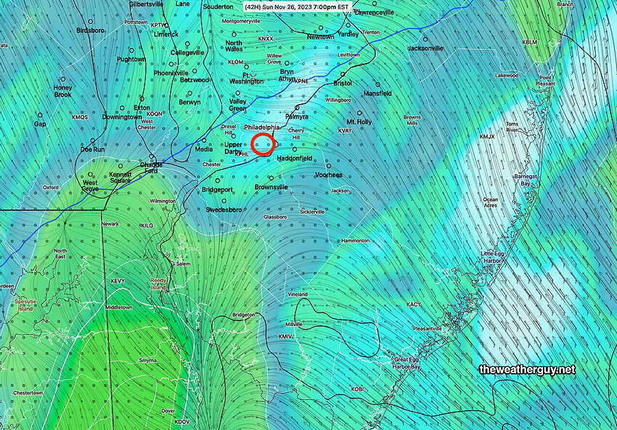
Update Sun 11/26 @ 3:58 PM — The latest HRRR and NAM-NEST have rainfall amounts during tonight’s Eagles game significantly higher than had been forecast—
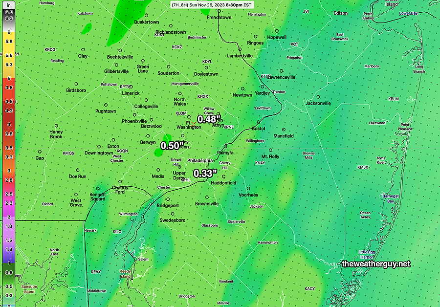
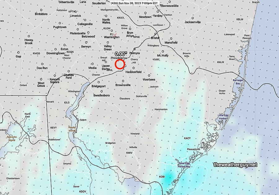
Here’s the total rainfall forecast through midnight—
Sunday Forecast Update
Update Sun 11/26 @ 9:24 AM — No change from the forecast update last night. An earlier start of the rain, and much heavier than previous model guidance had forecast. A faster system that will leave around or before midnight, but not after almost 0.75″ of rain falling!
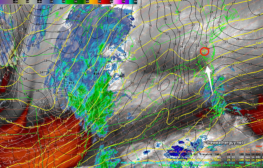
Current Radar/Water Vapor at 9:15 AM—
Here’s my original forecast from Friday evening:
Cloudy early, the some sun towards noon, becoming cloudy again during the afternoon. Light rain moves in about 6-8 PM. Breezy.
High temperature 49º ( NBM model— location Blue Bell, PA)
High temperature 51º ( NBM model— location Philadelphia, PA)
uncertainty is about average with a ± 2.0º sd
Here’s my latest forecast for today:
Cloudy early, then some sun towards late morning, becoming cloudy again just around noon. Light rain moves in between 3-4 PM and becomes heavier during the second half of the Eagles game. Rain departs about 11 PM to midnight.
High temperature 49º ( NBM model— location Blue Bell, PA)
High temperature 52º ( NBM model— location Philadelphia, PA)
uncertainty is about average with a ± 1.8º sd
Winds breezy and gusty up to 25 mph around 7 PM
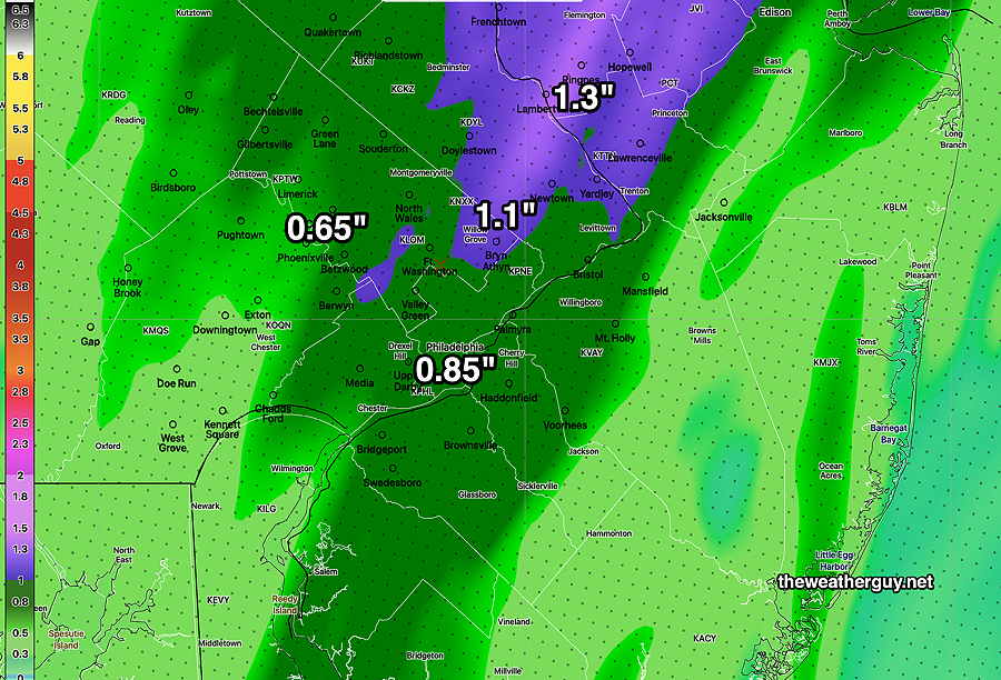
Here’s the latest, NBM 12z forecast total rainfall by midnight—
Sunday Forecast Update
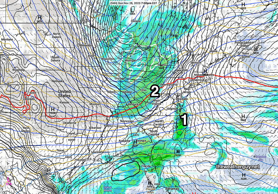
Update Sat 11/25 11:18 PM — As mentioned this morning, there was a shift in the forecast towards an earlier start of the rain but the GFS became what was possibly an outlier. Well, this afternoon, and this evening, the models converged on an earlier start with some light rain as early as 3-4 PM. The HRDPS has been the most consistent and it’s forecasting some significant rain by the Eagles second half.
Rain likely after the Eagles Game Sunday
Update Sat 11/25 @ 11:12 AM — A quick update. Our high resolution models have joined the Canadian and European ECMWF with an earlier onset of the rain, 5 PM to 7 PM Sunday, and somewhat heavier. This morning’s GFS, just available, has moved in the opposite direction: a more eastward track of the storm, a later start to the rain, and less overall rainfall for Philadelphia. So high uncertainty.
Update Sat 11/25 @ 09:17 AM —
There remains timing issues with the onset of the light rain late Sunday afternoon/evening. The ECMWF and Canadian HRDPS continue with an earlier onset of the light rain, about 4-7 PM. Our NOAA models (GFS, HRRR, HREF) show a later start, after 8 PM. I’m leaning towards a later start, but this forecast is lower than average confidence.
Either way, any rainfall during the game should be light, on the order of 0.01″ – 0.03″ inches or so.
The HRDPS has the most rain during the game 0.03″ at 7 PM—
Our NOAA HREF shows 0.00″ at 7 PM —
I’ll provide further updates later.
Previously Posted Fri 8:02 PM —
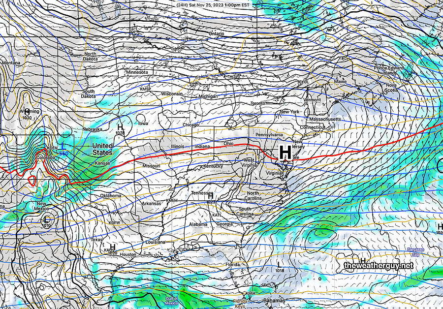
Following a weak cold front that moved through today, colder weather is expected. High pressure directly over us will provide mostly sunny skies on Saturday—
Low pressure will approach from the south on Sunday and very light rain with this system will move in about 6-8 PM Sunday. The rain will become somewhat heavier after midnight, but only about 0.25 inches of rain are expected, somewhat heavier north and east into NJ —
Colder weather expected next week.
Saturday
Mostly sunny and colder. Light winds.
High temperature 41º ( NBM model— location Blue Bell, PA)
High temperature 43º ( NBM model— location Philadelphia, PA)
uncertainty is low with a ± 1.3º sd
Sunday
Cloudy early, the some sun towards noon, becoming cloudy again during the afternoon. Light rain moves in about 6-8 PM. Breezy.
High temperature 49º ( NBM model— location Blue Bell, PA)
High temperature 51º ( NBM model— location Philadelphia, PA)
uncertainty is about average with a ± 2.0º sd