
#weather #paweather #wx #pawx #philadelphia #phillywx
Monday Forecast Update
Update Sun 05/28 @ 6:19 PM— Some cloudiness moved in today as expected and Monday will be similar with high clouds from the city northward and some thicker mid-level cloudiness in areas south of the city.
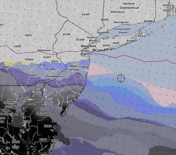
The Jersey shore will be chilly with an easterly wind flow and significant cloudiness from Atlantic City southward. Some sprinkles possible around Cape May and Delaware.
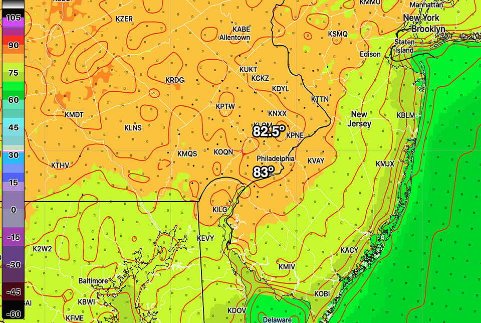
High Temperatures Monday—
Looking ahead, another Omega block takes hold over the coming weekend. No rain expected until June 7th!
Update Sun 05/28 @ 7:18 AM — We may see some periods of clouds from the city and southward today along with periods of sun. Northward of the city, things look good. The Jersey Shore will see cooler temps from an easterly wind and some light showers can’t be ruled out in far southern areas (Cape May) and Delaware later in the day. I’ll update later today.
Previously Posted Fri 3:11 PM —
There haven’t been any postings this past week because I’ve been away, but I’ve been keeping an eye on the models and the local weather remotely.
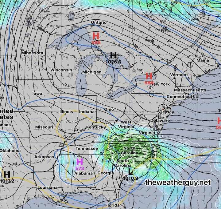
We remain in a very dry pattern with a stalled upper low in the southeastern US and a persistent upper ridge and surface high pressure system blocking any rain from moving into the Philadelphia area from the south. This will continue over the weekend.
The latest NAEFS model forecast for Sunday shows this setup—
This very dry pattern is a bit of a concern, with our still being in May. Our springtime weather is often much wetter. Hopefully things change; if not, I see the likelihood of parched lawns and stressed trees this summer, as we had last summer. Possibly worse.
Anyhow, it may be premature to worry about a “pattern” with just three weeks of minimal rainfall. I guess we’ll see.
The forecast for this weekend is straightforward, provided the system to our south remains to our south. More uncertainty for Monday.
Saturday
Sunny with high thin cirrus cloudiness at times as some moisture from the south tries unsuccessfully to move northward.
High temperature 76.7º sd 1.4.º ( NBM model location Blue Bell, PA)
Sunday
Sunny but a bit more cloudiness southern areas, especially late in the day. Moisture from the south still trying to move northward will cause the cloudiness towards Delaware and South Jersey.
High temperature 78.8º sd 1.8º ( NBM model location Blue Bell, PA)
Monday – Memorial Day
Sticking with the NBM model, some cloudiness just north of the city, becoming sunny in the afternoon. Cloudy in areas south of the city, especially South Jersey and Delaware. Some very light sprinkles are possible in the same areas.
High temperature 81.5º sd 2.1º ( NBM model location Blue Bell, PA)