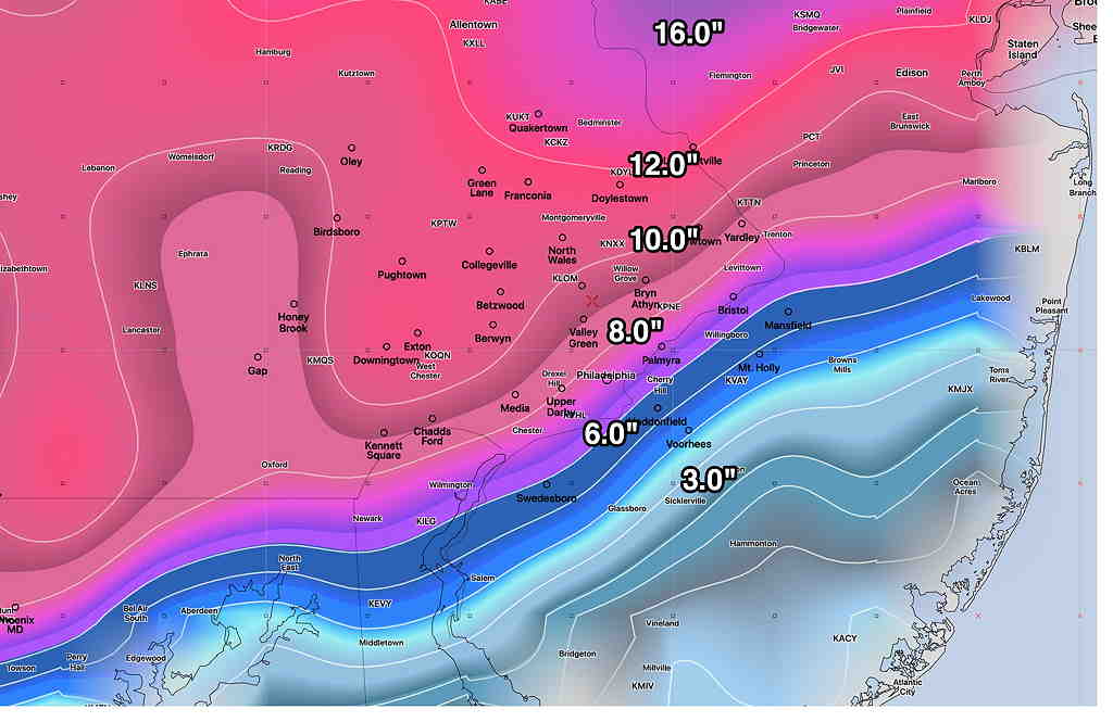
The latest models have become available for the snowstorm forecast for Wednesday afternoon into early Thursday morning. Current timing is that snow starts about 2 PM Wednesday and ends around daybreak Thursday. A significant nor’easter is forecast by most models. The latest GFS snow totals forecast is also representative of the Canadian and ICON models—

However, there has been a re-emergence of a complication that I had mentioned yesterday. The NAM, SREF and NAM-NEST have a wedge of warm air being drawn in at 3000 feet during the peak of the storm Wednesday evening, changing the snow to sleet or a rain-snow mix—

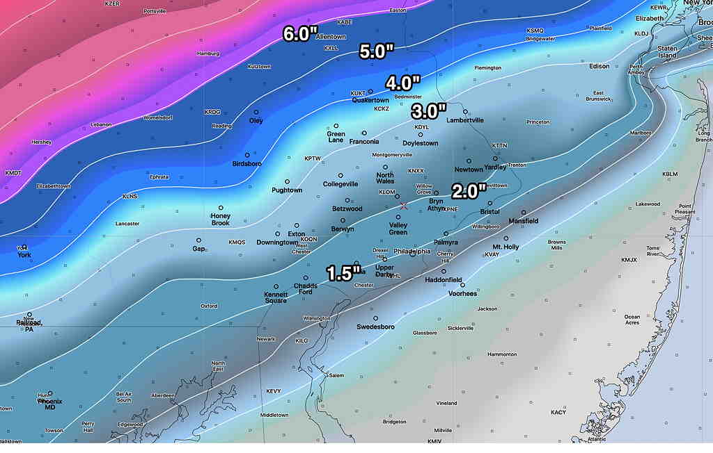
As a result, the NAM and NAM-NEST show snow totals much lower—

So there’s some real differences with the higher resolution models (that are just coming into forecast range) and the GFS, Canadian and current ICON models.
Most higher resolution models only forecast 48-60 hours in advance. They will begin to come into forecast range with this evening’s model runs and certainly by tomorrow late morning. Stay tuned.
