
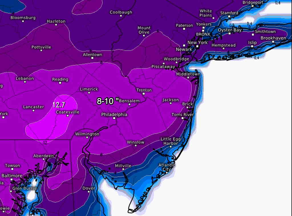
The general trend with today’s models has been for more snow. The ECMWF model has as much as 8-12 inches for our area, but it is on the very high end of the scale right now. I believe the ECMWF, despite its stellar reputation, is over-doing the snow.
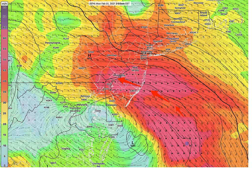
The latest GFS forecast shows significantly less snow, the difference being a further east development and less intensification of the coastal low. The GFS brings warm air in during the storm, with a mix of snow/sleet at times reducing accumulations.
The NAM, Canadian regional GEM and the ECMWF have the snow starting late afternoon/early evening Sunday, while the GFS and model blend (NBM) have some light snow starting earlier in the afternoon Sunday with the warm front.
As mentioned, the storm consists initially of a “warm air advection type snow” on Sunday afternoon from the original low pressure in the Midwest. Then, the bulk of the storm’s precip comes on Monday with the expected secondary coastal low. The Monday time frame still beyond the forecast range of all of the higher resolution models.
Stay tuned.
I’ll update tomorrow morning when we have some newer model data.
from earlier this morning…
Last night’s models have become available. Here’s the breakdown on current model forecasts— The GFS is more disorganized with the secondary low formation off the coast. As a result, the primary low’s circulation continues to bring in milder air in our area through a low level jet circulation instead of having a colder northeast flow from the secondary—
As a result, the GFS has a changeover to rain for some part of the storm in the immediate PHL area and suburbs, keeping the snow accumulations to 1-4 inches.
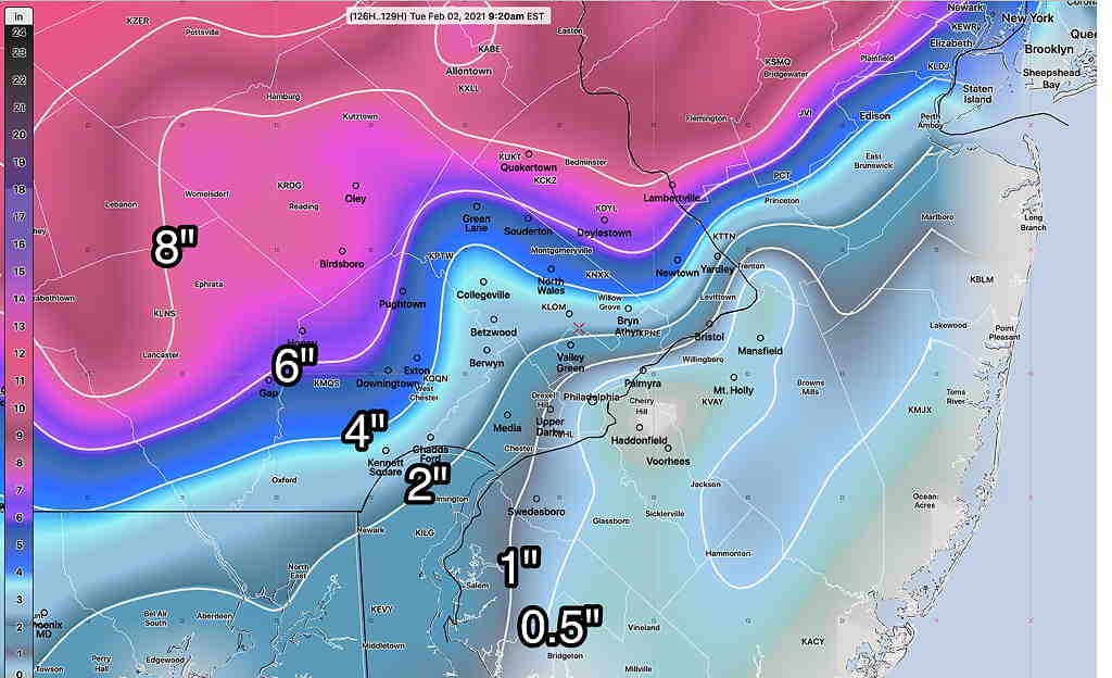
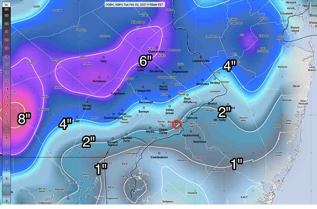
The GFS sequence is snow (Sunday)–> rain mix (Monday morning) –> Snow (Monday afternoon.)
On the other hand, the Canadian CMC-GDPS and European ECMWF have it colder but develop the storm further east and north. The have somewhat different snow totals and for different reasons— the secondary storm is stronger and colder, but is slower to develop and is further east. They don’t show the changeover to rain, but they have less total precip for our immediate area.
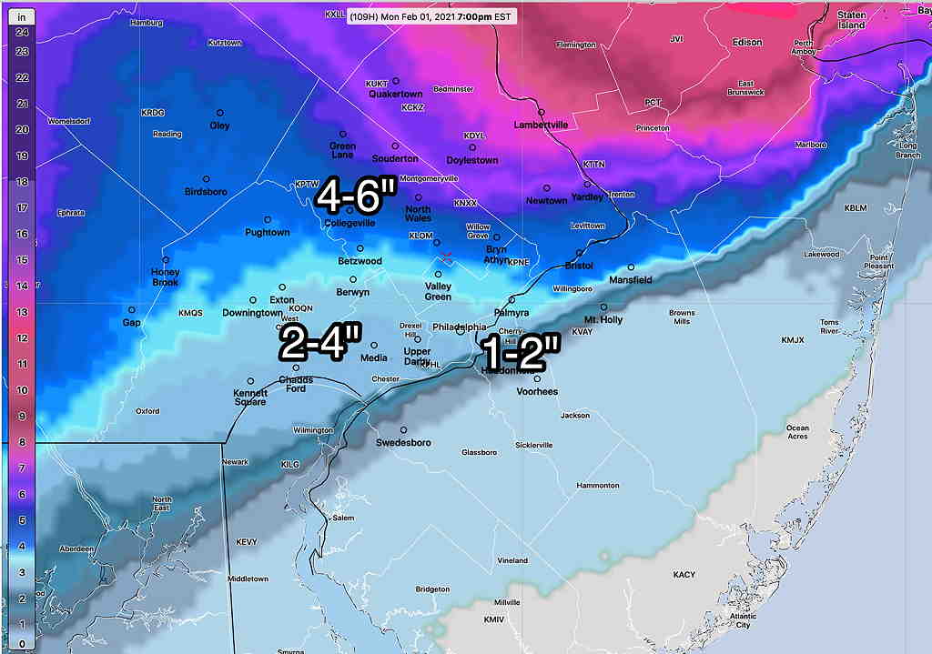
The model blend (NBM) in recent years has been quite good (a recent exception being this past Monday). Here’s its snow totals (average)—
The current takeaway from all of this early prognostication is that the initial warm front snow starts as early as noontime on Sunday. About 1 inch of snow likely by Sunday evening.
The coastal storm, depending upon track and development, affects us on midnight Sunday into Monday with additional accumulations.
Look for more updates later today.