In yesterday’s forecast, I mentioned the possibility of cloudiness for Sunday afternoon. Several of the models have low cloudiness moving in on an easterly flow Sunday afternoon.
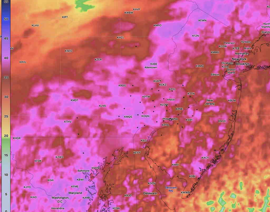
The model blend statistical treatment shows about 40% mean (average) cloudiness, but the standard deviation (a measure of the spread in the models or it can be interpreted as uncertainty) is as high 45-50%, especially west of Philadelphia Sunday afternoon by 3 PM.
NBM Cloudiness Standard deviation at 3 PM (Click on image for a larger view.)
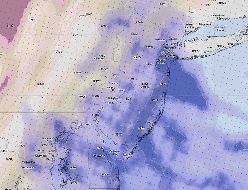
The high resolution NAM-NEST shows low level cloudiness moving in, with a mix of high and middle level clouds further to our west—
NAM NEST cloud forecast (high, medium, low clouds) for 3 PM Sunday. Low level clouds are in blue. (Click on image for a larger view.)
So, there’s uncertainty in the degree of cloudiness for Sunday afternoon, but I’m thinking it might be significant by 3 PM.
High temp Sunday 63.7º with a high confidence of 0.8º standard deviation. (The standard deviation can be thought of as 67% of the time, the temperature will fall with ± 0.8º of the mean temp 63.7º)
The models over-predicted the rain totals by about 1-1.5 inches.
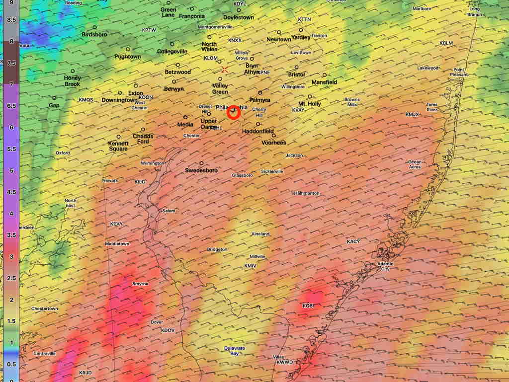
The latest Model Blend (NBM) rain forecast for tonight through Monday night for the Philadelphia area showing 2.0 – 3.5 inches of rain, especially east into NJ—
NBM accumulated rain forecast (Click on image for a larger view.)
Heaviest rain will be Monday morning, but rain should persist through the day into the evening. Wind gusts 35-40 mph possible.
The models are again holding back the rain until late afternoon.
Based on the latest model runs, very light scattered sprinkles are possible 3-5 PM today in the immediate Philadelphia area, but the main area of rain arrives between 5-7 PM, moving up from south.