Update 6: 15 PM- This afternoon’s GFS has activity moving through earlier, possibly as early as 8 PM -10 PM
This afternoon’s hourly HRRR (High Resolution Rapid Refresh) and RAP (RAPid Refresh) models show substantial increases in available convective energy (CAPE ~ 2400 j/Kg ) and thermodynamic instability (“Lifted Index” -5ºK to -7ºK, which is very unstable) for this evening. Maximum Precipitable water values have increased as well to 1.7″ range.
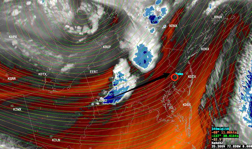
At 4 PM here’s the current satellite water vapor image showing disturbance east of Pittsburgh that will affect us in about 5-7 hours.

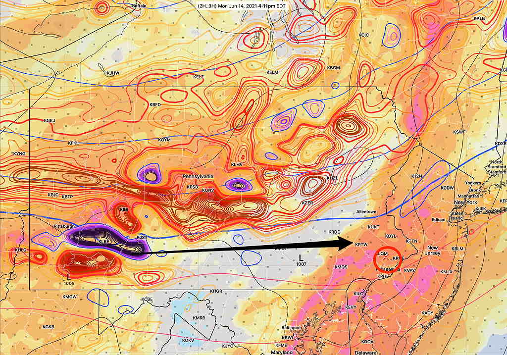
Not coincidentally, the HRRR shows a corresponding strong vorticity maximum/minimum couplet in the same spot—

This upper air disturbance will affect us by 10 PM to 2 AM, although some models are showing the possibility of thunderstorms developing in western suburbs a few hours earlier.
The weather model forecasts have not been too good over the past three days. On Friday, we had much more rain than predicted and on Saturday/Sunday, our area never received the areas of rain that many models had predicted.
We are more likely to see some thunderstorm activity this evening. The models are showing a distinct trough passing through between 6 and 8 PM this evening, yet there is quite a bit of model spread regarding the timing of the showers and thunderstorm. Many show the precipitation occurring behind the trough, anywhere from 5 PM to midnight!
If we continue to get some breaks of sunshine this afternoon, most models show potential energy (CAPE) and thermal instability levels that can produce strong thunderstorms. That said, the amount of precipitable water is not at the level seen with the heavy rains a week ago and it’s not all that clear that we’ll get enough sunshine to ignite strong storm development.
Strong storms a possibility from 5- midnight, but considering the model track record with the current pattern, we’ll have to see. If things clarify, I’ll update.

Thank you for yet another thoroughly lucid and concise explanation of what’s going on weather-wise. You cut through the clutter better than most people (except maybe NOAA and a few others) who get paid to do it. Much appreciated.
You’re welcome! Most of the time, I’m amazed at what the models are able to predict. But, every so often, we go through a stretch where they just can’t seem to do it. This has been one of them.