
#Philadelphia #weather #PAwx
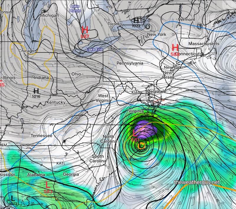
Uncertain Forecast for Francine Remnants
Posted Thursday 09/12/24 @ 8:13 PM — Despite this morning’s forecast for coastal redevelopment of Francine, today’s models are all different with no clear forecast. Perhaps the most consistent forecast is for a poorly defined area of rain to try to move northward as part of an inverted trough. The heavy rain may not make it into Philadelphia. (Wow, what’s new.)
The artificial intelligence ECMWF model has a storm off our coast next Tuesday, but it’s an outlier right now. So no clear forecast.
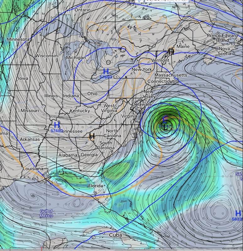
Hurricane Francine Re-forms?
Posted Thursday 09/12/24 @ 8:15 AM —Recent model runs now show the secondary low remnants of Francine off the North Carolina coast re-forming back to a possible hurricane next Tuesday and moving northward, affecting our area next Wednesday or Thursday.
An interesting potential development. Stay tuned.
Blocking High Pressure
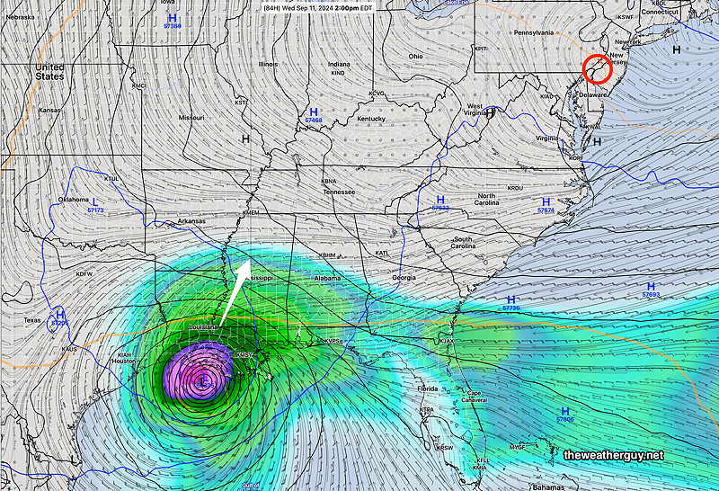
Posted Wednesday 09/11/24 @ 5:18 PM — The models have been in remarkably good agreement regarding the path and fate of hurricane Francine’s energy over the next several days. Blocking high pressure will prevent northward movement of the moisture remnants and been a forecast for secondary low pressure to develop off of the southeast coast. This, too, will be blocked from reaching our area.
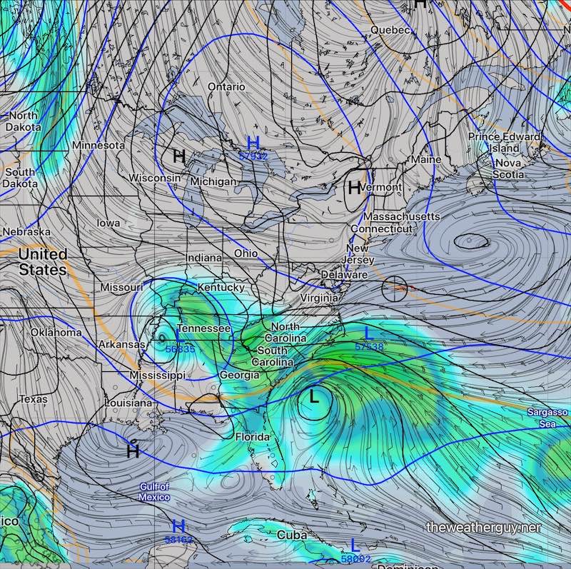
Some moisture will attempt to move northward aloft on Thursday and Friday in the form of high cirrus clouds, but even that moisture will be pushed southward by Saturday.
Posted Monday 09/09/24 @ 5:02 PM — A mid and upper level high pressure system, part of a strong upper ridge, will keep us in sunny skies and gradually warmer temperatures. The upper air configuration shows the current blocked setup—
While hurricane Francine is likely to make landfall in Louisiana late Wednesday, the upper ridge over our area will block the storm from affecting us directly.
Some high clouds may move into South Jersey and Delaware of Friday, but they’re forecast to dissipate by Saturday.
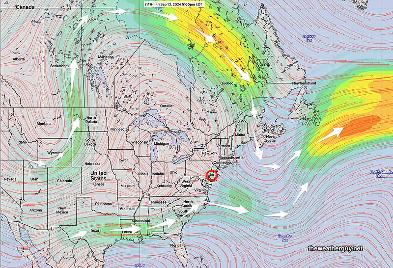
Tropical System Enters the Picture this Week
Originally Posted Sun @ 10:44 AM — —Most of our week will be dominated by large, sprawling high pressure that warms up to above seasonable levels, into the low 80s, by Wednesday. Another beautiful weather week ahead for us.
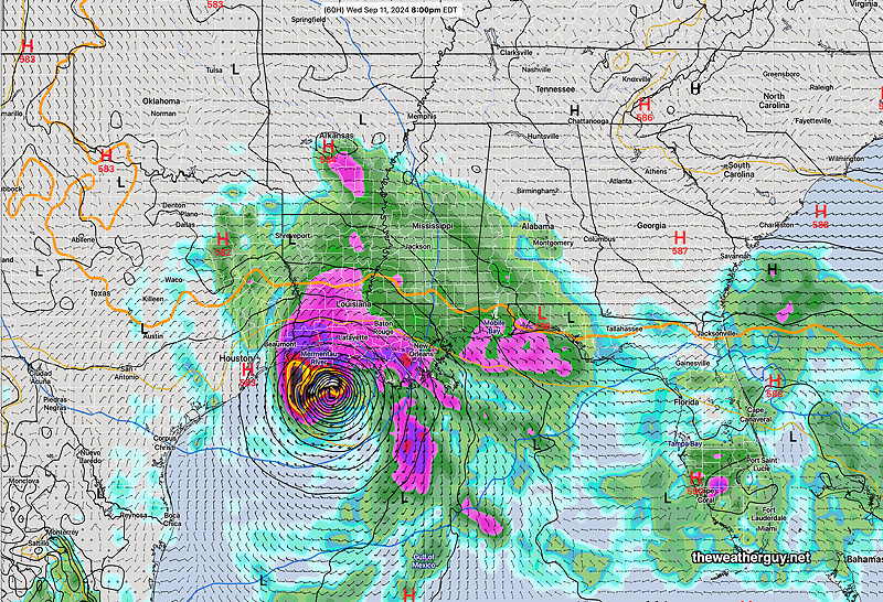
A likely tropical system or hurricane is expected to develop in the western Gulf of Mexico and move towards Louisiana this week. Most models show this developing into a tropical storm or hurricane, likely directly impacting Louisiana with rain with the system extending into western Tennessee The path of the tropical moisture associated with this storm beyond this that point is uncertain.
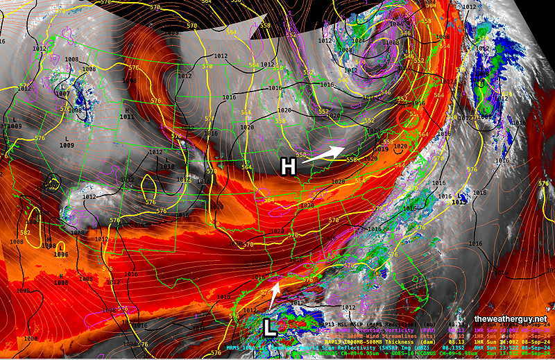
Here’s the current water vapor image—
Here’s the latest ECMWF AI (machine learning- artificial intelligence) model forecast for Wednesday—
The moisture from this storm may never make it into our area, being blocked by high pressure (GFS forecast) or may move up from the south to give us rain sometime next weekend (ECMWF).
Stay tuned.