#Philadelphia #weather #PAwx
Quick Weekend Outlook
Update Fri 3/29 11:16 PM — Too many things happening today, including a router malfunction and home electrical breaker issue. So no Weekend Weather Forecast in its usual form. Just want to say that the showers on Saturday won’t arrive until after 6 PM, despite what I’m hearing on TV.
Weekend Outlook Early Edition
Posted Friday 03/29/24 @ 9:48 AM — Today, Friday will be sunny and quite windy.
The first of a series of fast moving clipper disturbances will move across the ridge ridge (see yesterday’s graphic) to bring some light showers late Saturday.
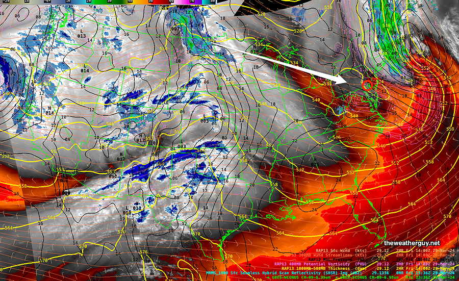
We should see increasing cloudiness between noon and 2 PM Saturday. Light showers possible after 5-6 PM. High near 60.
Easter Sunday will have sunshine through high cloudiness. No rain. High low 60s.
Friday through Sunday Outlook
Posted Thursday 03/28/24 @ 5:51 PM —
I guess the Phillies could have played today, but except for the wind, they’ll have a nicer day on Friday for their season opener.
Friday does look sunny, but very windy, especially in the afternoon. Highs 54º Blue Bell, 57º Philadelphia.
Saturday looks partly to mostly sunny, less wind. There may be a period of cloudiness early afternoon. Some clouds move in again towards evening with showers possible in the mid evening. Some models have these showers staying to our north.
A series of disturbances moving across a somewhat stationary upper air ridge will begin to affect our weather beginning Sunday. Here’s the NAEFS forecast for Sunday—
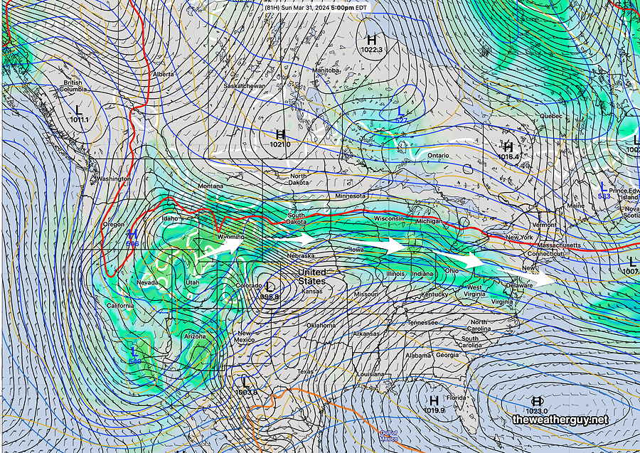
An approaching disturbance will bring a mix of clouds and sun on Sunday. The current forecast has showers moving to our south later Sunday, but this could change.
Thursday Update through Saturday
Posted Thursday 03/28/24 @ 11:01 AM — Current surface analysis shows a stalled front just through Philadelphia with waves of low pressure developing along the front—
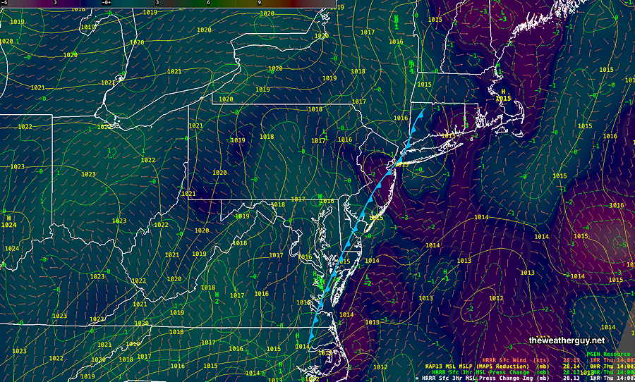
It appears that the eastern track forecast for the heaviest rainfall from this system was the most accurate, and additional rainfall through this afternoon is expected with it being considerably heavier along the Jersey Shore and east of Philadelphia.
The rain tapers off between 4 and 6 PM from Philadelphia westward. Here’s the latest NAM-NEST at 5 PM Thursday—
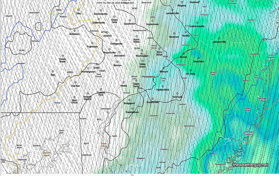
For Saturday, a clipper-type system will bring considerable clouds and showers late—about 6 PM according to some models and a bit earlier, late afternoon, according to some other models.
Thursday Forecast Update- Phillies Opener Rescheduled
Posted Wednesday 03/27/24 @ 5:18 PM — The rain came in slowly on Wednesday, but by 3 PM, most areas from Philadelphia westward were getting rain from this developing coastal system.
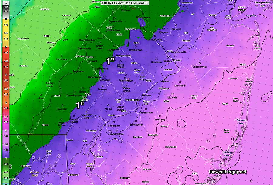
Phillies Opening Day has been rescheduled due to the wet forecast. The model trends over the past day have the heavy rain shield even further westward again, with rain likely all day Thursday and well into Thursday evening. The heavy rainfall totals forecast has increased. Here’s the latest NBM —
Wednesday Thursday Update
Posted Tuesday 03/26/24 @ 10:14 PM — It looks like light scattered showers slowly move move in from the west on Wednesday, as early as 11 AM but most likely between noon and 3 PM. Rain coverage increases but there may be a lull during the evening until about 3 AM Thursday morning.
Scattered rain through Thursday, much heavier near the Jersey Shore.
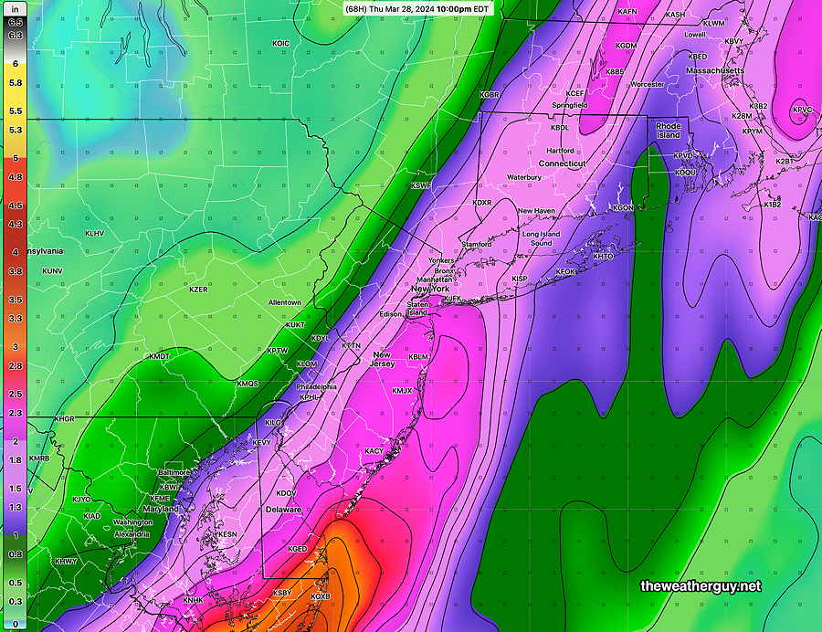
The models are converging on a more eastern track for the heavy rain axis. In the city and west, it will be less than 1″. Heavier rain east and at the shore.
Here’s the current GFS forecast rain accumulation through Thursday —
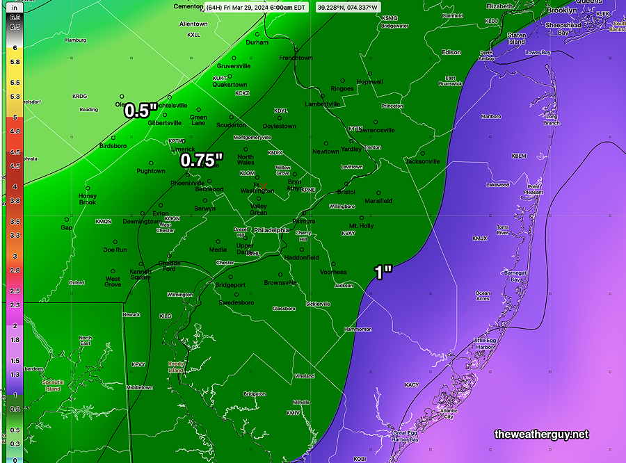
It’s not looking great for the Phillies opening day.
Tuesday Update
Posted Tuesday 03/26/24 @ 8:04 AM — Last night’s models have less cloudiness from Philadelphia and westward this morning. Thickening clouds still expected during the afternoon.
For Thursday, there’s a range of model forecasts regarding the heavy rain banding. The majority of the models keep the heaviest rain east into NJ and even further eastward. The GFS maintains heavy rain into Philadelphia—
Here’s the latest ECMWF—
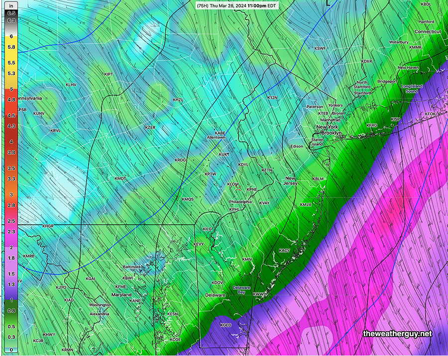
Here’s the latest GFS—
For last Saturday’s rain, the GFS also had a consistently westward track and was correct, but it had support from other models. This time, the GFS is the most westward. Updates later.
Tuesday
Posted Monday 03/25/24 @ 7:49 PM — A stationary area of low pressure in the western Atlantic will rotate clouds into our area on Tuesday. An approaching cold front will be here on Wednesday.
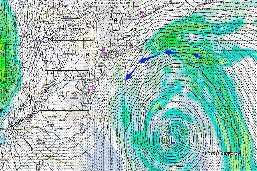
Tuesday -An easterly wind and thickening clouds during the day. Highs 51-53º but high uncertainty with a high NBM standard deviation of ± 3.5º
Some showers move in from the west on Wednesday, but rainfall totals look light.
Incredibly, the models are trending towards another 1″ + rainfall on Thursday, especially for NJ.
Overview
Originally Posted Mon 3:08 PM —Following Monday’s delightfully sunny but cool weather, the week ahead will be cloudier with several systems expected to affect us.
Here’ the satellite current water vapor image—
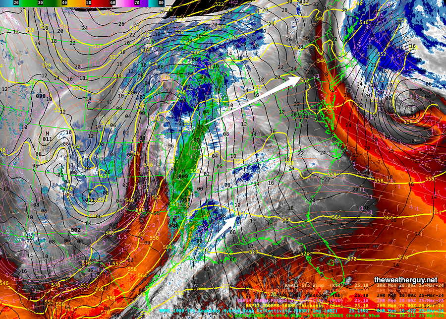
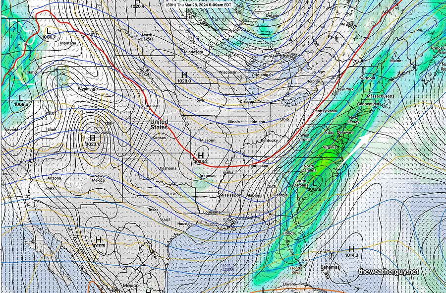
A cold front in the Midwest will have its energy shear off to our north as it passes through Wednesday into Thursday, bringing showers. Low pressure is expected to develop along this front and will bring some rain to our area Thursday, but the main system will be slightly to our east.
Here’s the current GEFS forecast for Thursday—
