#weather #paweather #wx #pawx #philadelphia #phillywx
Friday Forecast Update
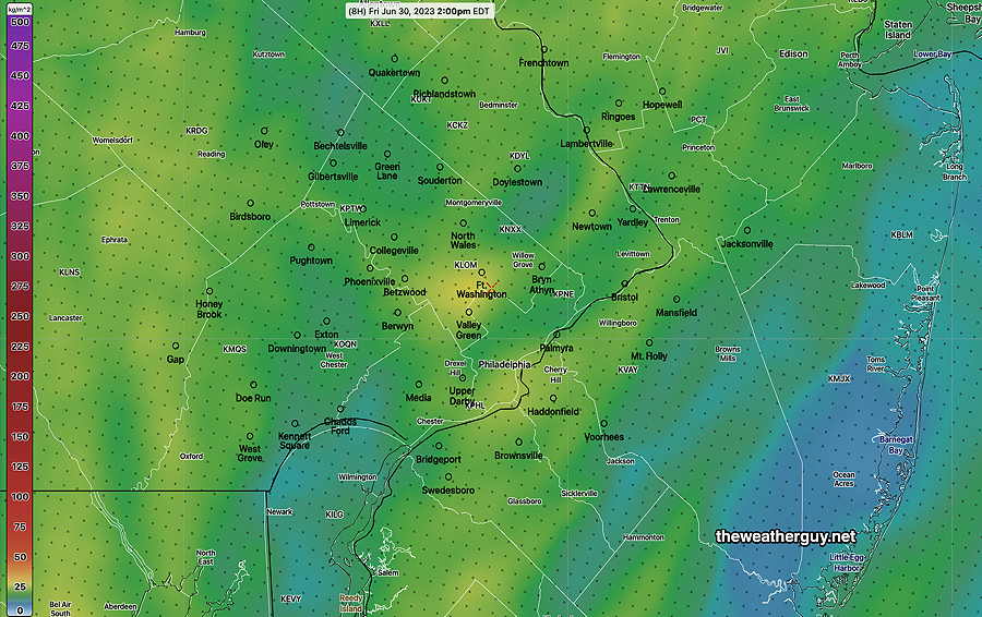
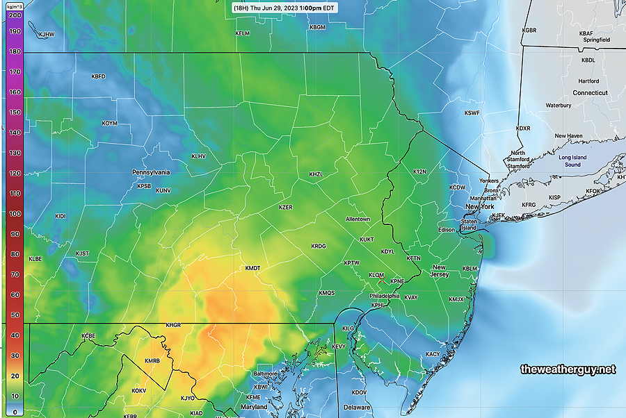
Updated Fri 06/30 @ 7:36 AM — Some smoke is still expected to be impactful today, with improving conditions Saturday.
Here’s the latest HRRR smoke forecast for 2 PM Friday—
We’re finally getting some warmer temperatures today—
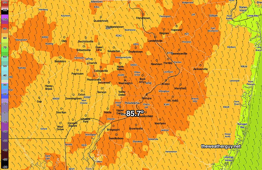
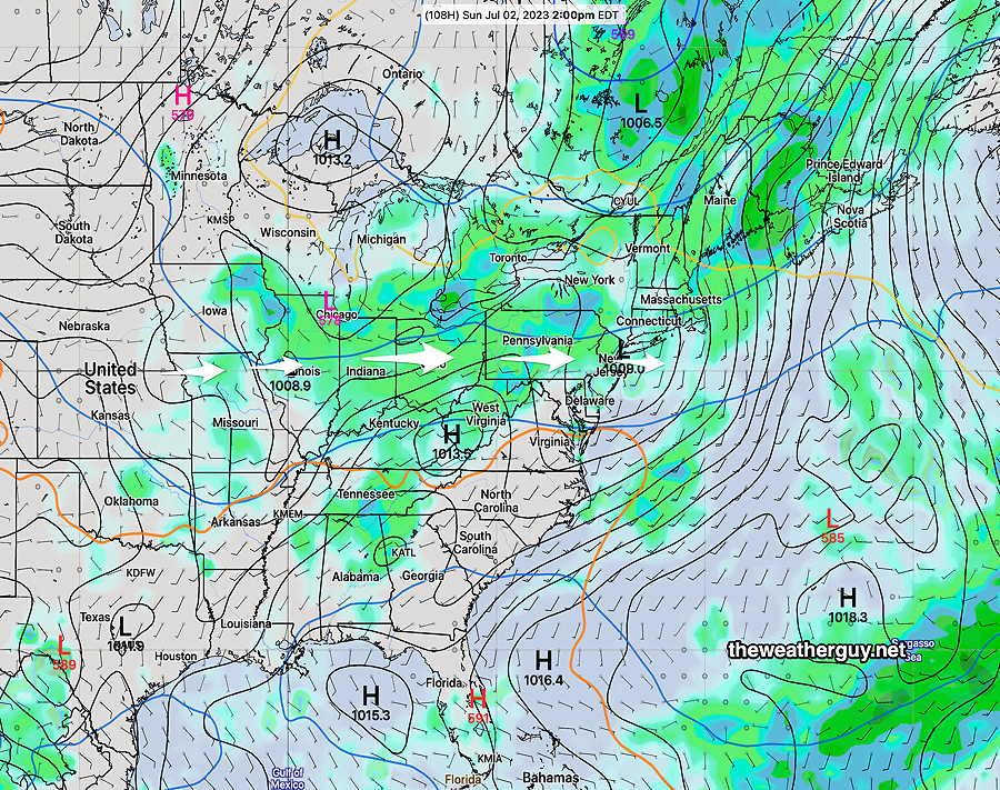
No rain expected daytime hours Saturday, with an increasing chance of light showers during the evening. Sunday is also looking somewhat drier than previously forecast; still uncertainty around Sunday’s forecast. Check back later this afternoon for my weekly “Weekend Weather Forecast”
Friday and Saturday Outlook
Updated Thu 06/29 @ 6:18 PM — Friday looks to be sunny with less smoke. Saturday is looking much better than previous forecasts—The latest GFS has no showers during the day, sunny skies with a few periods of cloudiness. Look for updates.
Show More
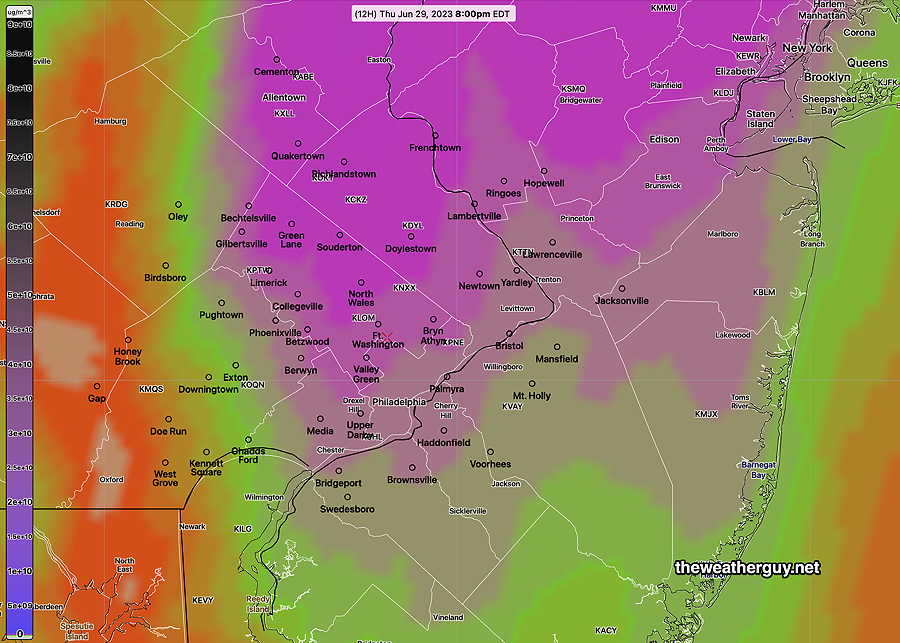
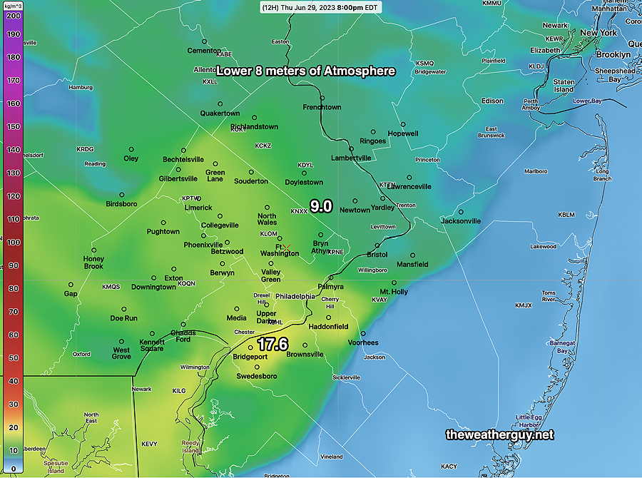
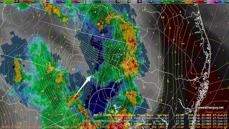
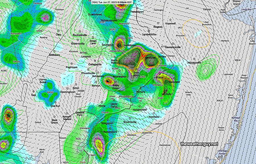
Updated Thu 06/29 @ 10:17 AM —It will become increasingly smoky here in the Delaware Valley today, although values will be significantly less than a few weeks ago. Using the latest HRRR smoke forecast— At near ground level (8 meters or 27 feet). ( A few weeks ago we were at 190!) Updated Wed 06/28 @ 9:32 PM — A nice day on Thursday. Plenty of sunshine and high temperatures in the low to mid 80s. Some increased smoke to contend with tomorrow. Smoke level near ground tomorrow – 11 compared to 190 a few weeks ago. Still quite noticeable— Friday will be very warm to almost hot. Mostly sunny, but some cloudiness at times, increasing in the afternoon. High in the upper 80s. Saturday will have considerable cloudiness with showers early morning and again in the late afternoon. Much cooler. Sunday will be warmer but with rain and thundershowers at times during the day. Possibly the most rain of any day this extended weekend. Monday and Tuesday, the 4th, will have plenty of showers and clouds, some sun, warmer and more humid. Check back for details on the smoke situation tomorrow morning. Updated Wed 06/28 @ 9:40 AM — Each model has varying degrees of cloudiness and sunshine today. A mix with more sunshine after 2 PM according to the latest NBM, but I would say today’s cloud cover forecast is a lower than average confidence. Little in the way of scattered showers, mostly far northern areas. The weekend is still looking unsettled and somewhat wet as we will be north of a diffuse boundary separating very hot humid air to our south and somewhat cooler air over us and to our north. Low pressure systems are expected to move along this boundary, from late Friday through at least Sunday— Update Tue 6/27 11:00 PM —Even more sun on Wednesday than previously forecast. Updated Tue 06/27 @ 8:11 PM — Wednesday looks better than the past two days. Some sun possible in the morning, mostly western suburbs, then considerable low clouds at times with some sunny breaks in the afternoon. A few very widely scattered sprinkles move through during the afternoon. Most areas will not see a sprinkle Hard to believe, but the weekend is looking fairly unsettled with rain at times. Updated Tue 06/27 @ 5:26 PM — The earlier arrival of the storms as predicted by the high res models was closer to reality. Additional activity may move in and intensify from now until 7 PM here in Philadelphia. Updated Tue 06/27 @ 11:39 AM — A quick update based on this morning’s high resolution models. Most models this morning have showers moving in as early as 3 PM -4 PM (3 PM western suburbs) with peak activity 5-7 PM in the immediate Philadelphia area. Unlike yesterday, these storms will move through New Jersey. Unlike yesterday, these storms will be moving from west to east instead of south to north. • Peak wind gusts 40-45 mph in some areas. Updated Tue 06/27 @ 9:53 AM — Latest HRRR model forecasts showers and thunderstorms moving in as early as 4 PM today. Peak thunderstorm activity expected between 6 and 9 PM. Latest RAP mode has similar early break out storms, but main line of storms moves through at 9 PM— Last night’s 06z HRDPS is right in the middle with a 7 PM maximum— Total rainfall expected Updated Mon 06/26 @ 9:31 PM — The main group of storms is poised to move into the immediate Philadelphia area with the next hour or so. Some of these storms are expected to be strong, possibly severe. Not much of this activity is expected to cross into New Jersey and eastward. Radar/Water Vapor Image at 9:32 PM— I don’t think the model forecasts were very good today. One bright spot— they had correctly predicted that little activity would move into South Jersey. More storms expected Tuesday afternoon about 4-5 PM according to the latest 00z HRRR. Updated Mon 06/26 @ 5:16 PM — Latest NAM-NEST just available shows the heaviest rain and storms tonight in western and northwestern suburbs— The NAM-NEST shows several groups of storms, an early group about 6-7 PM and a second large group moving towards Philadelphia between 8 PM and midnight. The western suburbs get the heaviest activity. Updated Mon 06/26 @ 4:15 PM — I’m looking at the latest HRRR and the live water vapor image. I have this terrible feeling that this afternoon’s forecast has been all wrong. Most of the activity for the afternoon have moved off to our northwest and there’s activity currently in NJ that was not forecast to occur at this time. So the first cluster of storms forecast for 3-5 PM isn’t happening here. The main activity is now expected this evening. The latest HRRR has the second main cluster of storms (9 PM to midnight mentioned earlier) still moving through. Here’s the updated HRRR forecast for 11 PM— Updated Mon 06/26 @ 12:45 PM — After reviewing this morning’s high resolution models, here’s what I see happening today— Updated Mon 06/26 @ 9:42 AM — The latest 12z HRRR just available. Here are the latest changes. I don’t see the 60-70mph wind gusts being advertised in the immediate PHL area, only near Allentown and south into Maryland. (Always listen to the NWS for these details.) The storms will be more scattered and clustered instead of a distinct line that moves through. More updates sometime around 1 PM, after all the 12z models have come in. Updated Mon 06/26 @ 8:49 AM —The media has been all over the forecast for severe weather today. So what’s going on? A prefrontal trough, currently located in western Pennsylvania, will move through our area this evening. (The actual cold front will come through tomorrow.) The trough is visible in satellite water vapor imagery this morning— A prefrontal trough is a distinct wind shift line with significant moisture convergence and strong vertical dynamics. Here’s the NAM-NEST position of the trough and moisture convergence at 4 PM— Based on the current water vapor image, some showers and thundershowers are possible this morning, especially in Bucks county and far western suburbs, but a shower anywhere can’t be ruled out this morning. With conditions as unstable as forecast, some storms will break out again after 3 PM. The main line of storms is forecast to move through about 7-9 PM, an hour or so earlier in western suburbs. Some storms may linger as late as midnight. It’s unclear how far any extreme weather will move east into New Jersey. Most of the current models have the main dynamics moving towards Philadelphia but affecting mostly western and northern suburbs. This may change. As we can see, far western areas (western Chester counties, Berks and Lehigh counties will be most affected. Areas north of Allentown may see possible tornadic development.Peak Smoke Thursday
Thursday-Friday Forecast & Weekend Outlook
Wednesday Forecast Update
Wednesday Forecast
Tuesday Forecast Update
Tuesday Quick Forecast Update
• Strong to severe storms, possibly stronger than yesterday.
• Hail possible, especially in New Jersey
• Forecast is for intensification as the storms approach Philadelphia and the Delaware River and move into NJ.
Tuesday Forecast
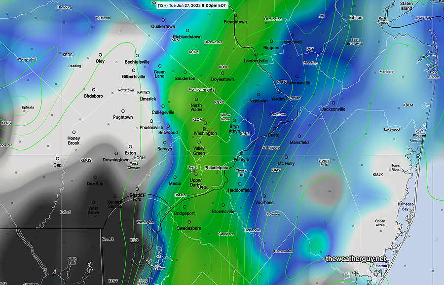
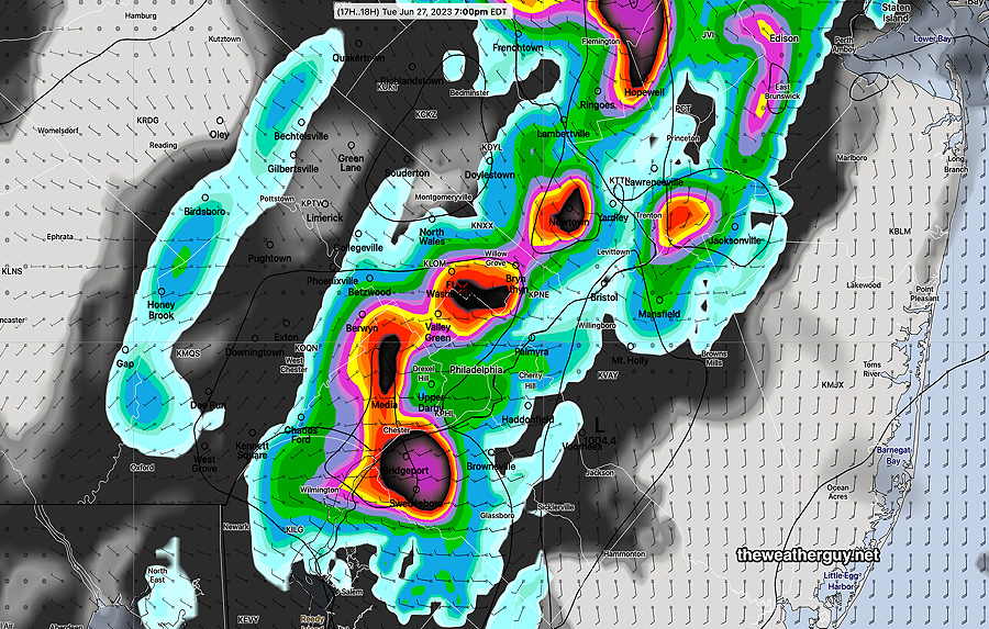
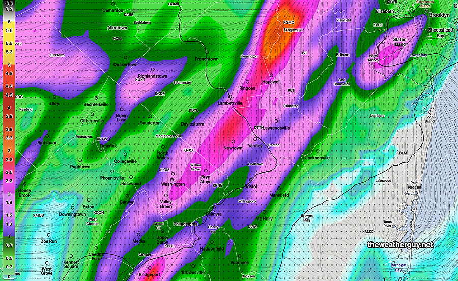
Monday night update
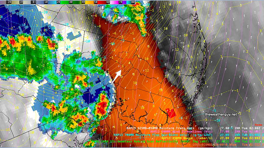
Update
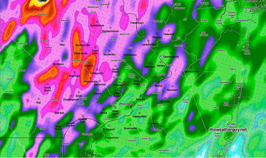
Problematic Forecast
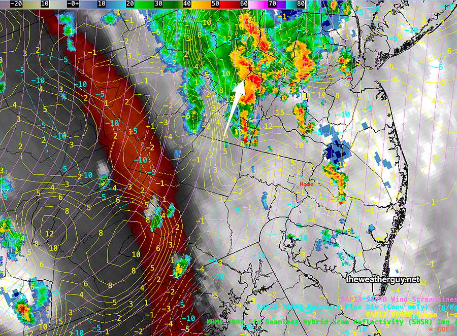
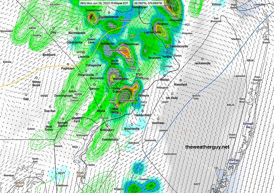
Monday Storm Update
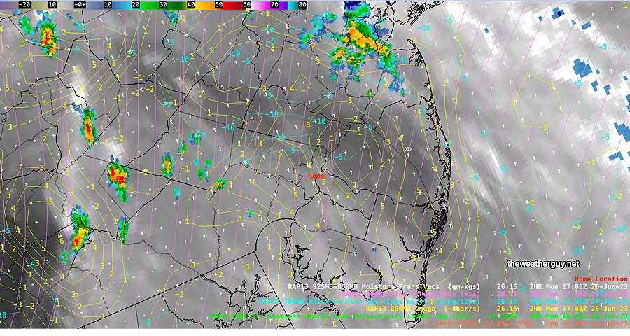
Monday Morning Update
Storms move into and develop in the Philadelphia area earlier, about 3- 5 PM. Another line of storms moves through between 9 and 11 PM.
Heavy Thunderstorms Forecast Monday
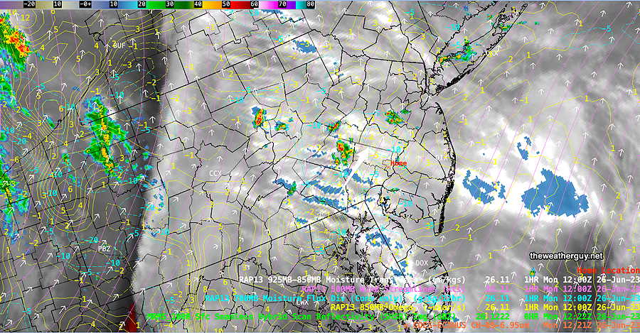
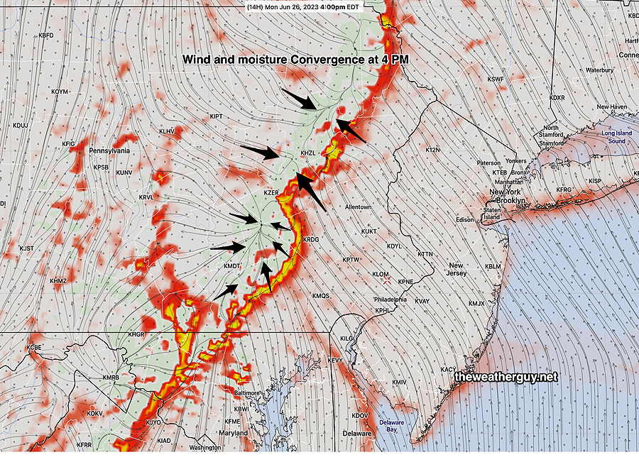
Current Timing of Today’s Storms
How Severe?
HRRR
Severity
ParameterSept 1 , 2021
Tornado Outbreak
(example of highly severe)Recent
April 1st 2023 Tornadoes
(Example of severe)Today’s
06z HRRR ForecastToday’s
ImpactNotes CAPE
Joules/kg 3500-4200 2100 2500 ⚑⚑ Helicity
m^2/s^2 1350 655 240 ↔ ⚐ High near Allentown Vertical Shear
1/sec40-46 40-45 12 ↓ ↓ Precipitable Water 2.7″ 0.83” 1.9″ ⚑ Lifted Index
º Kminus 6º minus 9.3º minus 9.4º ⚑⚑ HRRR Hail
inches1.9 1.4 1.5 ⚑ Peak Wind Gusts
mph 40-50 40-50 42 ⚑ far Western areas Storm Motion Shear Vector
AlignmentAligned – ~ 90º Almost aligned opposing
directionprefrontal
troughUnknown affect 250 mb
Jet Stream Wind
mph63 135 53-75 ⚐ far Western
areas
↓ indicates works against Severity ⇩ Significant, but less impact
