
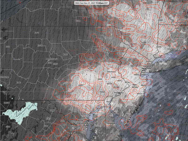
Update Sun @ 9:05 AM — Simple But Interesting— Following yesterday’s poor model cloud forecast, I wanted to get some better model data indicating the uncertainty in the model’s cloud forecast. The HREF model includes “statistical spread” data as a download parameter option. Here’s this morning’s HREF total cloud cover forecast for 11 AM Sunday—
I’m staying with the forecast update below from 9:21 PM last night.
Update Sat @ 9:21 PM — Reviewing this afternoon’s models and the early models available this evening, Sunday morning and the early afternoon is looking sunnier than previously forecast. As a result, the high temp will be about 54º.
Increasingly cloudy between 2 and 4 PM. The NAM-NEST has some light showers as early as 6-7 PM.
Most of this morning’s models showed 100% mid-level clouds by noon; clearly not correct.
I usually prefer the GFS for cloud cover, especially when the humidity parameters back up the cloud cover forecast. But the GFS didn’t come through for today.
Looking back at last night’s models, the NAM-NEST had the best forecast, but it’s not a model I would have chosen to predict today’s cloud cover.
With Saturday’s forecast incorrect, I will be checking tonight’s models to update Sunday’s forecast later.
Initial Post Discussion—[post_published]
A cold front went through Thursday night and high pressure moved in for Friday and expected to linger for some of Saturday. The high pressure system will move off the coast Saturday. A warm front will move in Saturday and another strong cold front moves in late Sunday. Windy Sunday evening ahead of this jet dip.
The cold front later Sunday will be propelled by an outbreak of cold air, pushing the jet stream into a highly amplified pattern for Monday and Tuesday—
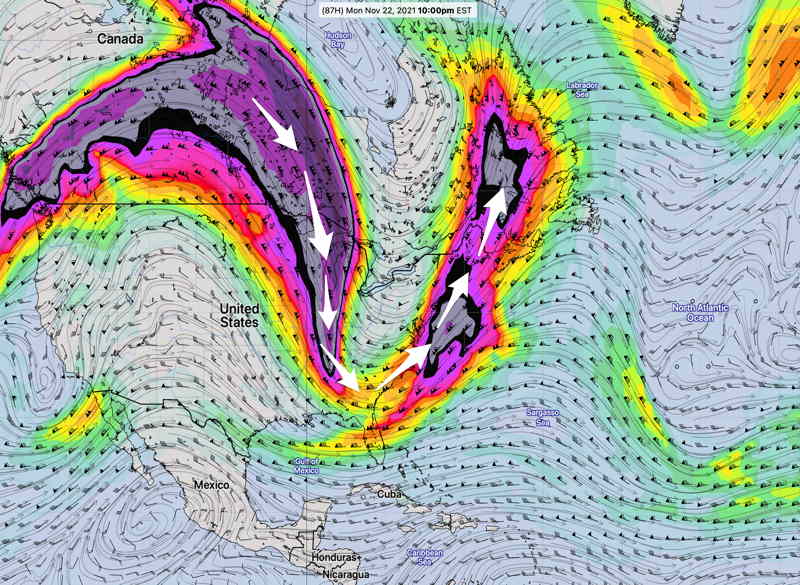
This upper air configuration causes low pressure development. This development will occur east of our area. A similar type of configuration, slightly west in winter, might cause a significant snow storm for the coast. Not this time.
Saturday
As high pressure departs, winds will shift to southeasterly as a warm front approaches. After some sunshine in the morning, considerable mid-level (altocumulus/altostratus) cloudiness develops by noontime and continues through the rest of the afternoon.
Update Fri @ 11:06 PM — Tonight’s high resolution models show a few more breaks of sunshine on Saturday than the earlier GFS that the above forecast is based on.
High temperature 48º ± 1.1º NBM (model blend) Blue Bell, PA
The warm front attempts to move north while a very strong cold front approaches from the west ahead of the dip of the jet stream (in the above graphic).
Clouds early, then many models show some late morning to early afternoon sunny breaks, but clouds return to become cloudy as showers approach from the west for later in the day.
Update Fri @ 5:36 PM — Friday afternoon’s GFS shows significant cloudiness, very little sunshine for Sunday.
Windy conditions develop during the evening and nighttime.
High temperature 50.1º ± 2.0º NBM (model blend) Blue Bell, PA
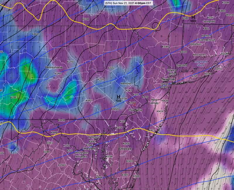
The GFS has some light showers/sprinkles by early evening in western suburbs. HIGH WINDS. Windy SUNDAY EVENING AND NIGHT ahead of the front.