The weak cold front that moved through on Friday will move north as a warm front later Saturday into Sunday. Showers expected with the warm front Saturday night. My regular readers know that a tropical system or hurricane near the continental US often plays havoc with the model forecast specifics.
Saturday—
- Significant and increasing high level cloudiness (cirrus). Lower level clouds increase during the late afternoon and early evening.
- High temp 87.0º sd 2.0º
- Dew points mid 60s.
- Winds calm to very light from the SE at 0-6 mph
The warm front moves north, but unstable and humid air may result in thunderstorms Sunday afternoon, especially west of Philadelphia.
Sunday—
- Cloudy in the morning, sun breaks out during the late morning or early afternoon.
- Showers linger early in the morning.
- Thunderstorms and showers possible later Sunday afternoon.
- High temp 91.3º sd 2.6º (larger than average spread)
- Very humid! Dew points near 75º
- Winds increasing 10-15 mph from the S and SW. Becoming gusty in the afternoon.
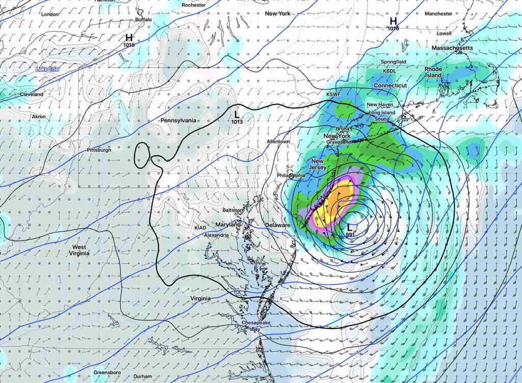
GFS (pre-release version 16) forecast Hurricane Isaias on Tuesday morning at 8 AM, currently the closest forecast approach to our area —
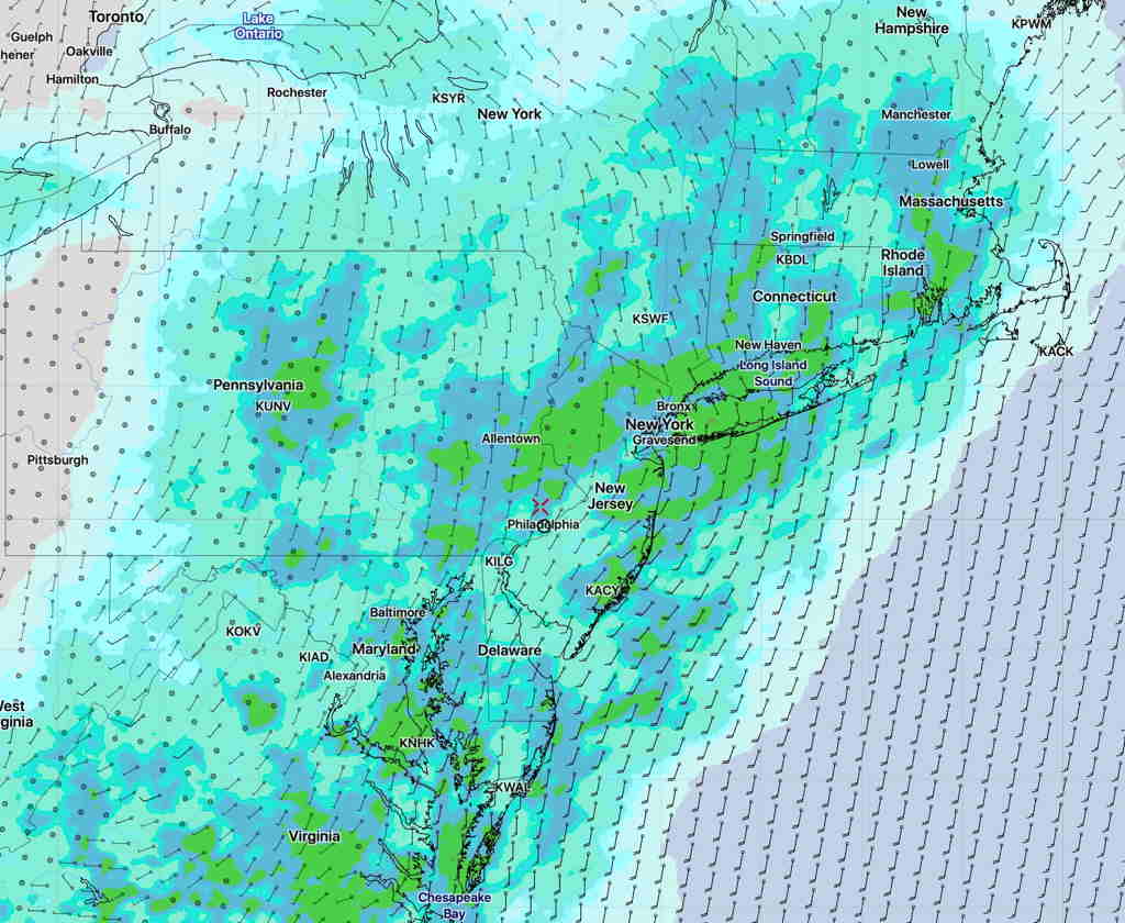
The model blend (NBM) shows much more rain to the west on Tuesday—