Tag Archives: Climate Forecast

WEATHER OUTLOOK -COLD THANKSGIVING

[su_box title=”Monday Update 10:30pm” box_color=”#defcdc” title_color=”#000000″]Tonight’s NBM model is showing a high temperature on Thanksgiving Day of 28 for Philadelphia![/su_box]

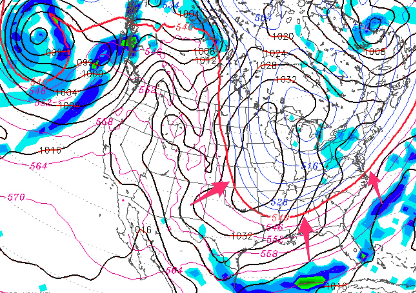
A dip in the jet stream is predicted for the coming week, with  the coldest temperatures forecast for Wednesday night through Thursday night.

amplified jet
GFS Model Forecast for Thursday, (Thanksgiving) afternoon.

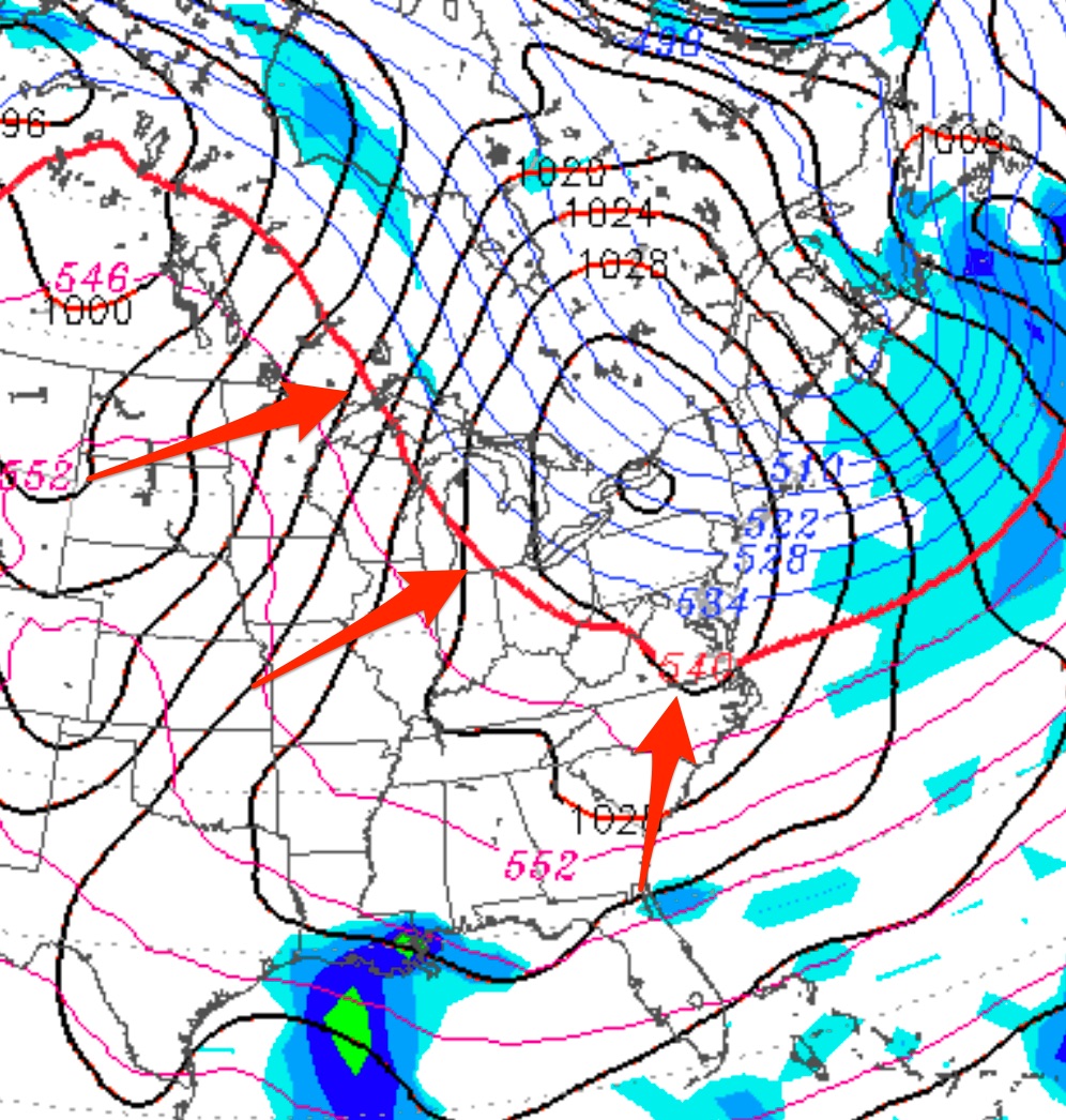
The extended range GFS and NBM (National Blend of Models) shows a high of about 32 for Philadelphia on Thursday!   Actually, that’s an improvement; the forecast dip was even more amplified just a few days ago.

A warm up and rain is expected next Sunday or Monday, then a return to colder conditions sometime during the following week.

[su_note note_color=”#d9f2da”]I continue to feel we will have a colder than average winter due to the nadir in the sunspot cycle and a stormier winter as well, with plenty of moisture available in the southern jet stream from a developing El Niño in the Pacific.

I first made this preliminary climate prediction a few weeks ago.  Past information about the sunspot cycle’s influence on temperatures can be found here.[/su_note]

VERY COLD WEATHER POSSIBLE NEXT WEEKEND

[su_box title=”Monday Update” box_color=”#defcdc” title_color=”#000000″]It appears that the cold snap in our area will be delayed a bit and will likely occur late Sunday night into Tuesday.  Monday’s models show a slightly less amplified jet stream.

Tues update: Some of the models are showing a coastal storm developing as a result of this jet dip next Tuesday with some snow falling in western PA and possibly further east.   [/su_box]

So far, the autumn season has been a mix— a very mild and rainy September and plenty of rain in October.

This week we will have another few days of mild weather, but things are setting up for a change to much colder weather, at least for a period, sometime next weekend.

Over the past few days, the  medium and long range models have been showing a cold short term pattern developing the end of next weekend that one would expect to see in winter— a highly amplified jet stream, allowing unseasonably cold air to flood into the US.

Here’s the current operational GFS for next early Monday, showing the highly amplified jet stream for early November:

GFS forecast
GFS Forecast for Monday Morning, Nov 12th

This amplification is impressive for this early in the season.

So, get your winter coat ready, at the very least, for next weekend.

By the way, above average temperatures will likely return after this cold outbreak.


EARLY WINTER CLIMATE OUTLOOK

I received an email from a follower of this blog asking for my thoughts regarding the upcoming winter.   Here’s what I replied:

Thanks for the confidence you expressed in my forecasts. Winter weather seasonal forecasts are more about climate than weather.  Even the National Center for Climate Prediction doesn’t do too well with these very long range forecasts.

That said, I usually take a stab at the Winter Weather Seasonal Forecast towards the end of November.  By that time, any pattern that may become established will have revealed itself.

But if you want an early sense of things, the nadir in the sunspot cycle suggests plenty of cold air.  The current dips in the jet stream suggest a stormy winter.   And an expected appearance of El Niño in the Pacific suggests plenty of moisture.

So expect a cold winter with plenty of storms and plenty of snow.   That’s my best bet right now.  But things could change if the jet stream dips change over to the western side of the US.