Here, just northwest of the city limits, the precipitation has changed to rain with a pause in the action. A lot has to happen to get to snow totals that the models have forecast! Perhaps things have been a bit over-forecast?
This morning’s GFS model continues with the same scenario all the models have been forecasting; heavy precipitation with dynamic cooling to allow temperatures to drop and accumulations to occur.
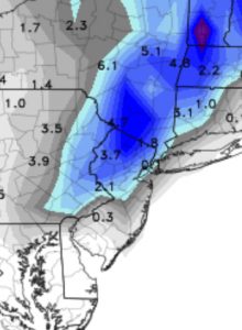
HOWEVER, the GFS Kuchera snow algorithm makes this storm a bust—

As mentioned last night, I’m not big on the Kuchera snow algorithm; it tends to seriously underestimate snowfall in past storms. (Last Friday’s storm had the Kuchera algorithm forecasting NO snow!)
Radar trends show a significant increase in precipitation rates in NJ, rotating westward into Pennsylvania. Despite all forecast parameters as snow, things have to change soon for this forecast to not be a bust. And as I type this, precipitation has changed back to snow! So let’s see what happens.
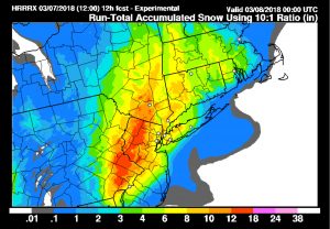
BTW, here’s the latest HRRR (High Resolution Rapid Refesh) experimental forecast snow totals—

