The most important weather model runs, based on global weather balloon (“radiosonde”) upper air measurements, are done twice a day— at 7 PM EST (00 UTC, also called 00z) and 7 AM EST (12 UTC, also called 12z).
These new upper air measurements often account for any significant change in the model forecasts. The latest NAM-NEST has a decrease in snow totals due to significantly more sleet.
Here’s the latest 00z model data, based on these new upper air measurements.
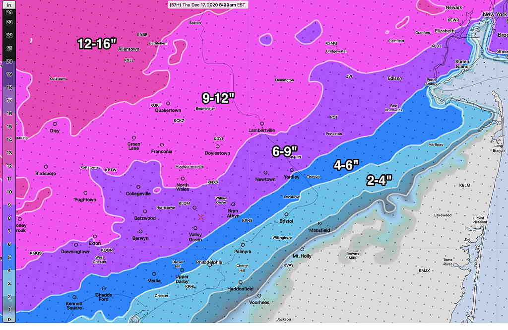
The 00z HRRR (High Resolution Rapid Refresh) shows snow developing between 12 noon and 2 PM Wednesday and ending 7-10 AM Thursday. It will become very WINDY Wednesday night.
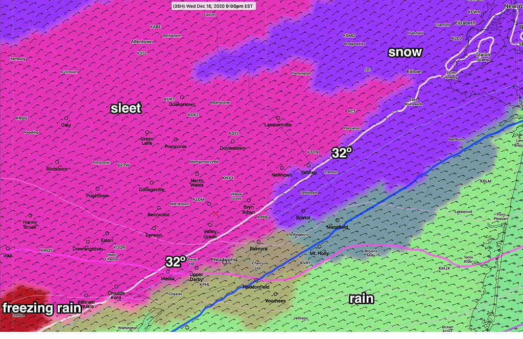
The HRRR continues the trend for sleet to mix in with the snow in a large portion of the area during Wednesday evening, and then change back to snow before ending.

Despite the changeover to sleet at times, the latest HRRR has increased snow totals by Thursday morning—

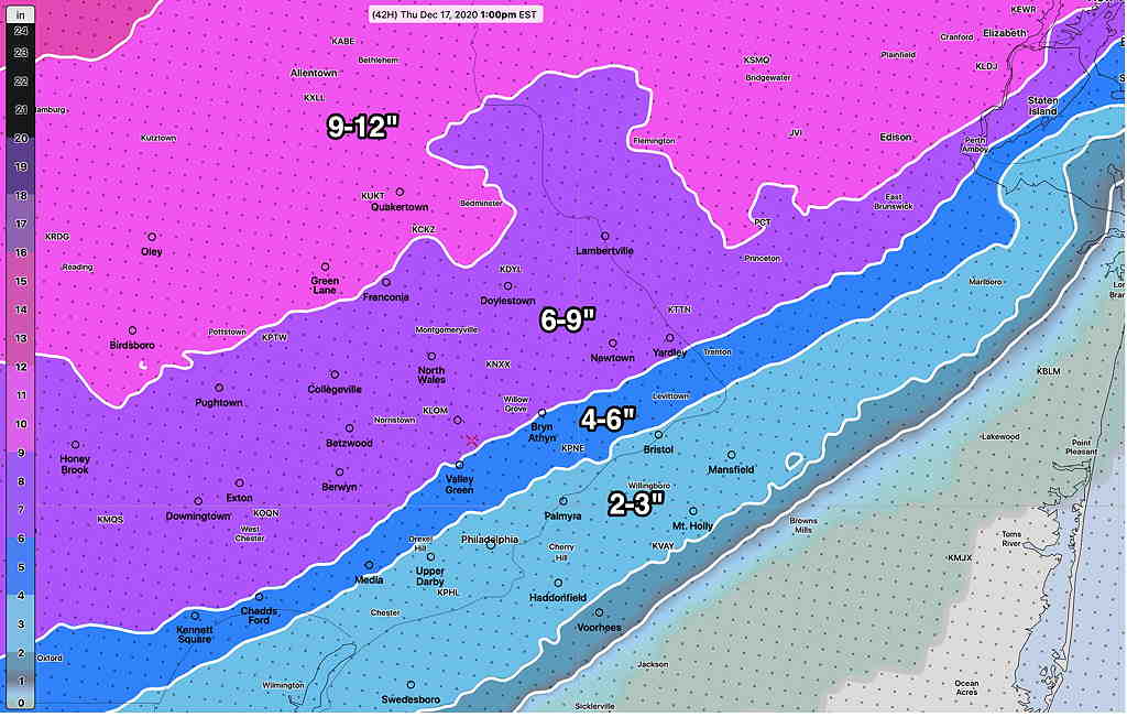
The 00z NBM (Model Blend) shows a similar snow total forecast—

Several models are showing wind gusts in excess of 50 mph Wednesday evening.
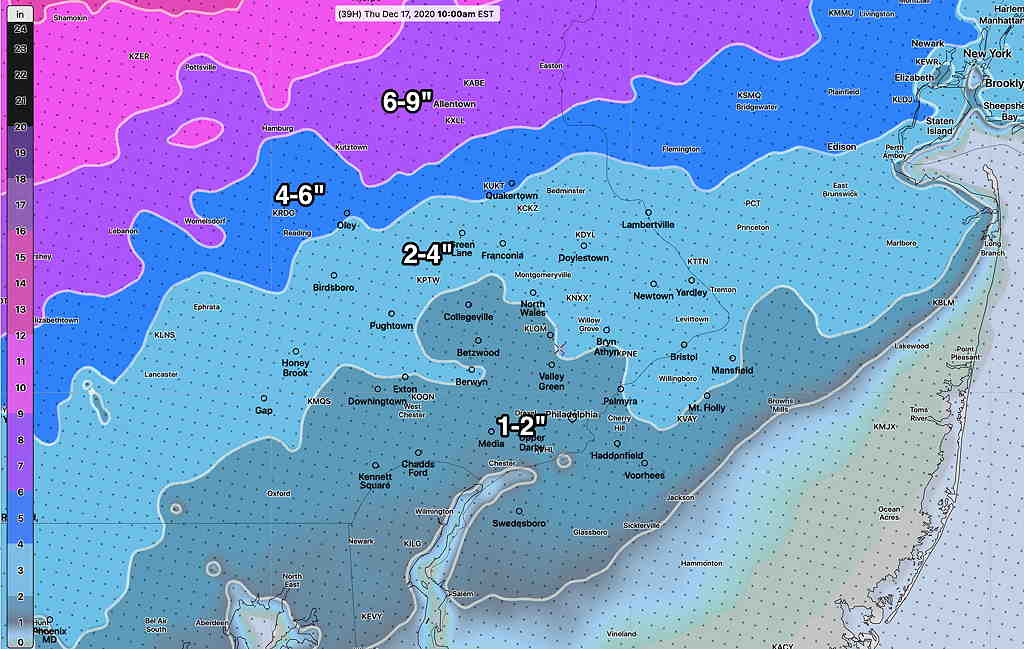
Speaking of model forecast changes, the NAM NEST just available has more sleet and much less snow—

I think the NAM-NEST may be too warm with too much sleet. We’ll have to see the trends into tomorrow morning.
Right now I’m sticking with the HRRR and NBM snow forecasts above.
