Thunderstorm Outlook- Wednesday

The frontal passage and thunderstorms in Philadelphia expected today will be well-handled by the NWS.

So, what value-add can I offer this early in the day?

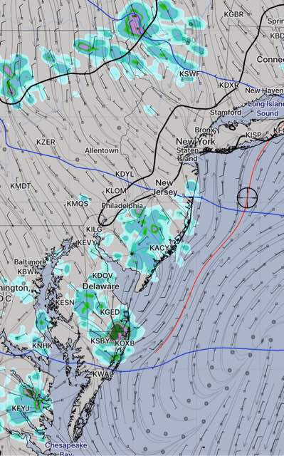
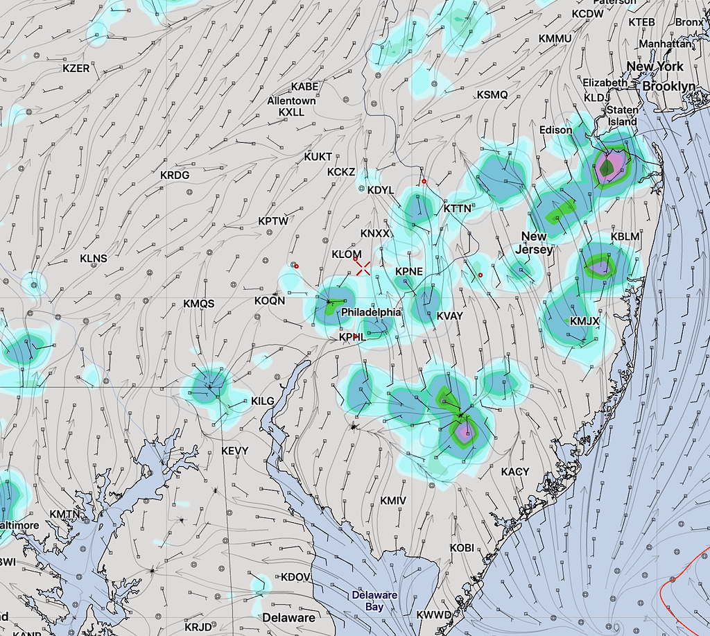
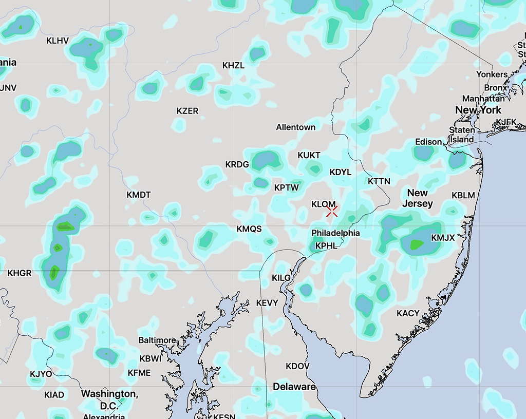
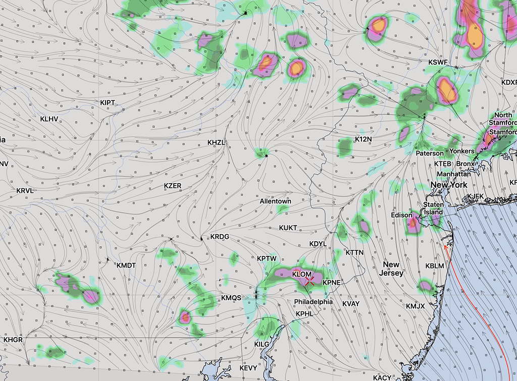
Reviewing the models from earlier this morning, the following characteristics and trends exist:

There’s a possibility of some earlier scattered showers and thunderstorms as early as 12-2PM.

Increasing  areal activity is expected between the hours of 4 PM and 8 PM.   A line of storms should develop by 5-6 PM and move through the Philadelphia area, according to the latest RAP and HRRR models.

The severe weather parameters (cape, helicity, shear, precipitable water) are all elevated, but not as elevated as seen a few weeks ago with the tornado development.

Some low pressure centers are expected to develop in this line of storms and additional activity may linger until after 8 PM.

WEEKEND WEATHER UPDATE

[su_note note_color=”#d9f2da”]No showers developed Philadelphia and west, as expected. There were some thundershowers in south Jersey, not as much areal coverage as predicted by the models last night. Dew points were delightfully lower than had been predicted.  [/su_note]

Pop-up, widely scattered thundershowers did develop today (Saturday), but the areal coverage was hardly close to the model precipitation forecast graphics that I posted yesterday. (This morning’s models which came out after 10:45 am had actually cut back on the showers for today.)

Tonight’s model forecast just becoming available shows even fewer showers for the immediate Philadelphia area westward, but a weak frontal boundary passing through sparks some thundershowers, mostly from the city eastward into N.J. mid to late afternoon.

Current WRF 1hour accumulated rain forecast Sunday 4:30 pm

As we’ve seen today, prediction of specific areal location of thundershowers is something models attempt to do with limited and inconsistent success.

Except for these showers, Sunday will be mostly sunny, very warm and somewhat humid— typical August weather. High 87-89.


WEEKEND WEATHER FORECAST

[su_note note_color=”#d9f2da”]Sat 7:30 AM Update: High temperatures Saturday updated to about 86-87. Scattered thunderstorms still expected mid to late afternoon as depicted in last night’s model data below.

Sunday looks to be considerably drier and somewhat warmer with a high of 88-89. [/su_note]

A typical summer weather pattern with a diffuse stalled frontal boundary to our south.

Summer daytime heating combined with  the entrance of areas of vorticity and moderately high moisture (precipitable water values about 1.6 inches) will result in instability and mostly afternoon and early evening thundershowers.

The sky conditions will be similar to today (Friday) with most areas seeing considerable sunshine mixed with clouds.  Highs around 85.

What everyone wants to know— when will these showers develop where?  Unfortunately,  the weather models are just not that capable in this situation, but I’ve looked at the models that did fairly well with the showers today and I’m providing a sampling of what I think might capture the answers.  (Three high resolution models, including the new Canadian HRDPS.)

As shown below, the models are showing the period between 2-5 PM Saturday as having the highest areal precipitation coverage.   These areas are now closer to Philadelphia than had been showing on my Thursday’s Outlook post.

WRF-ARW precipitation forecast 3-4 PM Saturday afternoon
HIREF precipitation forecast 3-4 PM Saturday afternoon
Canadian HRDPS precipitation forecast 3-4 PM Saturday afternoon

For Sunday, the larger scale models (NAM, GFS) show things drier with a similar mix of sun and clouds.   High 86.


Weather… and Other Things 'Up in the Air'