
[su_note note_color=”#d9f2da”]No showers developed Philadelphia and west, as expected. There were some thundershowers in south Jersey, not as much areal coverage as predicted by the models last night. Dew points were delightfully lower than had been predicted. [/su_note]
Pop-up, widely scattered thundershowers did develop today (Saturday), but the areal coverage was hardly close to the model precipitation forecast graphics that I posted yesterday. (This morning’s models which came out after 10:45 am had actually cut back on the showers for today.)
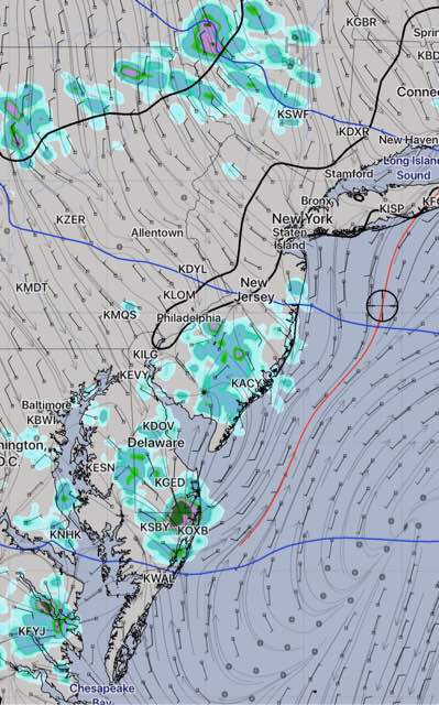
Tonight’s model forecast just becoming available shows even fewer showers for the immediate Philadelphia area westward, but a weak frontal boundary passing through sparks some thundershowers, mostly from the city eastward into N.J. mid to late afternoon.
As we’ve seen today, prediction of specific areal location of thundershowers is something models attempt to do with limited and inconsistent success.
Except for these showers, Sunday will be mostly sunny, very warm and somewhat humid— typical August weather. High 87-89.