TODAY’S UNEXPECTED RAIN IN PHILADELPHIA

I find it fascinating that most of today’s models didn’t predict the rain that developed in a narrow, persistent band over Philadelphia. Interestingly, little rain developed at the shore to this point.

Radar 4:30 PM Friday, courtesy of weathertap.com

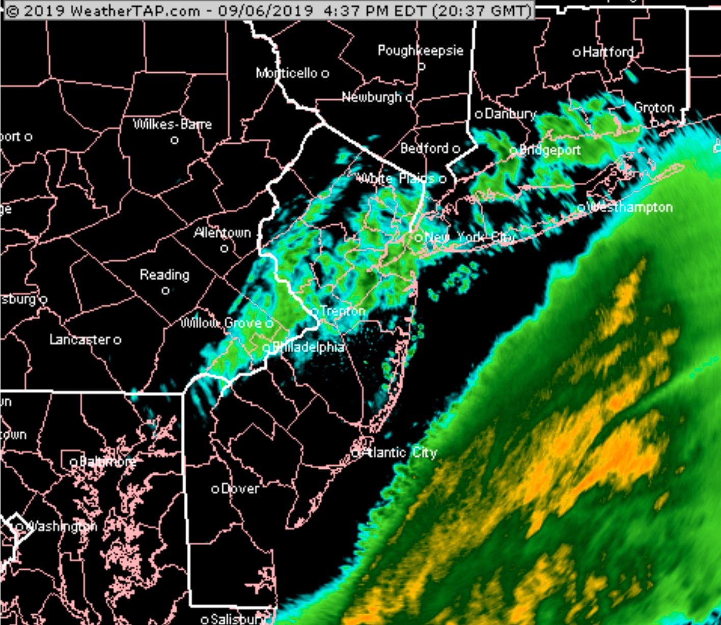
Going back to last night’s models, the WRF-NMMB and to a lesser extent the WRF-ARW were the only models to predict this rain last night.   However, the same models run this morning didn’t show it as much and the GFS, NAM really were off about this.

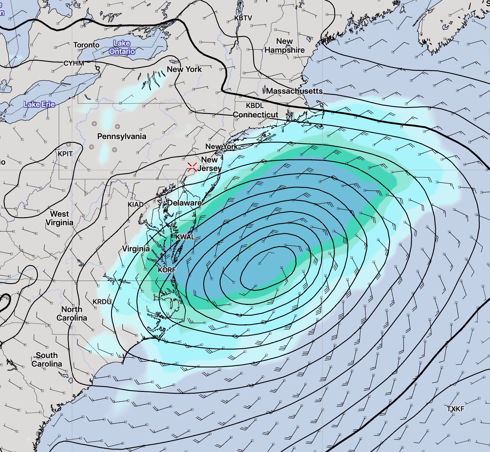
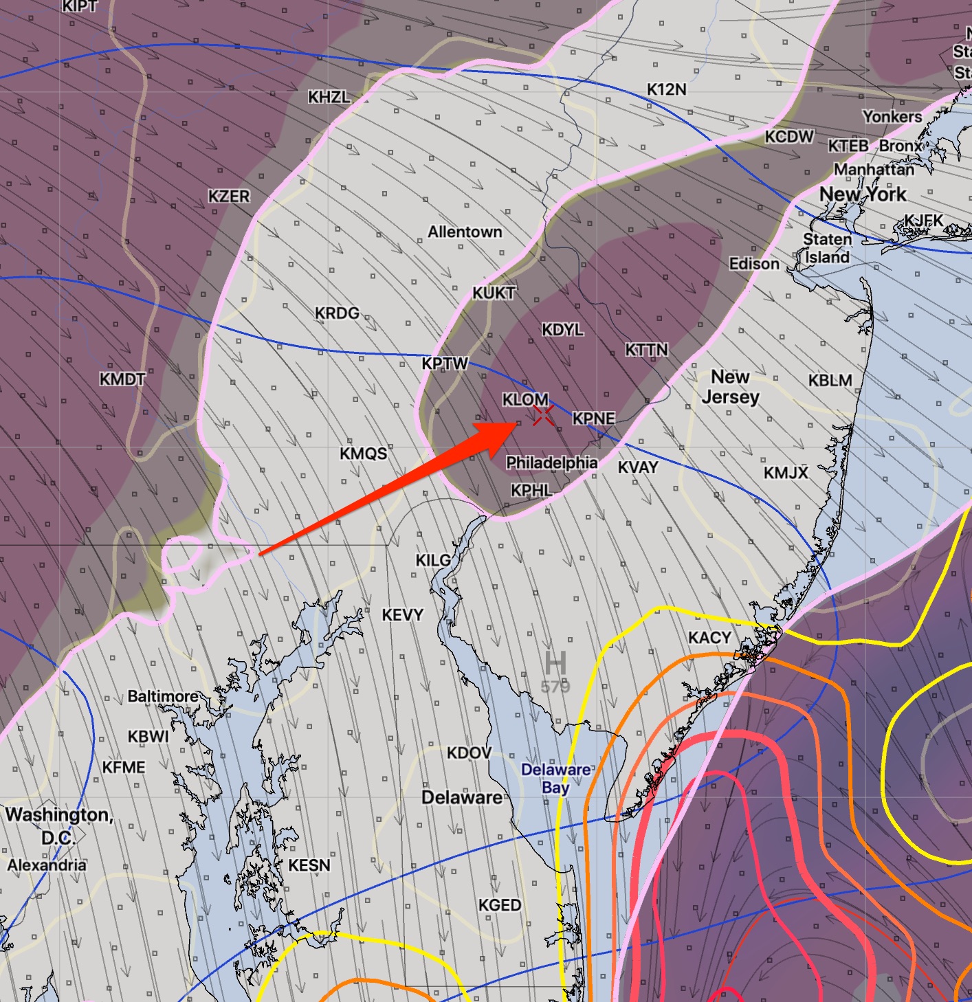
The unexpected rain was the result of some vorticity and vertical lift in the mid levels of the atmosphere, captured on this afternoon’s 2PM RAP model analysis—

RAP Model 2 PM Friday Analysis showing lift and vorticity at the 500 mb level (~18,000 feet)

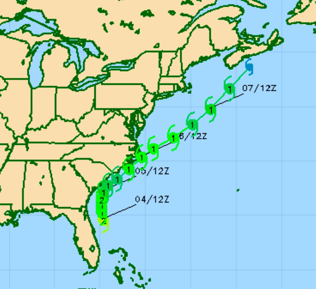
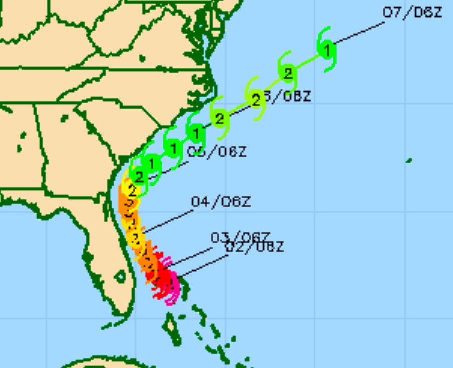
I don’t know why, but as I mentioned last week, hurricanes seem to throw off the model forecasts, often in big ways.

This rain is expected to clear out later today.  The weekend looks to be beautiful with sunny skies and comfortable temperatures in the 70s.  I’ll do a brief update later this evening.


HURRICANE DORIAN UPDATE

Hurricane Dorian continues to follow the track predicted by the greatest consensus of models.

Here’s the current COAMPS-TC forecast track, which like many other models, has the storm brushing the South Carolina and North Carolina shores—

COAMPS-TC  forecast from Wednesday morning


Hurricane Dorian will affect our area at a distance of Friday.  Here is the latest SREF (Short -Range Ensemble Forecast) for Friday afternoon.

A chance of light showers at the Jersey Shore, windy conditions for Friday.  (The GFS and NAM keep the shore dry.)  Winds 20-25 mph with some higher gusts.

Cloudy conditions expected even into the Philadelphia area.

HURRICANE DORIAN UPDATE

The experimental US Navy COAMPS-TS did a great job at predicting the movement of Hurricane Dorian. It looks like the Navy is tracking several other tropical storms/disturbances and they haven’t released an update on Dorian since early Monday morning.

(I can only guess that their experimental modeling work needs to share computer resources with modeling of other tropical storms.)

Nonetheless, this is the latest COAMPS-TS track available, which is  similar to previous predictions with this model. The storm is not expected to directly hit the Florida coast.   It’s current predicted track is remarkably similar to that posted this past Friday.The vast majority of the other major models have similar tracks for Dorian, as of Monday afternoon.

Weather… and Other Things 'Up in the Air'