[su_note note_color=”#d9f2da”]Update Sat 7AM: Addition to the forecast below— Sunday will be WINDY. The GFS shows wind gusts of over 40 mph with the frontal approach late morning. [/su_note]
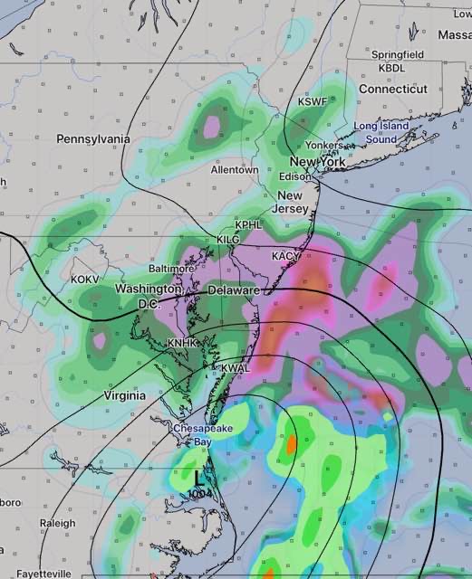
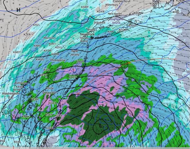
A moisture-laden low pressure system which formed in the Gulf of Mexico will approach the region over the weekend. All the models, are in good agreement with this system.
A warm front associated with this system will approach on Saturday.
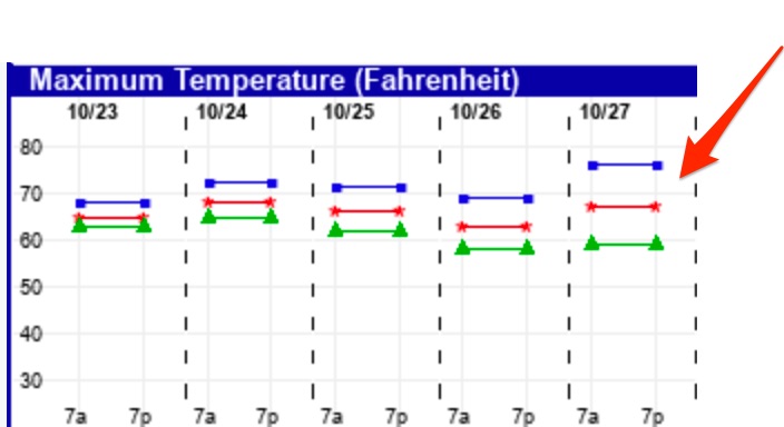
Saturday will begin will high to mid-level cloudiness, similar to what we had today—Friday, associated with this warm front. Some sunshine will be possible through this thin but increasingly thick cloud layer. Full cloudy conditions by Saturday mid afternoon. High temp 68.
Some statistical models are maintaining a chance of showers with this front in the late afternoon Saturday, but the main models keep the showers to our far north and west.
The main low pressure system and it’s associated cold front move through on Sunday. Rain starts early and ends later in the afternoon or evening. Heavy rain is predicted by most models, with QPF values between 1 and 1.5 inches. It will be mild, with high temps near 71.