Yesterday’s cloud base did lift and thin, but we never saw the degree of clearing that was forecast by the HRRR or NAM-NEST models. Showers moved in, as expected, about 5 PM, but the northern-most extent and their duration into the evening hours was greater than predicted by any model.
For today, (similar to last Sunday), several upper air disturbances are causing the cloud deck right now. Sun should break out later this morning, but another upper air disturbance is expected about 4 PM (not talking about the Eagles here.) So, another period of cloudiness possible later.
The coastal storm for mid-week mentioned in last Friday’s post remains difficult to forecast. The NAM and Canadian GDPS have 1-2 inches of snow (less in the city) late Tuesday afternoon into evening. The GFS shows less development and a coating at most. The GFS has done the best this season with these storms. This storm is still beyond the range of the shorter range models. Stay tuned.
[su_note note_color=”#defcdc”] Update 10 AM: I just downloaded the new HIRESW NMMB2 and HIRESW ARW2 (yes, so many models, so little time.) They are a little less optimistic about clearing. At best, patchy clearing with highly scattered sprinkles possible, increasing about 4-5 PM.
HIRESW NMMB2 2 PM Simulated Radar and cloud cover
Well, we’re going to get a bike ride in, I hope.
[/su_note]
…from earlier—
The low clouds and widely scattered showers were expected this morning.
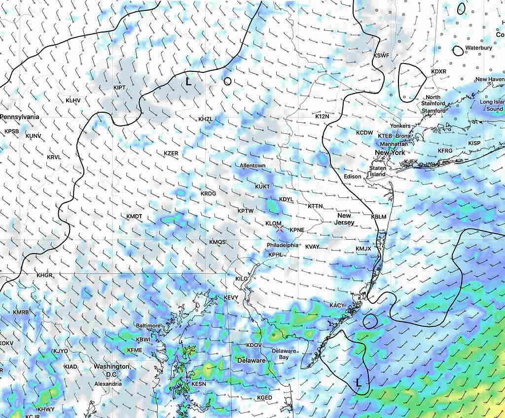
I just downloaded the very latest NAMNEST, HRRR and RAP model data.
All models have winds shifting to the west about 11-12:30 PM, bringing in some drier air. The HRRR is most optimistic about seeing some sun and bright skies by 12-2 PM. The NAM NEST also has brightening skies by 2 PM, although not as clear as the HRRR.
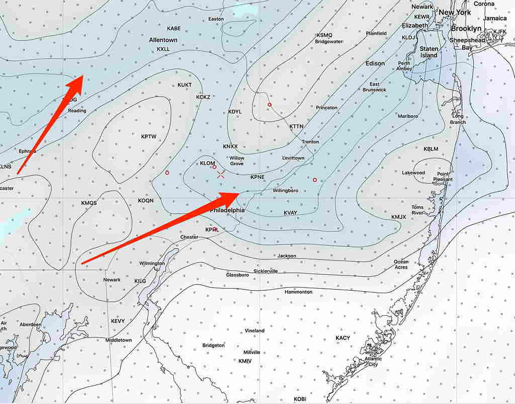
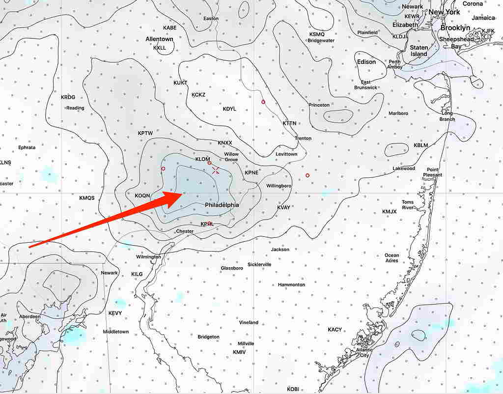
I’m using the (sometimes unreliable) built-in cloud parameters, but clearing also supported by looking at the humidity fields.
HRRR cloud forecast 2 PM (Arrow shows clearing skies)NAMNEST Cloud Forecast 2 PM Arrow points to few clouds.NAM 3-D humidity below 70% (grey, not blue here!) shows areas of clearing.
The models maintain an increased chance of showers again about 4-7 PM as the main front moves through and again this evening.
We’ll see if the patchy clearing occurs as predicted.
[su_note note_color=”#defcdc”] Update Fri 10 PM: After reviewing this evening’s NAM, NBM and Hi Resolution model data, the gist of the forecast below still stands. The rain tapers and ends mid morning Saturday but it will remain unsettled. Cloudiness lingers, and breaks in the clouds, bright patches, even some sun is possible. Widely scattered sprinkles/showers remain possible as well and increase in likelihood again for a short period around 4 PM, as the main front moves through. Temperatures reach a high of about 58º around noon and slowly fall during the afternoon and especially after the frontal passage.
Sunday’s forecast below also remains intact. High 46º. There’s a chance of an upper air impulse bringing sprinkles or flurries after midnight.[/su_note]
…. from Fri morning:
Low pressure will gradually move over us on Saturday and depart on Sunday.
Despite the location of the center of the low being directly over us, the rain will be will not be continuous. It will become spotty.
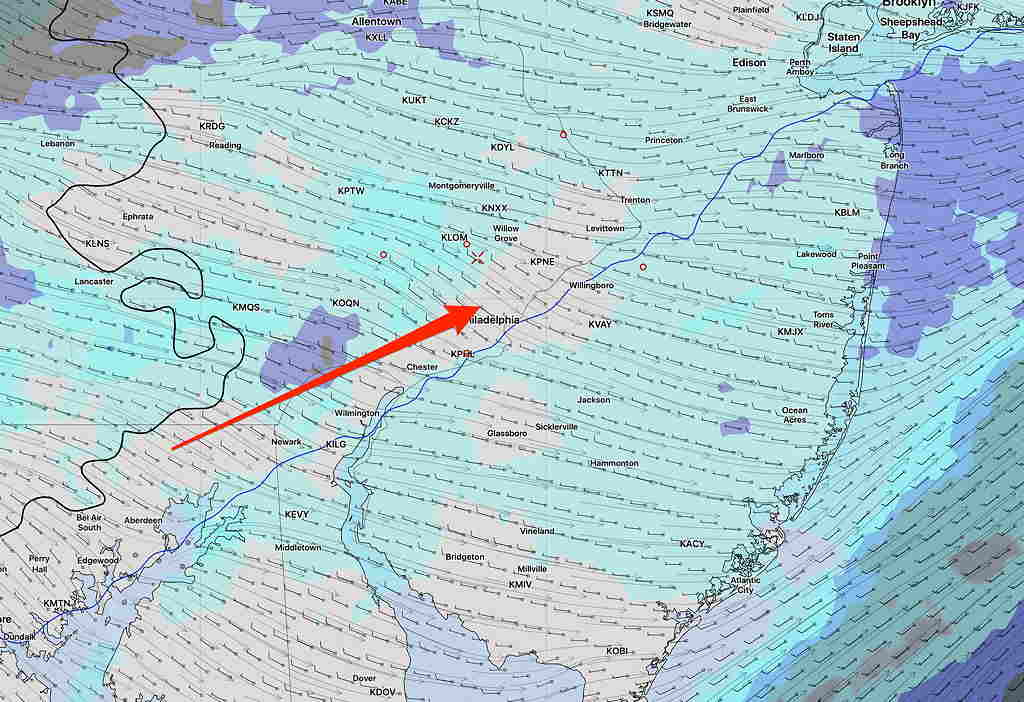
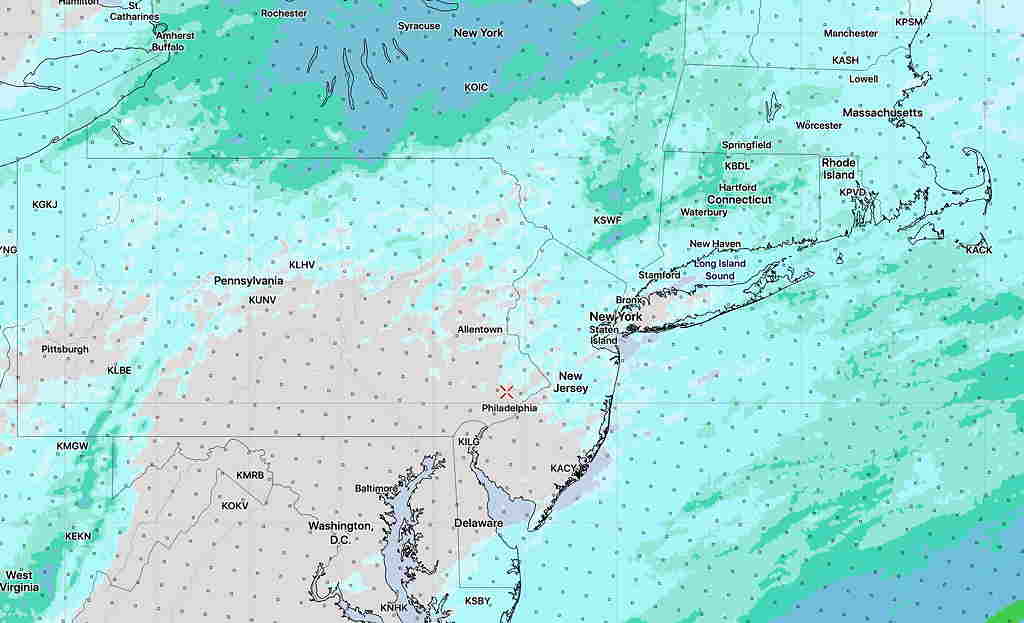
Current NBM model forecast 1 Hour mean rain 1 PM Saturday. Click for larger image.
For Saturday, most models have rain moving through in the morning and to the north of us by afternoon. Any rain lingering will be light and widely scattered. The NBM 1 hour mean rain depiction for 1 PM Saturday gives a better picture. There may even be some “dry slotting” in the afternoon, allowing brighter skies. High 58º!
A weak cold front moves through during the mid to late afternoon Saturday. There may be another burst of showers and it will become windy.
For Sunday, mostly sunny skies, windy and colder with above average seasonable highs of 46º. Winds diminish somewhat during the evening.
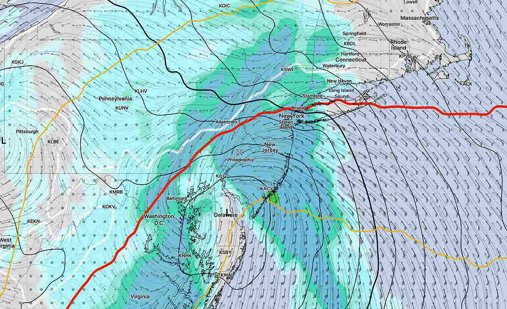
[su_note note_color=”#defcdc”] Next Week: Of interest is a dip in the jet stream on Tuesday into Wednesday with the spawning of a coastal low. There appears to be a shortage of cold air needed to make this a snow storm here, but this needs to be watched.
Canadian GDPS forecast for about midnight Tuesday-Wednesday. North and west of red line is likely snow line. White line is 32º surface temp line.