INTERESTING WEATHER FOR MONDAY

From earlier today…

On Sunday evening into Monday, most models have low pressure developing in the southeastern US and moving up, just missing the Philadelphia area.

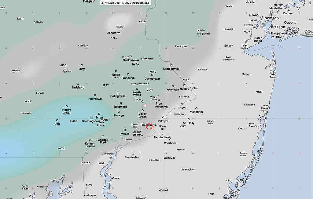
Interestingly, the new soon-to-be-released GFS model version 16, (still in test mode, expected to become operational In January-February 2021) has been consistently showing a different track than other models, a track that would brush our area with light snow early Monday morning.  Most areas will NOT receive any accumulation (too warm at the surface), or a coating at most, shown in the second graphic.

GFS “Pre PARA” Model 10AM precip/cloud forecast Monday (Click on image for a larger view.)
GFS Pre-PARA model shows very light snow accumulation  (Click on image for a larger view.)

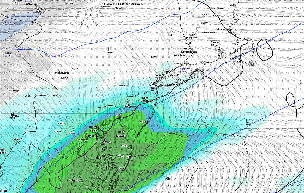
This model currently is an outlier. Most other models have to moving off to our south, missing us.

The latest NAM model suggests it might have moved into the new GFS model camp.

It’s interesting that the major US model scheduled to replace the existing GFS in a month or so consistently has had such a different forecast. Stay tuned. I’ll keep an eye on it.

(BTW, the long range model forecast suggests another ‘interesting’ weather event next Wednesday or Thursday.)

FORGET ABOUT THOSE SNOWFLAKES?

From earlier Wednesday—

Today’s forecast of snow flurries was always on the edge of not meriting a blog post. But I wanted to keep my skills honed, so it’s been the subject of my recent two posts.

I’m ready to bring this to a close.   Today’s models continue with the trend of the clipper system coming through, although none of the models just available  show this current radar situation at 9 AM (which could be showing precip evaporating before reaching the ground).

Current 9AM Radar Loop (courtesy of weathertap.com)   (Click on image for a larger view.)


HRRR Precipitation Type forecast showing light rain sprinkles north of Philadelphia  (Click on image for a larger view.)

Indeed, this morning’s models don’t show any precipitation reaching us until 12-2 PM, and being extremely light, mostly north of us, with the lowest layer of the atmosphere too warm for even snow flurries. 

So, there’s a disconnect right now with current conditions and model forecasts. The non-event of possible light snow flurries could just become light rain sprinkles or just be a total non-event.  Let’s see what happens.


FIRST SNOWFLAKES OF THE SEASON

NAM-NEST Precip type forecast 2 PM  (Click on image for a larger view.)

from Monday …

We have a chance of seeing the first snowflakes of this season early Wednesday morning. A weak upper air disturbance (clipper system) will move through the Philadephia area between 6 AM and 9 AM Wednesday morning.

Snow flurries are likely but most areas will either get no accumulation, or a light coating at most. Current water equivalents are very low, about 0.03 inches.

If this sort of non-event were to occur later in the season, it might not even merit a blog posting, but being the first flakes, I thought I’d get into gear.

There are some differences in model timing with tonight’s NAM and NAM-NEST having the this occur later in the morning. Stay tuned.

Weather… and Other Things 'Up in the Air'