From earlier today…
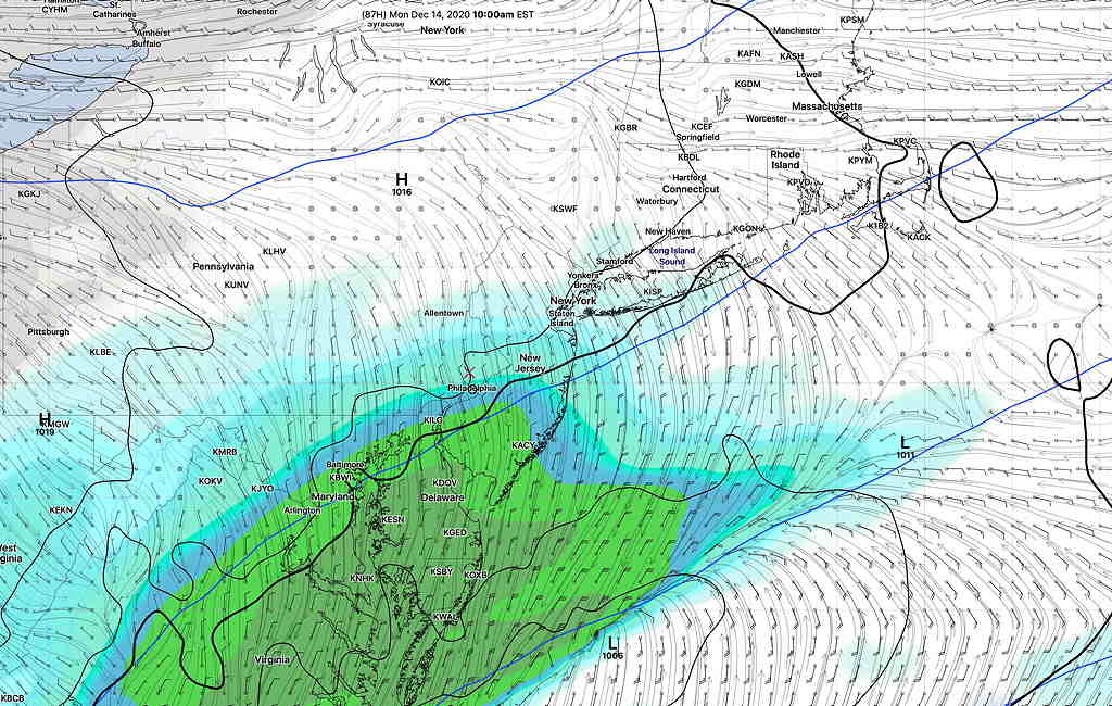
On Sunday evening into Monday, most models have low pressure developing in the southeastern US and moving up, just missing the Philadelphia area.
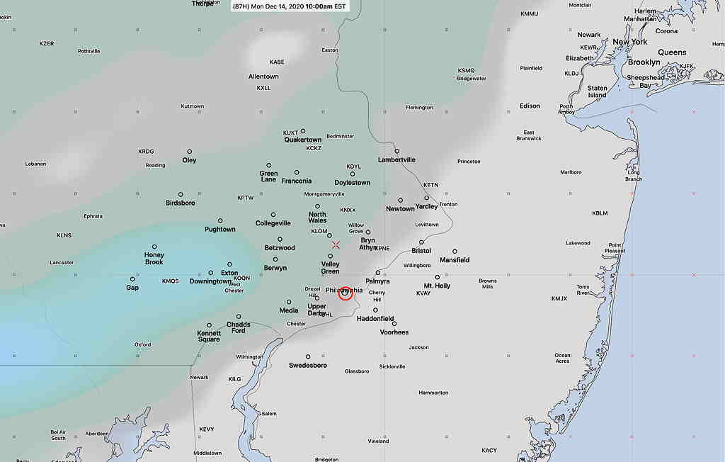
Interestingly, the new soon-to-be-released GFS model version 16, (still in test mode, expected to become operational In January-February 2021) has been consistently showing a different track than other models, a track that would brush our area with light snow early Monday morning. Most areas will NOT receive any accumulation (too warm at the surface), or a coating at most, shown in the second graphic.


This model currently is an outlier. Most other models have to moving off to our south, missing us.
The latest NAM model suggests it might have moved into the new GFS model camp.
It’s interesting that the major US model scheduled to replace the existing GFS in a month or so consistently has had such a different forecast. Stay tuned. I’ll keep an eye on it.
(BTW, the long range model forecast suggests another ‘interesting’ weather event next Wednesday or Thursday.)
