
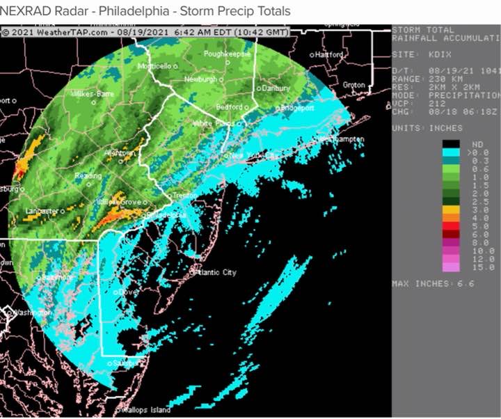
Thu 7:00AM— Some areas got very heavy rain. The activity did not make it east of Philadelphia. The tornadic potential was luckily over-forecast.
Henri looks to remain far enough off the Jersey coast, affecting Long Island and Cape Cod later Sunday-Monday.
Wed 10:05 PM—Latest models are looking less impressive with activity getting east of Philadephia, as current storms rotate up northward instead of eastward.
.
Wed 7:30 PM— Latest HRRR has slowed down the passage of storms in the immediate PHL area. Current timing is between 11 PM and 2 AM. The HRRR also shows some areas of high helicity and gusty winds with the passage of these storms in our area.
Still watching Henri which may indirectly affect NJ on Sunday.
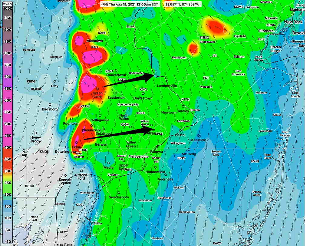
Wed 1:20 PM— Latest GFS has the thunderstorms moving through our area somewhat earlier, starting about 5:30 PM. Strongest dynamics remain to our far northwest, closer to Allentown.
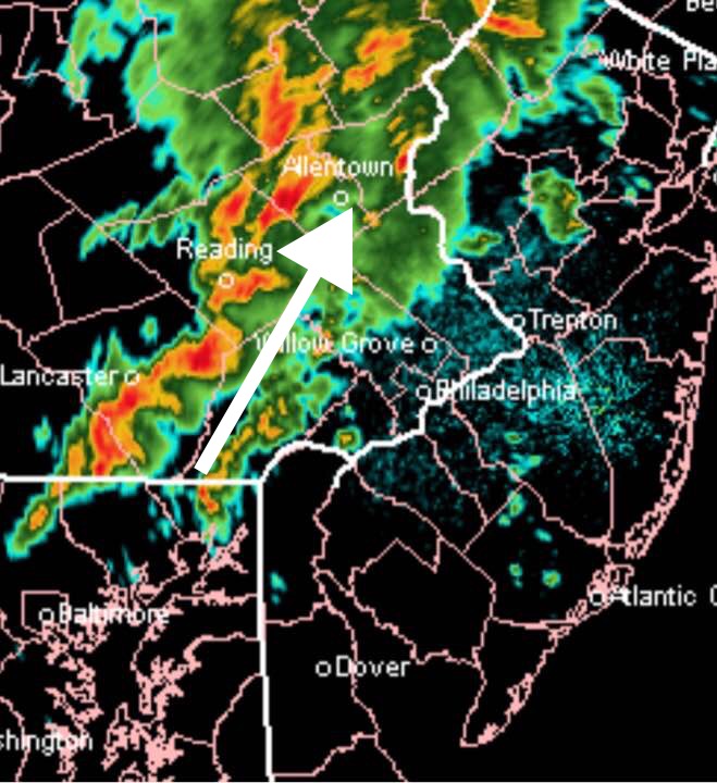
Wed 7:14 AM- Last night’s models have moved the chance of tornadic activity a bit more westward into Lancaster, Berks and Lehigh Counties. Most likely time for thunderstorms in our area 8-11 PM tonight.
As for Henri, last night’s models have it encountering blocking high pressure and an upper low with it moving more westward, now impacting Long Island with indirect effects possible at the Jersey Shore on Sunday. This complex situation continues to result in a changing forecast.
Tues 10:15 PM— Tonight’s models just becoming available show very strong dynamics ( specifically “helicity” and upward vertical motion ) between 7 and 10 PM Wednesday evening, especially west of the Delaware and specifically in Chester and Lehigh counties. Tornadic activity is possible.
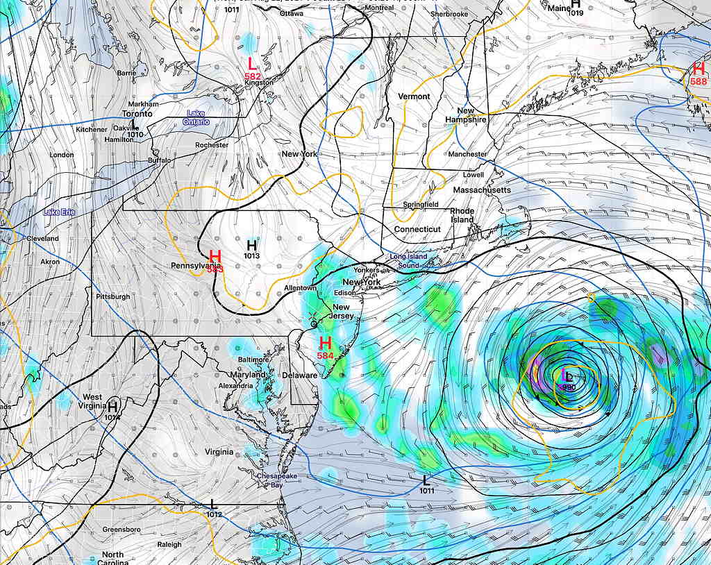
Tues 8:53 PM— An interesting and highly complex weather scenario is unfolding this week as the remnants of tropical storm Fred move up the Appalachians Wednesday into Thursday and a new tropical system, “Henri” moves up near the coastline over the weekend.
First, Fred. The moisture remnants of Fred will stay mostly west and northwest of our area with most of the heavy rain also staying west of Philadelphia and its immediate surrounding counties. The model forecast has been very consistent with this path.
Rain should move in during the evening hours Wednesday and depart by Thursday morning.
More interesting is a dramatic shift in the forecast path of Henri, developing in the Atlantic. It appears that an upper air closed low may draw Henri closer to the coastline.
While the major impact is currently forecast to affect Cape Cod and New England, the combination of moisture and upper dynamics may bring some significant rain thunderstorm activity to our area Saturday and Sunday. The ICON model is forecasting some very heavy rain on Saturday. (Although the ICON has been over-forecasting rain lately.)
It should be noted that if Henri stays a certain distance from us, Saturday may turn out to be exceptionally nice, as sinking air (subsidence) occurs a certain distance west of a tropical system.
This is a complex scenario and it’s likely that the current forecast will change significantly over the coming days. I’ll keep an eye on it.
Fwiw, we got 3.5 inches (measured by my home weather station) in Lower Merion. Crazy. I guess you never know, and the models can only be so good. Still, thanks for all you do. So interesting to read what you have to say. Thanks.
Yes, I woke up about 1:30AM hearing heavy rain. The later models were correct about the rain not making it east of Philadelphia. The earlier afternoon models were correct with the timing change from 11 -2 AM. The GFS was wrong about the 5:30 start time. The tornadic activity potential was (luckily) over-forecast.