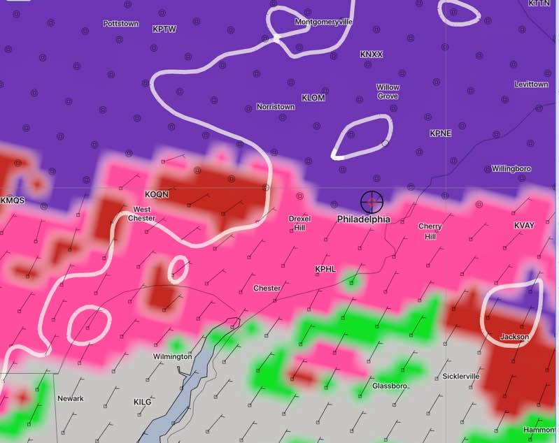
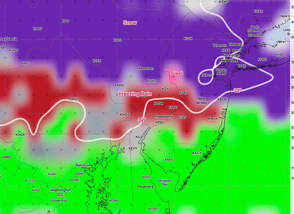
[su_note note_color=”#defcdc”]Update Sun 5:30 pm: This afternoon’s models have much lighter precipitation, both as light snow in the morning and sleet–> rain in the early afternoon. The graphic below is still accurate, but as stated, the colors indicate the precipitation type, not the intensity. Total QPF during the daytime is less than 0.10 inches water!
Most of the US models still have very light snow starting 8-9 AM. (The Canadian and European delay the precip into the afternoon.) Temperatures will not be as low tonight as previously thought.
The probability of freezing rain near the city is very low. Snow or sleet will accumulate a coating to 1/2 inch at most in PHL and the immediate counties. Heavier precipitation in the form of rain will arrive Monday night. [/su_note]
…from earlier this afternoon:
The wintery weather forecast has become more complicated with today’s models.
First, this will not be a snow event. Any snow at the onset will accumulate less than an inch, likely a coating to 1/2 inch. The city may have zero accumulation.
Previous model runs had very light snow in the morning, then changing to sleet, freezing rain and then rain.

The trend is for precipitation as light snow to start later ( European and Canadian start later) in the morning and change to rain in the early afternoon. The latest new version NBM has it too warm for freezing rain in the city, but areas north and west may have a prolonged period of sleet or freezing rain.
The Canadian high resolution model has precip starting later in the afternoon with more sleet and freezing rain as temperatures drop due to dynamic cooling.
Last night, I said I would hang my hat on the NAM Nest and the NBM. Unfortunately they don’t fully agree with timing or temperatures. I’ll clarify tonight. The new models become available by 9:40 and I’ll update after that time.

