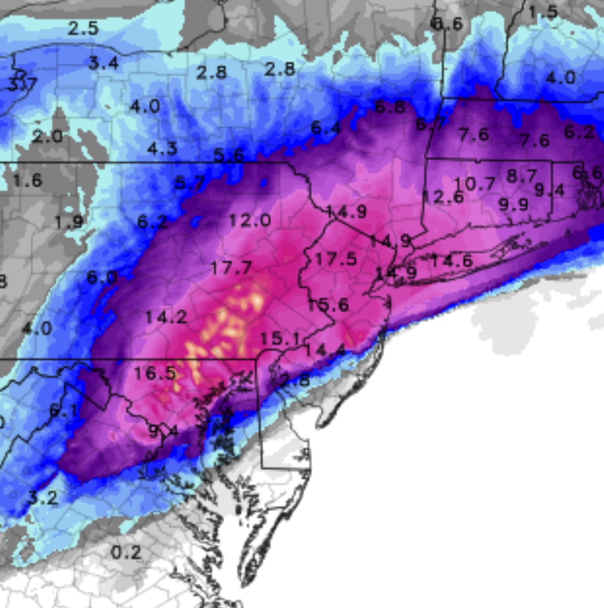
So the storm for tomorrow has fallen into the time frame of the HRRR short range model. I usually find the HRRR very reliable in predicting snow totals. Here is the current snow totals for the HRRR expected by noon on Tuesday:
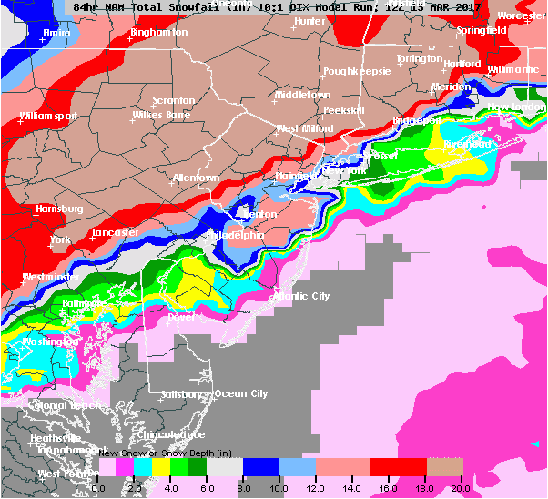
Here’s my forecast dilemma: I’ve checked the GFS and NAM model data and both show a parameter called “1000-500 mb thickness” to be above the level that supports snow formation from about 5 AM to about 10AM in Philadelphia and the immediate surrounding suburbs.
This “thickness” parameter relates to density of the upper atmosphere and basically captures temperatures in the upper levels of the atmosphere above 18,000 feet. Higher thickness levels generally mean that it’s too warm for snow formation. So I’m having real trouble with the “official” snow forecasts. I expect a significant changeover to sleet and freezing rain during the height of the storm, keeping snow totals below that shown in the above graphic.
I might have egg on my face with this forecast, but that’s why you read this blog. I have to go with my experience on this one. Hey, I may be wrong. It won’t take long to find out.
I’ll update with the latest NAM data at 10:30 PM.