There’s a change in the forecast for Sunday, specifically with the timing of the rain and with frontal passage.
The latest models have delayed the cold front passage until 7-9 PM Sunday evening. The clouds and rain will similarly much occur later in the day. More sun will translate into milder temperatures.
The latest NAM-NEST delays the rain until late afternoon or evening— 6 PM or so.) The Canadian models even later.
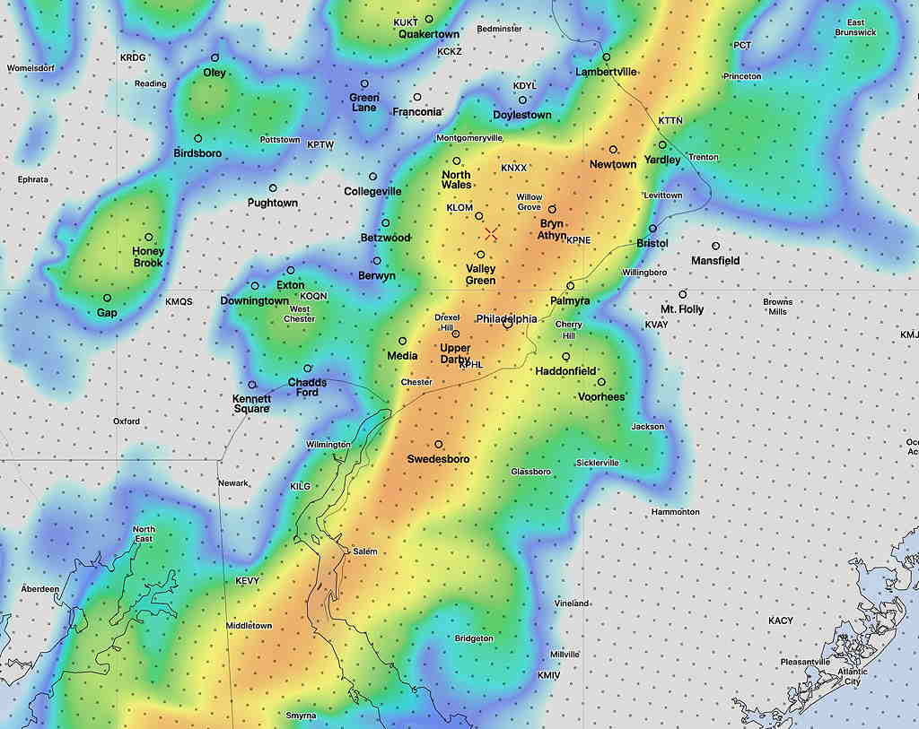
Here’s the latest High Resolution Window (HIRESW) Model (pre-release version) simulated radar at 6 PM EST Sunday.—
As first noted last night, Sunday’s forecast for late afternoon light showers has changed significantly.
A strong cold front will spawn coastal low pressure. Rain will move in around noon. Winds will become gusty by late morning with gusts 35-40 mph. Accumulated rain will be about 0.4-0.6”, higher in NJ. High temperature 53-55°
The actual cold front moves through between 5-6 PM with a shift in winds to the NW. Still gusty winds.
Temps drop into the 30s during the Eagles game. Winds gusty early will reduce somewhat by late evening.
Thursday 6:45 AM Update— Last night’s 2AM (06z) GFS still maintains the same 2-3” rainfall as previously posted. Rain begins to taper to lighter showers between 8-9 PM tonight.
Wednesday 10PM Update— Tonight’s models just becoming available have delayed the heavy rain onset to just after daybreak and have shifted the heaviest rain southward. Reduce the rain totals posted below by about 1 inch less than the amounts, shown except for Delaware.
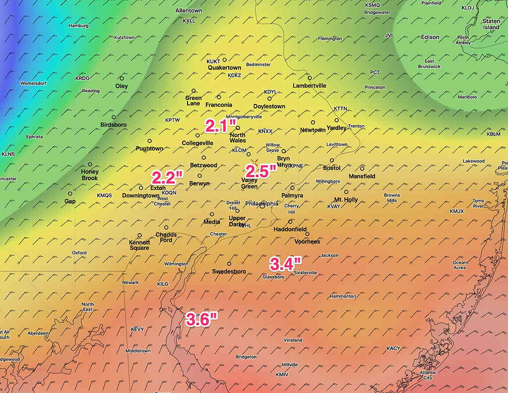
Based on the latest GFS model, here’s the current total rain forecast expected from our encounter with the remnants of Zeta on Thursday—
GFS accumulated Rain Forecast by Friday late morning. (Click on image for a larger view.)
Rain will start between midnight and daybreak Thursday. The heaviest rain will occur in the afternoon, tapering after 8 PM. Highest wind gusts about 5 PM into early evening, about 30-35 mph.