The models, particularly the GFS, over-estimated the chance of precipitation on Saturday. When I looked at the NAM-based HRRR model (High Resolution Rapid Refresh) yesterday, it did seem to keep the precipitation to our north and west. The GFS-based LAMP forecast was very off with precipitation forecast yesterday.
This morning, there are scattered light showers, mostly far north and west of the city.
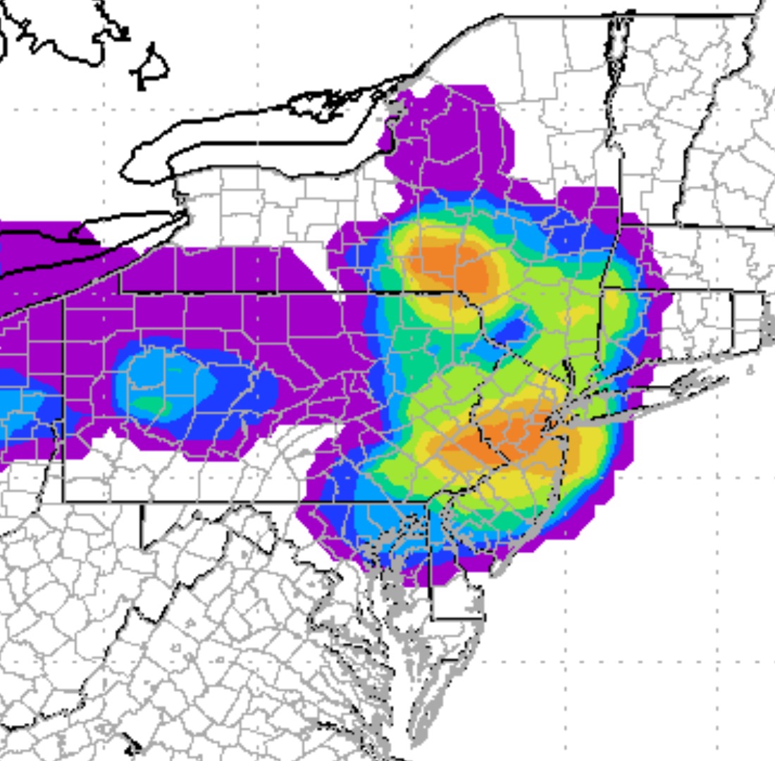
Looking at the short-range models, the HRRR brings widely scattered showers into the general PHL area by about noon. The real action (possible severe thunderstorms, possible heavy rain) develops to our west between 1-2 PM and moves through from 2-7 PM. Any breaks of sunshine late morning or early afternoon will only fuel the thunderstorms.
We’ll see if the severe weather develops. The NAM instability indexes for PHL aren’t forecast to be that impressive, enough for heavy thunderstorms, but not necessarily severe. But the NWS has been forecasting severe weather and I’ll defer to the NWS for their forecast here.
4PM update- Not the rainy day that had been expected a few days ago. This weather “event” will basically be a frontal passage with heavy rain and strong thunderstorms, starting in PHL about 5:30 to 6:30 PM . Best chance of severe weather looks to be in Delaware and areas of NJ around Delaware Bay.