There are interesting differences in last night’s models regarding the chance of showers/thundershowers this evening. (Sunday evening)
An upper air disturbance drops down into our area this evening, between 7PM and 1 AM. The NAM has been consistent in keeping any showers far to our north. One version of the WRF with NAM physics (WRF-NMMB) also does the same.
The GFS (and its similar physics version, the WRF-ARW) has showers and thundershowers making it in to the Philadelphia area towards midnight, then dissipating. It will be interesting to see which model does the best here.
Either way, today will be hot and slightly more humid. Highs 91-93 with dew points near 60.
Today’s official high temperature was 97 and the high heat index was 106.
The global GFS overshot the temperature forecast. The mesoscale models (NAM, WRF, HIREF) did better with the temperatures but over-forecast the pop-up showers in a big way.
Tonight’s models, just becoming available, are predicting a hotter day on Sunday than Saturday. Highs are coming in at 98-100. Thunderstorms move in from the northwest after 8PM Sunday evening.
[su_note note_color=”#d9f2da”]Some cloudiness did develop mid afternoon, especially north of the city. But, it really wasn’t worth focusing on…essentially, this was a beautiful, sunny day. [/su_note]
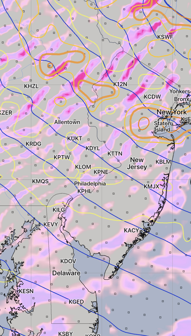
The most recent NAM and WRF models continue to show upper air disturbances rotating through our area early to mid afternoon from an upper cyclonic flow around a closed upper low off northern New England. (The GFS does not have it this far south.)
Areas of upward vertical motion (pink-blue-magenta) and vorticity (yellow lines) at 2:30 PM today
Some cloudiness is expected about 1-4 PM from this disturbance. Widely scattered sprinkles also possible, especially far north. Skies clear out later afternoon. High today 85-87.
So without the GFS on-board with this forecast, we’ll see how the WRF does.