Thu 02:53 PM Update — Thunderstorms look much less likely this afternoon and tonight. It also appears that we won’t hit the highly advertised 94º high temp today.
My previous post postulated that it’s tougher to accurately forecast the weather with a tropical system in the picture. That’s not going to stop me from trying.
Tonight’s models are just becoming available. A warm front moves through overnight and dew points rise almost 10° by 8 AM.
Tonight’s models show some scattered/isolated thunderstorms developing between 5 AM and 7AM Thursday morning with the warm frontal passage. The ‘severe weather parameters’ are fairly elevated at that time, so while these storms will be isolated, they may pack a punch.
Some models are showing more thunderstorm activity late Thursday afternoon and evening.
Unfortunately, I’m unable to access the HIRESW model this evening.
Forecast review— So the majority of the high resolution models (including my favorite, the HIRESW-ARW MEM2) got the thunderstorm forecast wrong. The HRRR, which is run/updated hourly, showed the change to a dry frontal passage with the noontime model run but was trending in that direction as early as the 8 AM run. Ironically, last night’s forecast was more on target.
Tue 03:36 PM Update — Despite all of this morning’s model data, the latest HRRR (High Resolution Rapid Refresh) model shows no storms in our immediate PHL area with this frontal passage— the front comes through dry! Hard to believe, but also hard to ignore.
The HRRR shows some dynamics, but no moisture. The GFS model suggests that the front loses upper air support. This would negate the storm forecasts of the NAM NEST, the HIRESW and the Canadian HRDPS. We’ll find out soon enough! Fascinating.
Tue 05:11 PM Update — So, some models still have some action here, albeit, an hour or so later. Here’s the 2PM NAM NEST model with its 3 hour rain accumulation at 8PM—
2PM NAM NEST Model : 3 hour precip forecast at 8 PM (Click on image for a larger view.)
These things are interesting. Are so many models wrong today?
from earlier today…
Last night, the models were unimpressive about heavy thunderstorms in the immediate Philadelphia. Based on this morning’s models, I’m fine-tuning and updating.
It appears that thunderstorms will develop in our northwestern suburbs about 4 PM and rapidly move southeastward through Philadelphia and south Jersey between 5 and 7 PM. Fast moving, you can expect gusty winds 30-40mph.
Today’s HIRESW and HRRRR show increased helicity, especially as the line of storms crosses over into NJ.
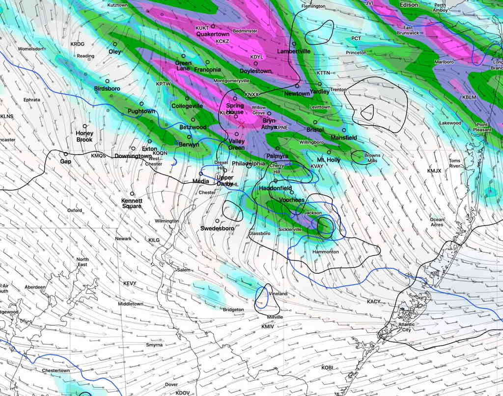
HIRESW High Helicity values (bright green) at 6 PM (Click on image for a larger view.)
Helicity values show the potential of rotational winds.
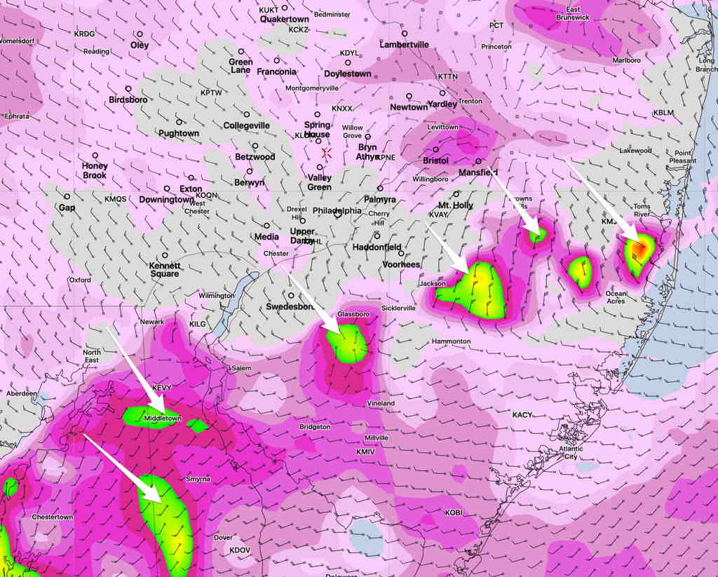
Below is a depiction of maximum horizontal moisture convergence and vertical velocity at its position at 5 PM and 6 PM. This will correspond to storm position and strength—
HRESW Horizontal moisture convergence and Vertical Velocity 5 PM and 6 PM. (Click on image for a larger view.)
In summary, the storms move from the northwest to southeast. The most severe activity will likely be when the storms move into and through NJ.
There’s been a lot of talk about heavy thunderstorms Tuesday afternoon as a front moves through. The models do show the front moving through early evening, with showers and thunderstorms between 4 and 7 PM. However, several models tonight have anything heavy moving through to the south of the immediate Philadelphia area.
Indeed, the models are not that impressive with many severe storm parameters in our area. Severe storm parameters such as helicity and shear are not that high, especially with the latest HIRESW model. Precipitable water values are not that high. Available convective potential energy (CAPE) is moderately high, but it takes more than high CAPE to get severe storms. We’ve seen much more impressive setups in past weeks and months.
As always, it’s best to keep an eye to the sky, but I think the heaviest storm activity will pass to our south between 4 and 7 PM.