Updated Wed 8:40AM, highlighted below:
Updated Wed 8:25 PM: This afternoon’s GFS has heavy rain blossoming around Philadephia between 8-10 PM, while the HRRR and the RAP do not. Current radar seems to support the GFS. We’ll see soon enough.
Wednesday’s thunderstorm outlook is looking a bit like Tuesday’s, but with some differences. These storms will also be slow moving and will develop like today’s but will be moving southward instead of northeastward.
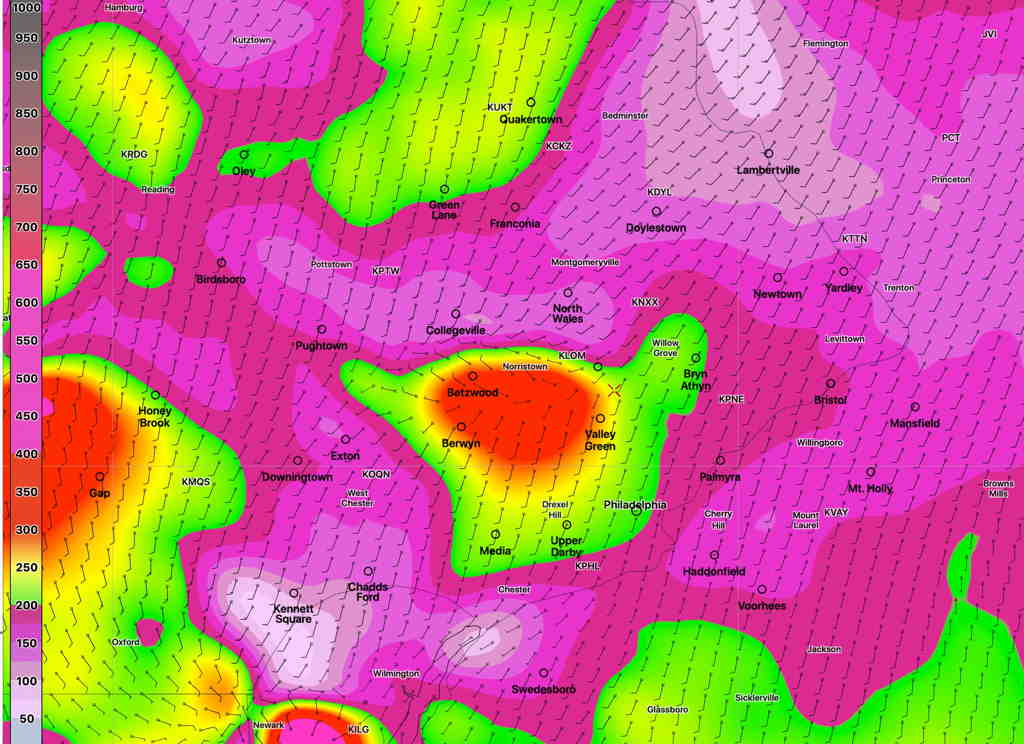
CAPE values only about 2000 instead of Tuesday’s 2800 J/Kg. Precipitable water still high at 1.9-2.0″ water, but also a bit lower than Tuesday. Instability values also lower.
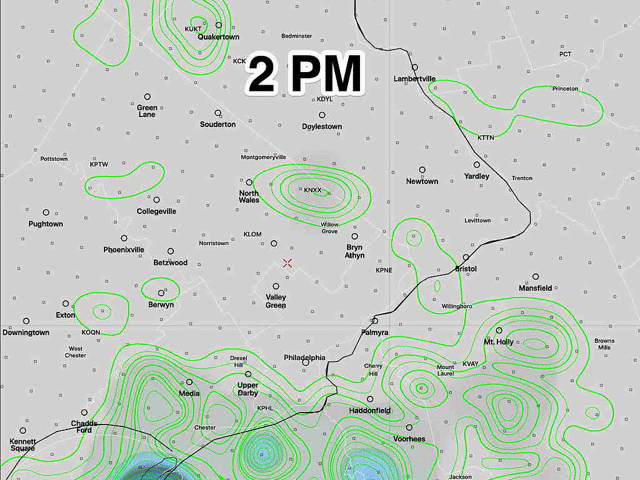
Storms are possible in as early as 2-4 PM but eventually blossoming in the immediate Philadelphia area by 4 -7 PM and continuing into the late evening. There is some suggestion that areas south of the city and in NJ may be more affected, especially in the evening. Last nights’s models continue with a timeframe of 4-7 PM for the onset in the immediate PHL area, then continuing southward. Highest probability is 6 – 8 PM
Here’s their afternoon’s HREF precip forecast