Category Archives: Philadelphia Weather Outlook

THIS WEEK’S WEATHER

Thu 05:41 PM Forecast Review — The trend was for an earlier start and the heavy rain came through about 1.5 hours earlier than forecast.

Rain totals were in the 1-2.5″ range, according to the latest MRMS
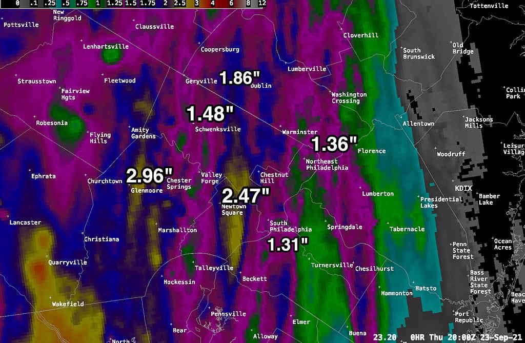
Showers will linger this evening as weak low pressure formed near us.


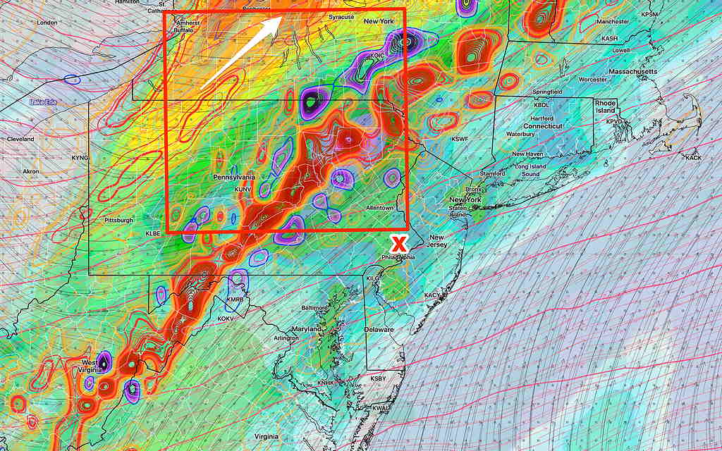
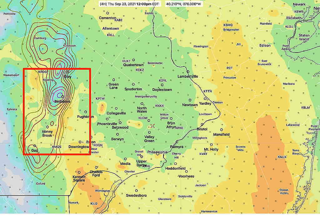
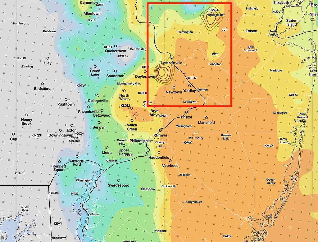
Update Thur 10:45 AM— This morning’s high resolution models just becoming available. Front moves through 2-4 PM with heavy rain, some embedded thunderstorms and high wind gusts both prior to and after the frontal passage. Rain totals 1.5-2″ with locally higher amounts.

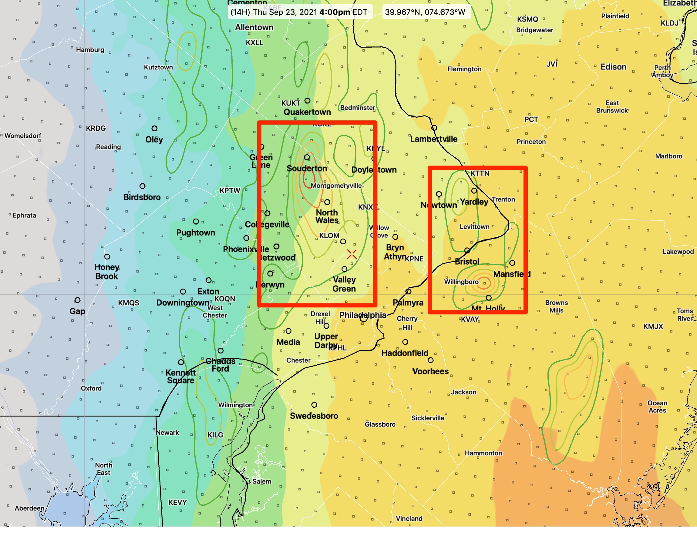
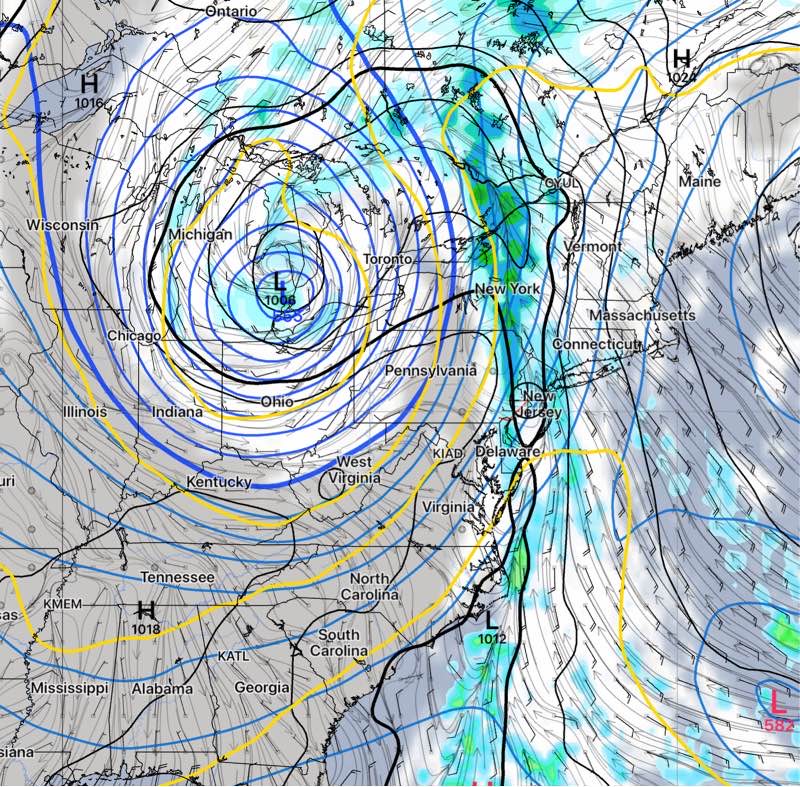
Here are some areas of potentially severe weather based overlap of higher CAPE values and higher helicity

HRRR high helicity/CAPE overlapped areas in red box. 4 PM (Click on image for a larger view.)
NAM-NEST helicity/CAPE overlap areas at 12 PM (Click on image for a larger view.)
HIRESW-ARM-MEM2 high CAPE, High Helicity 2-4 PM


Update Wed 9:45 PM — Tonight’s models just coming in suggest an earlier frontal passage, about 3 PM. An earlier start for showers, about 10 AM. Heavy rain and high wind gusts expected earlier, about 2-3 PM. Rain will continue into the evening. About 1-2 inches of rain total.


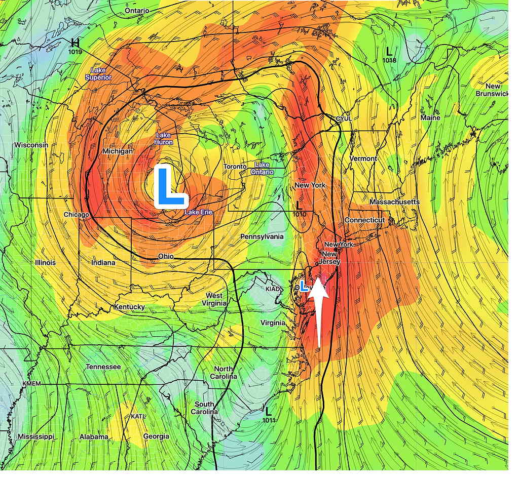
Wed 7:20 PM — The timing of the the cold front passage for Thursday has been a difficult call for much of the week, as the models have all differed with this system. Things have come more together this afternoon, with the deep low pressure system over Ohio propelling the front through earlier than previously thought: about 9 PM Thursday.

Ahead of this front, strong dynamics, at all levels including the lowest levels (“lower level jet”) will bring gusty winds and abundant moisture.

GFS wind forecast at about 3000 feet (925 mb) tomorrow. Strong 50 mph winds will mix down to the surface. High precipitable water (PWAT) will also be in the mix. Main low pressure system will spawn low pressure over Delaware. (Click on image for a larger view.)

Some significant showers develop as early as 11 AM to noon over our area. The main dynamics move through during the afternoon. The time-frame to watch is around 4-5 PM, where high wind gusts and heavy rain will be moving through and continue until about 9 PM Thursday.

Currently, the forecast CAPE values are less than 600 (suggesting that any thunderstorms that form could be strong, but not severe) and while helicity values are high (>400), the helicity doesn’t overlap with the higher CAPE; tornadic activity is not likely.

The main issue will be heavy rain (latest NBM is forecasting over 2″ of rain) and high wind gusts. Stay tuned.


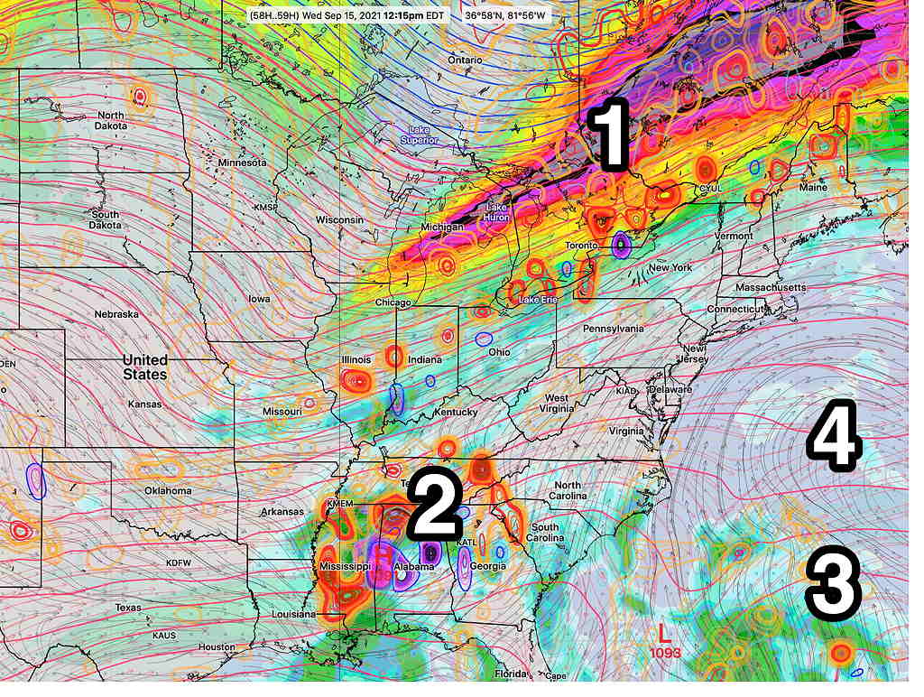
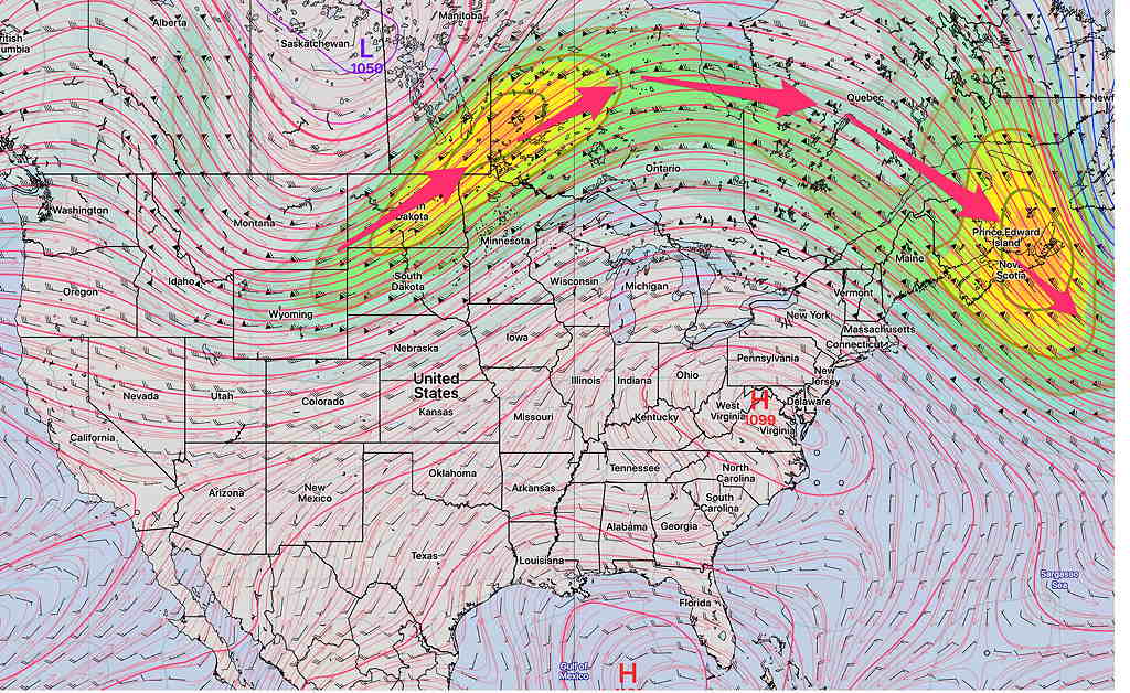
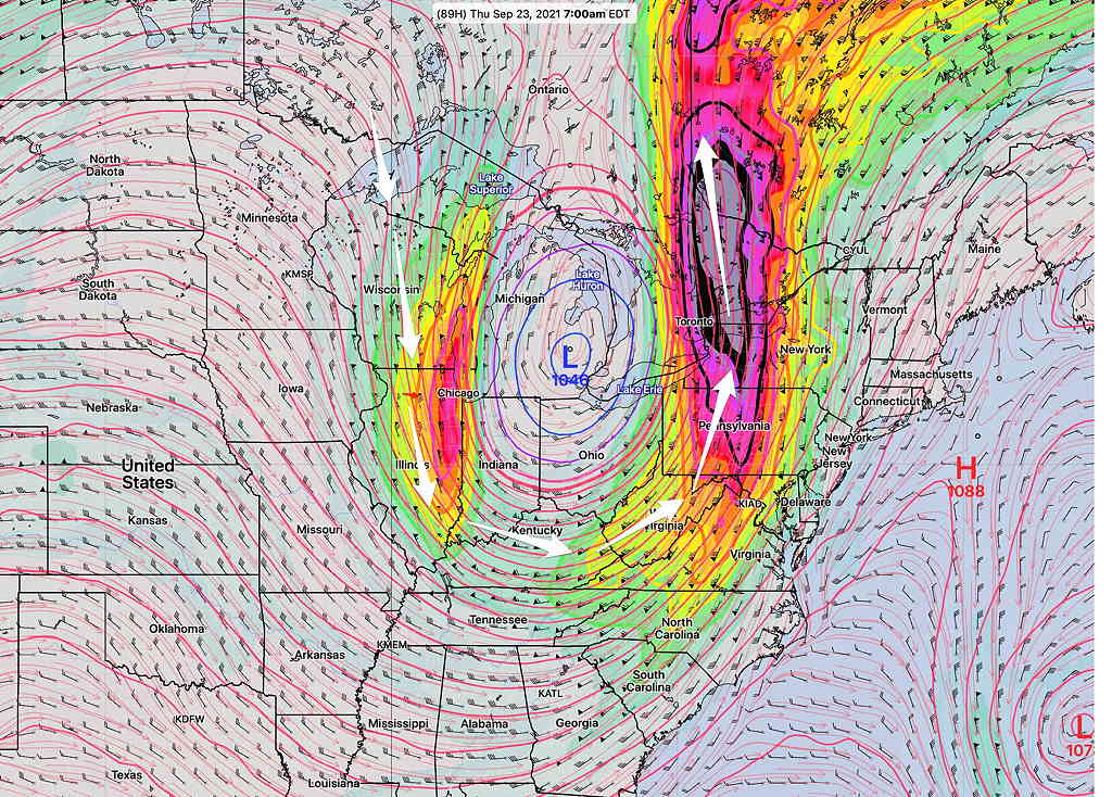
Tues 9:22 PM — A brief plunge in the jet will bring a cold front through about 1 AM Friday morning. A strong upper closed low will form over Michigan, but will lift into Canada on Friday.

A southeasterly flow of moisture ahead of this low will result in showers developing as early as Wednesday afternoon. With this frontal passage, rain with some embedded thunderstorms will develop on Thursday during the daytime and especially during the evening.

Fairly heavy rain (1-2 inches total) and increasing winds will be our weather over the 36 hour period from Wednesday afternoon until about midnight Thursday.

GFS Forecast midnight Thursday showing the backend of the rain with the cold front and the closed low over Lake Huron. (Click on image for larger view)

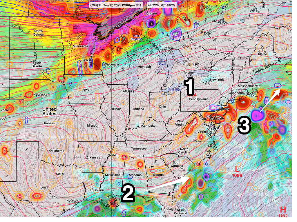
Another cold front moves through over the weekend.


Original post

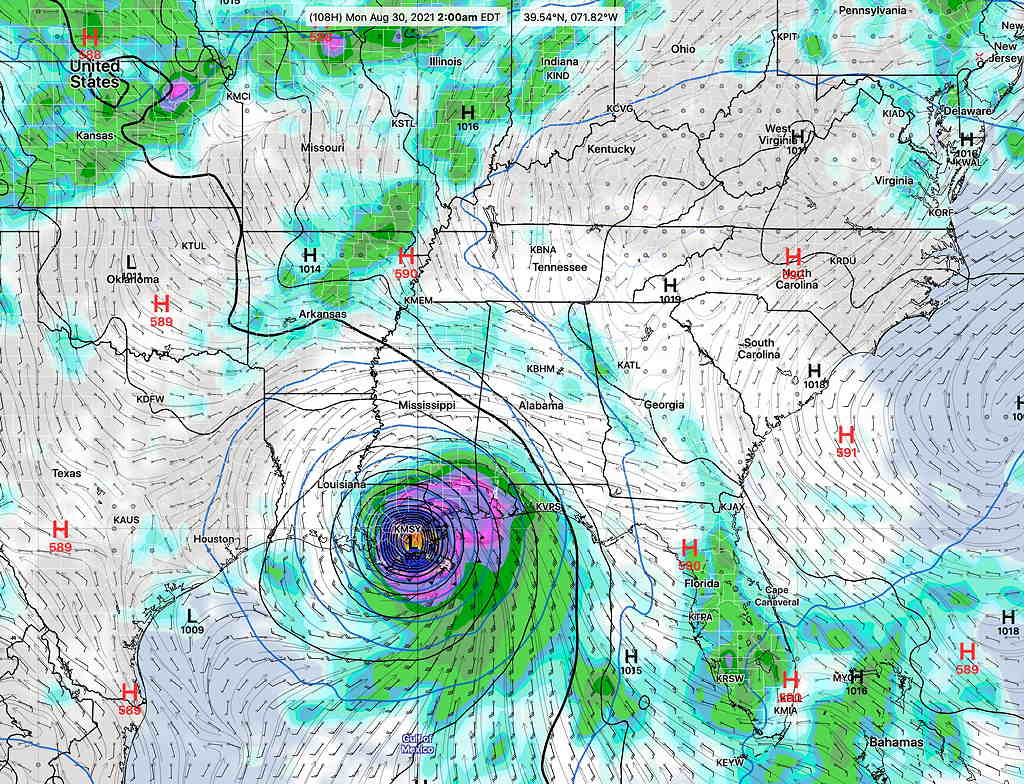
Autumn 2021 begins on Wednesday, and just in time, the jet stream makes a deep plunge with colder air briefly pushing into the U.S..

As mentioned in Friday’s Weekend Forecast, some models have the “540 thickness line” (the generalized demarcation between rain and snow in winter) making its first appearance for the season on the weather map.

The GFS isn’t forecasting as cold a plunge in the jet flow as Friday’s ICON model, but it still shows a considerable plunge in the jet.

The cold front that is associated with this plunge will move through sometime late Wednesday into Thursday with some heavy rain possible.

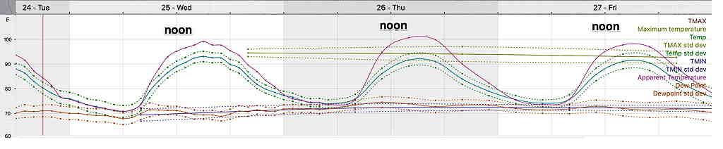
Prior to the front, continued warm weather on Monday with increasing cloudiness on Tuesday. Some showers possible on Wednesdayahead of the actual front.

GFS 250 mb (jet stream level) wind flow for Thursday at 7 AM. (Click on image for larger view.)

This jet plunge will pinch off into a closed upper low that near Ohio, eventually opening up over Friday into the weekend. As a result, some of the details in timing with this week’s forecast are uncertain at this time.

THIS WEEK’S WEATHER

Update Wed 7:15 PM— No change; heavy activity remains far northwest areas. GFS continues with some showers around Philadelphia around 8-9 PM, while most of the high resolution models don’t have any showers until after midnight and whatever makes it here won’t be too significant.

Thursday is looking more tranquil than previously thought.


Updated Wed 1:30 PM — This morning’s models are in two camps: the high resolution models have the main thunderstorm and rain activity remaining to our far north and west this evening with some rain moving in around midnight and afterwards.

In the other camp is the GFS (and Canadian GEM) models which also keep the main area of thunderstorms to our north and west, but have some scattered rain and thunderstorm activity breaking out about 7-9 PM in the immediate Philadelphia area. In the past several months, the GFS timing and placement of showers/thunderstorms has been better than the high resolution models, so I’m going to lean towards its forecast.


Updated Wed 8:40AM— see graphic caption

Most of the energy (vorticity – colored concentric contours) remains in what’s called the “right entrance region of the jet streak” (red box). This region stays far northwest of the city (Lehigh Valley) for tonight as the jet streak (white arrow) exits far northwest. Some rain and showers move in about 11 PM or so tonight, but the heaviest rain and thunderstorms stay far northwest tonight. A different setup for Thursday…stay tuned. (Click on image for a larger view.)

Updated Tue @ 8:44 PM — It looks like the tropical systems (2) (3) will stay to our south and east. A cold front sags into our area late Wednesday evening into pre-dawn Thursday but will stall.

It currently seems as though most of the thunderstorm activity with the front will weaken by it time it gets to Philadelphia Wednesday night with just some residual rain/showers.

With the front stalled near us, showers and thunderstorms are possible Thursday and Friday. Some moisture from the Atlantic tropical system may affect us Friday.

Weekend looks good after a cloudy start as high pressure (1) builds in.

GFS 18z upper air forecast for Friday at noon. Upper air winds and contours and areas of vorticity. (Round concentric contours are areas of vorticity.) Tropical system (3) passes east of us. Remnants of Nicholas (2) remain to our south, but some moisture will be brought northward. High pressure (1) will build in for the weekend. (Click on image for a larger view.)


Original post from Monday
High pressure (4) off the Atlantic coast will bring a southwesterly flow of very warm and humid air to the Philadelphia area this week. A somewhat stationary cold front (1) will remain to our north but may slowly sink south towards Thursday—

GFS 06z forecast Wednesday noon. (Upper air contours, near surface winds. Round contours are areas of vorticity.) (Click on image for a larger view.)

There’s considerable uncertainty in the forecast for later in the week. The models are inconsistently handling two tropical-like disturbances (Remnants of Tropical Storm Nicholas-2) and a second tropical type disturbance near the Bahamas (3).

Even without the tropical disturbances, it’s unclear how much cloudiness and instability will develop in our area with the unseasonable heat and humidity.

While the forecasts on the TV/radio suggest just warm/hot and humid days, I suspect there might be considerable cloudiness at times with scattered showers/thunderstorms as the week goes on. To be watched is tropical disturbance #3 which may trend closer to the NJ coast than currently forecast.

THIS WEEK’S WEATHER

Thu 10:30 PM — Tonight’s models just becoming available shows heavy thunderstorms developing Friday between 4 PM and 8 PM and continuing into late evening as the cold front mentioned in my Wednesday update tries to make further progress southward.
(The HIRESW-ARW has storms as early as 2 PM)

High CAPE values and high PWAT will make for strong storms and heavy rain.
Saturday looks rainy according to the latest NBM. My regular weekend weather forecast will cover the details.


Thu 6:50 AM — The GFS, RAP and HRRR have backed away from numerous showers/thunderstorms this evening. Still some scattered around. The HI Resolution models and NAM still have showers as shown in last night’s graphic..


Wed 8:02 PM— Thursday’s forecast has come into somewhat better focus as a weak front will try to get its toe in the door late Thursday with little success as it’s pushing against strong upper level high pressure entrenched over much of central and southeastern US. Today’s models have some showers and possible thunderstorms in the Philadelphia area late Thursday afternoon as the front tries to move through. Most, but not all, of the activity is is currently forecast to be north and northeast of Philadelphia.

HREF 1 hour rain forecast for Thursday at 7 PM. Just a single time snapshot. Any storms break out as early as 4 PM in some areas. (Click on image for a larger view.)

A slight change in wind direction on Friday; the front will make another attempt to move through Friday evening with more showers and thunderstorms, likely more prevalent.

The weekend weather outlook still looks uncertain, but a mix of clouds, some sun and showers/thunderstorms is the most likely scenario for Saturday as the front hangs up somewhere near us. Sunday looks to be the better day.

Also on the horizon is another tropical storm that the GFS is forecasting to become a hurricane in the Gulf and approach the US coastline, possibly Louisiana, as early as Monday.

Current GFS Forecast 2 AM Monday (Click on image for a larger view.)

Tue 9:16 PM— After the ‘exciting’ weather from Henri, this week’s weather will be relatively unexciting, as a large high pressure ridge in the upper atmosphere continues with the high heat and the humidity—

GEFS jet stream (250 mb wind/height) forecast for Saturday (Click on image for a larger view.)

There really isn’t any sign that crisp cold air from Canada will descend upon us any time soon.

Wednesday through Friday appear to be hot and humid (although without the mid 70s degree dew points we have recently had). It will still feel very hot.

A meteogram is worth a thousand words. Here’s the NBM Temp/Dew point/Heat Index (“Apparent Temperature) for Blue Bell this week—

NBM model meteogram for Blue Bell. Wed-Fri. Note that the near 100º is the Heat Index (in the model world, known as the “apparent temperature”) Also included is the standard deviations. (Click on image for a larger view.)

While the general pattern is for continuation of hot/warm weather, small ripples in the upper air flow will result in possible thunderstorms Thursday late afternoon (especially far north) and Friday evening.

Following a cold front Friday evening, high pressure will try to move in over the weekend. Unfortunately, it appears that the main high pressure system will remain in Canada and we’ll get some easterly winds as the front stalls somewhere just to our south. That means somewhat cooler weather, but it also can mean some clouds and some showers.

The weekend forecast is too uncertain at this time to even try.