Category Archives: Philadelphia Weather Outlook

THIS WEEK’S WEATHER & MEMORIAL DAY WEEKEND OUTLOOK

PERIODS OF SHOWERS AND STORMS FRIDAY

Update Fri @ 5:04 PM — Not much in the way of strong storms or severe weather in our immediate area. (Although severe weather was picked up on radar in NJ.) The amount of rain so far has been less than forecast. More showers expected later this evening and around/after midnight.

Update Fri @ 9:44 AM — Latest HRRR and RAP have converged on a peak time for storms to start: about 3 PM, earlier in western areas.

Update Fri @ 9:10 AM — Reviewing the latest hourly models, the previous forecast time frame for showers and thunderstorms has remained unchanged in our immediate area: a large range of time, from 2 PM to well after midnight.

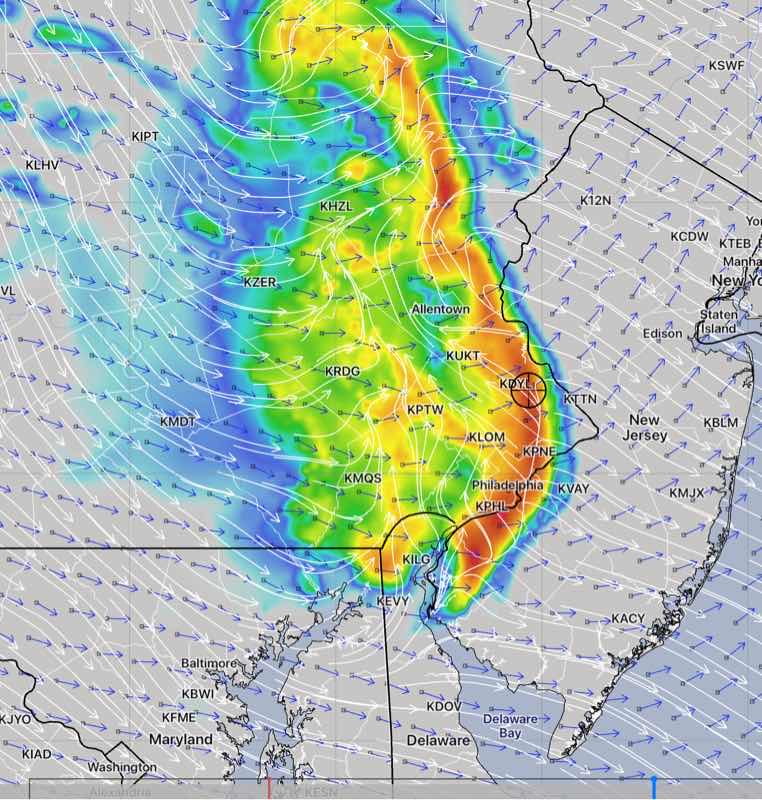
Based on helicity values and storm motion/shear vectors, the strongest storms appear to be most likely this evening, after 5:30 PM, although CAPE values are already high at 2 PM.

Different severe parameters and factors peak at different times. There’s a strong jet stream influence later in the evening after midnight.

The severe parameter values are similar to those shown in my severe parameter table from last night.

Last September‘s Tornadoes (9/1/21)Thursday’s
RAP 21z Model
Today’s
RAP 09z Model
!!
CAPE 3500-4200 Joules/kg12001200
Helicity 800-1100 m^2/s^2350250
Vertical Shear 35-45 16-2025
Precipitable Water 2.0″1.8″1.9″
Lifted Index minus 7-9 minus 5minus 5
Peak Wind Gusts 40-503532
Aligned Storm Motion and Shear Vectors- YESYES (early)YES
6 -9 PM
Jet stream- Highly CyclonicFlat to anticyclonicMore Cyclonic
Jet Stream Speed – HighModerateMod-High
(midnight)
!!
500mb – Highly CyclonicAntiCyclonicCyclonic
midnight
!!
Updated Update Fri @ 8:44 AM

As was my forecast last night, these storms can be strong. I don’t expect severe weather, but I’m sure the NWS will issue severe storm watches and warnings. Base your plans on the NWS.

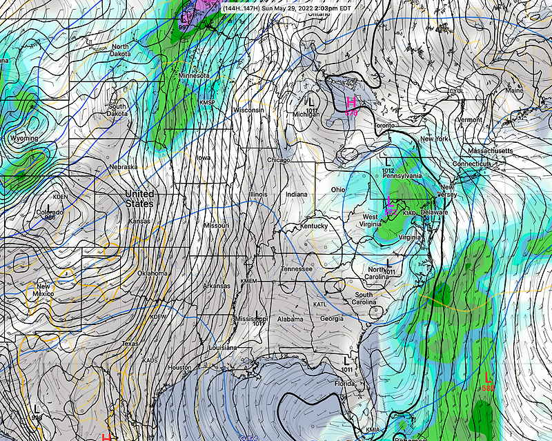
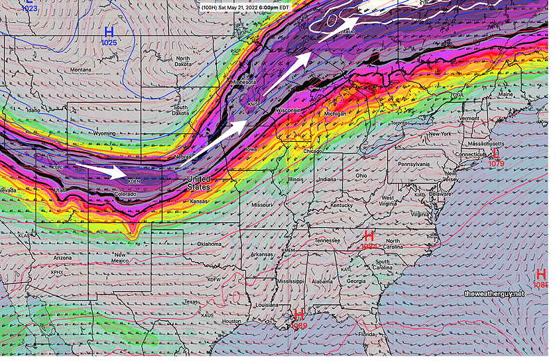
As for this weekend’s weather, this has been an especially challenging forecast, especially for Saturday, with models having inconsistent and shifting forecasts from day to day. The upper low has been hard to pin down. The ICON, whose forecast had been totally dry for Saturday has added showers and even some thundershowers for mid-day Saturday. Indeed, several models have a mix of sun, clouds and convective showers (thundershowers) during the morning and early afternoon.

I’ll post the weekend forecast this evening.


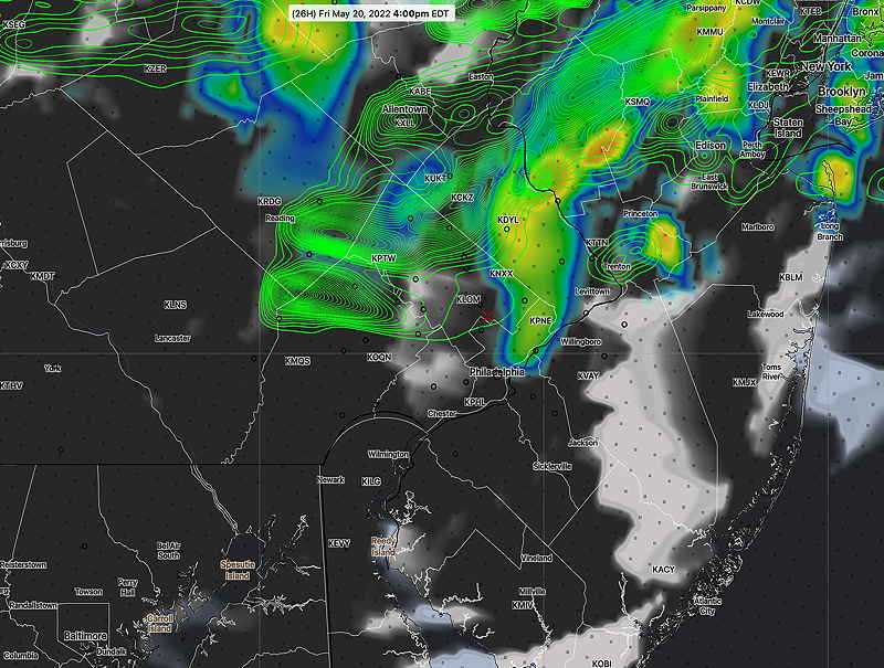
Updated Thu 11:30 PM — Tonight’s models continue with forecast from the earlier RAP— showers and thunderstorms develop late morning/early afternoon Friday and continue through at least midnight.

Several batches of storms during this period— Some late morning activity possible to start things off —then early afternoon (2PM) and some potentially stronger storms 6-9 PM. Another batch around midnight. Some models have some showers even Saturday morning before the major clearing trend starts for the balance of the Memorial Day weekend.


Updated Thu 7:38 PM — Prior to what’s shaping up to be a rather nice weekend, we’ll have to get through Friday.

An approaching upper air trough will trigger the development of showers and thunderstorms on Friday. My table of severity parameters below compares tomorrow model forecast (RAP) to what has become my standard of extremes- last year’s (9/1/21) tornadic storms.

Last September‘s Tornadoes (9/1/21)Fridays Storms
RAP 21z Model
CAPE 3500-4200 Joules/kg1200
Helicity 800-1100 m^2/s^2350
Vertical Shear 35-45 16-20
Precipitable Water 2.0″1.8″
Lifted Index (minus) 7-9 minus 5
Peak Wind Gusts 40-5035
Aligned Storm Motion and Shear Vectors- YESYES (early)
Jet stream- Highly CyclonicFlat to anticyclonic
Jet Stream Speed – HighModerate
500mb – Highly CyclonicAntiCyclonic

As you can see, the current severe parameters are in the middle range. I expect some strong storms tomorrow. I’ll use the disclaimer that severe weather is always possible with thunderstorms, but I don’t expect much in the way of severe.

What appears to be the most important aspect of tomorrow’s storms will be the extended time frame that scattered storms develop and move through. Some early activity late morning, the bulk of the activity from about 2 PM to midnight.

This afternoon’s 21 RAP model radar/accumulated rain forecast at 2 PM Friday. Large area of rain (1) for the afternoon. A second batch of rain (2) catches up and moves in around midnight. (Click on image for a larger view.)

I’ll keep an eye on things. Stay tuned.


Show More

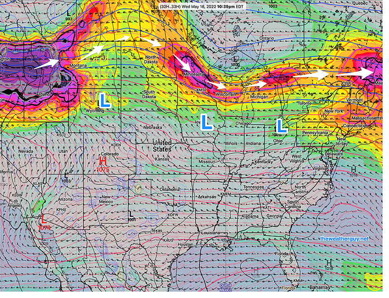
For the weekend, there’s a lack of agreement between the GFS, ECMWF, ICON, and CMC regarding the upper trough and closed upper level low. The GFS has a slow, closed low forecast which would adversely affect this coming weekend’s weather, while the other models open up the low and move it off the coast. It’s too early to tell which is correct and we’ll have to follow the model trends for the next few days.

The most optimistic forecast right now: Friday looks to be rainy, sunny Saturday, Sunday into Monday—

Today’s 12z ECMWF optimistic forecast for early Saturday morning. (No closed upper level low) (Click on image for a larger view.)

Unfortunately, the latest GFS maintains that closed low through the weekend with plenty of showers. Again too early to hang our hats on the pessimistic GFS—

Today’s 18z GFS pessimistic Sunday forecast. Closed low over Pennsylvania Plenty of rain and clouds. (Click on image for a larger view.)


THIS WEEK’S WEATHER

Bow-Echo line of storms possible Friday

Forecast Review— The storms that had broken out early, ahead of the main group, were not forecast. These storms stabilized the atmosphere and reduced CAPE. Despite the official ”Tornado Watch”, the storms that moved through our immediate area were not as severe as forecast.

Update Fri @ 3:31 PM — Latest radar shows storms have broken out ahead of the main line (not forecast by the models) and the main line of storms will move in about 4 PM

Radar composite loop 3:24 PM (courtesy of WeatherTap.com)

Updated Fri 11:20 AM — Mobile update: Latest HRRR 13z has the storms closer to 6-7 PM and has reduced shear and helicity values, but still high. Still affecting PHL area.

Update Fri @ 10:12 AM — One more thing…the latest NAM just available keeps the severe weather near Allentown. So quite a bit of uncertainty here with the exact placement of the storms.

Update Fri @ 9:41 AM — Latest HRRR just available—

12z HRRR just available shows bow echo through Philadelphia. This is the 1 hour accumulation at 7 PM, so the actual storms move through from 5 to 7:30 PM. (Click on image for a larger view.)

These storms DO have the potential to be fast moving and SEVERE.

Last September‘s TornadoesMonday’s Storms RAP 17zToday’s Forecast HRRR 12z
CAPE 3500-4200 Joules/kg22002500-2700
Helicity 800-1100 m^2/s^2130900-1100
Vertical Shear 35-45 15-2022-24
Precipitable Water 2.0″1.6″1.6-1.8”
Lifted Index (minus) 7-9 minus 6-7 minus 6
Peak Wind Gusts 40-5025-3045-50 mph
Aligned Storm Motion and Shear Vectors- YESNOYES
Jet stream- Highly CyclonicCyclonicLocally Cyclonic
500mb – Highly CyclonicCyclonicCyclonic
This profile is SEVERE

Current Radar Composite (courtesy of WeatherTap.com)

I’ll be out the rest of the day. I’ll try to update via mobile.


Update Fri @ 9:20 AM — Some additional showers have developed in western suburbs this morning, showing the answer to the ? in the graphic below. The NAM-NEST shows these as weakening as they approach the city.


Update Fri @ 9:12 AM — The current water vapor imagery shows a lack of agreement between the real world (water vapor) and last night’s GFS NAM (contours) superimposed.

Water Vapor with superimposed GFS/NAM potential vorticity. Notice the water vapor X is ahead of the potential vorticity X (Click on image for a larger view.)

This suggests the models may not be accurately capturing the storm. The water vapor image suggests that the storm is moving faster than forecast.


Update Fri @ 9:01 AM — For this storm, I decided to dust off the recently updated Canadian high resolution model (HRDPS), a model I don’t routinely download because it takes a lot of post-processing time. Anyhow, it continues with several other model’s northern track of this storm line. So the northern track, missing Philadelphia, appears to be the model-preferred track except for the HRRR.

06z HRDPS (Canadian High Resolution Deterministic Prediction System) model forecast for 6 PM showing southern extent just south of Allentown. (Click on image for a larger view.)

I’m waiting for the latest 12z HRRR and RAP models to get a better handle on the likely track of this mesoscale complex.


Updated Fri 7:34 AM — A quick update. Last night’s models are suggesting the possibility of a fast moving line of strong to severe thunderstorms between 3:30 PM and 6 PM tonight. The latest HRRR and RAP forecast a ”Bow Echo” mesoscale complex associated with a derecho type clusters, a long-lived line of severe storms in bow formation.

06z HRRR showing bow-echo simulated radar at 5 PM Friday. Arrows (blue) storm motion vectors Arrows (white) shear motion vectors. (Click on image for larger view.)

I’ll update later with the 12z HRRR that becomes available about 9:35 AM.


Updated Thu 9:53 PM — The term ‘severe’ may actually become appropriate to describe the thunderstorms now forecast to move through late Friday afternoon 4 PM -6 PM. (The timing may change with this sort of system.)

The HRRR model graphic below still captures the current forecast track, with the most intense weather north of the immediate PHL area.

Tonight’s early models, along with the ECMWF, take a disturbance, currently in Illinois, through northern Montgomery, Lehigh and northern Bucks counties.

Thu 10:59 PM — Tonight’s HIRESW has the line closer to Philadelphia

I’ll update tomorrow morning.


Updated Thu 3:11 PM — What had been expected to be an uneventful warm front passage on Friday afternoon now appears to possibly be a little more noticeable: the latest models show clouds and even some showers/thunderstorms late afternoon Friday with the warm front. The heaviest activity (if any) will be far northern suburbs.

18z HRRR simulated radar/ accumulated rain (contours) at 4 PM Friday.

Continuing with my earlier theme of the week regarding thunderstorm severity, it will be interesting to see if ‘severe’ thunderstorm watches will be issued. (I expect it won’t be issued or needed.)

Here’s representative severe weather parameters from today’s 15z RAP model for Friday late afternoon compared to Monday and the superstorms of 9/1/21—

Last September‘s TornadoesWednesday’s NAM-NESTFriday’s Forecast RAP 15z
CAPE 3500-4200 Joules/kg2000-40001900
Helicity 800-1100 m^2/s^2130460
Vertical Shear 35-45 15-2024
Precipitable Water 2.0″1.6″1.6”
Lifted Index (minus) 7-9 minus 6-7 minus 5-6
Peak Wind Gusts 40-5025-3025-28 mph
Aligned Storm Motion and Shear Vectors- YESNOYES
Jet stream- Highly CyclonicCyclonicAnticyclonic**
Jet Stream Speed – HighHighLow **
500mb – Highly CyclonicCyclonicCyclonic
What’s different about this weather compared to Monday – this is a warm front compared to a cold front; the dynamics and vertical structure are very different.
The ** asterisked parameters may be critical here for not supporting severe weather.

Update Thu @ 9:54 AM — Latest NBM high temperatures Saturday—

NBM 12z high temperature forecast for Saturday. Dew points will be in the mid 60s, according to the model blend. (Click on image for a larger view.)

The ICON model was the first to show these temperatures. It has highs in the 97º range.


Updated Wed 8:09 PM — Some rain expected tonight which should end by mid morning Thursday.

An uneventful warm front moves through mid day Friday, possibly causing a short period of cloudiness. An increase in humidity will be noticeable Friday afternoon.

The big story will be the very hot temperatures for the weekend, especially Saturday. Highs look to be 93-96° with dew points approaching an uncomfortable 68-70°. Hot, even if this were July!

Thunderstorms are forecast to stay to our west on Saturday, but clouds and thunderstorms may move in late afternoon Sunday


Updated Tue 10:46 PM — The latest NBM model shows a high temperature of 93° on Saturday.


Show More


THIS WEEK’S WEATHER

Updated Thu 9:55 PM — Here are the forecast trends for Friday through Sunday—

Light scattered showers/sprinkles early Friday especially southeast of the city, low clouds. Much of the day cloudy but dry. There may be some breaks in the cloud cover especially west of the city. Updated Thu 10:43 PM —Tonight’s high resolution models have some sunny breaks in the afternoon along with some widely scattered showers.

For Saturday, the models (with the exception of the ECMWF) have further reduced the chance of showers except far western suburbs. Brightening skies and some sun expected. Increased chance of some showers late afternoon and evening. Possibly some thunder. Updated Thu 10:54 PM — Tonight’s. NAM-NEST shows a fairly nice day for Saturday

Sunday should be a lot like Saturday, but with more sunshine and warmer. Some showers possible late in the day or evening.


Update Thu @ 9:43 AM —The GFS and other models are in agreement with clouds and showers on Friday as a jet streak associated the closed upper level low affects us.

3 PM Friday—

GFS Jet stream forecast (250mb level) for Friday 3 PM. Notice the closed low is in a somewhat different position than had been forecast earlier this week. A counter-clockwise circulation around the upper low brings a jet streak (1) up the coast. Our area’s position in relation to the jet streak will be s in what’s called the “left exit region” – an area of upward vertical motion (white rectangle). With the upward vertical motion and moisture from the southerly flow, we’ll have showers on Friday. (Click on image for a larger view.)

3 PM Saturday—

GFS Jet stream forecast 3 PM Saturday. By Saturday, the previously closed low will have “opened up” in Virginia and the jet streak position is forecast to be somewhat north of our area. Our area will be in what’s called the “right entrance region” of the the jet streak (white rectangle). The right entrance region has less upward vertical motion. Showers should be less numerous on Saturday with a mix of clouds and even breaks of sunshine. (Click on image for a larger view.)

The latest ECMWF model, just available, has a different jet flow and forecast than the GFS. The ECMWF continues with a wetter Friday and Saturday.


Updated Tue 11:15 PM — Tonight’s models are showing the chance of clouds and scattered showers as soon as Thursday, with moisture brought inland from the retrograding coastal low.


Updated Tue 7:15 PM — Looking towards the weekend, the same low that gave us the rain last weekend, threatens to rotate back into our area by Friday (see image below).

For Wednesday and Thursday, the same cloud deck that moved in late Tuesday may affect our area at times. Temps in the 70s

As for Friday, there are differences between the ECMWF and the GFS, with the ECMWF showing showers moving in during the day, while the GFS keeps us just with some clouds.

Saturday looks unsettled with clouds and occasional scattered showers but not looking like a rain-out. Again, the ECMWF shows more rain than the GFS. Highs mid to upper 70s.

Sunday may feature warm temperatures and breaks of sunshine ahead of an advancing cold front. Highs may reach near 80º.


Updated Tue 6:53 PM — Well, the clouds from the retrograding coastal low moved in eventually, about 7 hours later than had been forecast last night.

Visible Geocolor Satellite Image 6 PM

Updated Tue 8:43 AM — The 06z models backed away from the clouds making it into Philadelphia today.


Updated Mon 10:47 PM — Tonight’s models are suggesting a slight forecast change for Tuesday. The retrograding low pressure system off the coast may throw back some low level cloudiness far west enough to make it into the immediate Philadelphia area.


Previously Posted Sun 7:33 PM —

This coming week’s weather will feature a blocked pattern, the other side of the coin of this past weekend’s cold, cloudy, rainy and slow moving upper air low pressure system.

Indeed, the same upper low that gave us the rain will retrograde to our southeast instead of the usual path moving off to the northeast.

ECMWF forecast upper air forecast for Tuesday morning showing the upper low in the Atlantic and its current forecast path (white arrows). This is the same upper air low that gave us the rain Friday through Sunday morning! Ordinarily, it would move off to the northeast (Path 1) , but its path (Path 2) is the result of a block in the Atlantic. This low may circle up to affect us again next weekend! (Click on image for a larger view.)

This week, upper air winds will come from the north and northeast. We should have dry conditions through Friday.

Meanwhile the same blocked pattern will allow temperatures to build to record levels in the mid section of the country.

GEFS mode Temperature forecast with upper air contours for Wednesday 5 PM. Notice the same upper low off the Carolina Coast and heat building in the mid section of the country. Temperatures here will approach 80º later in the week. (Click on image for a larger view.)

Incredibly, the same low is forecast to retrograde westward over Florida and then move back over our area for next weekend with more rain.