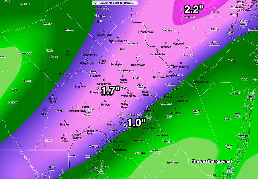
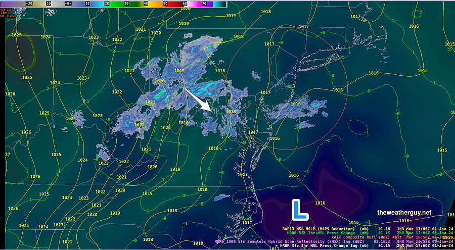
#Philadelphia #weather #PAwx
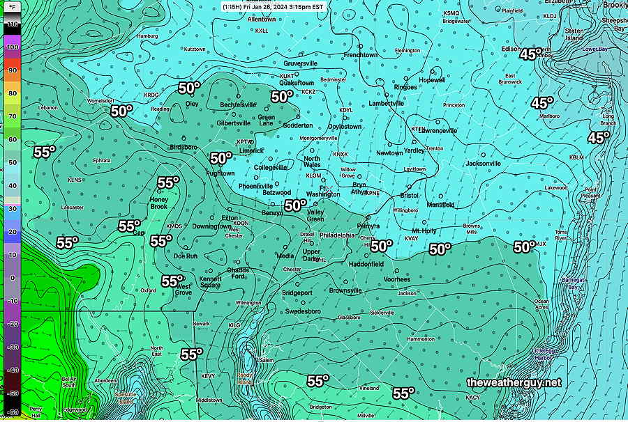
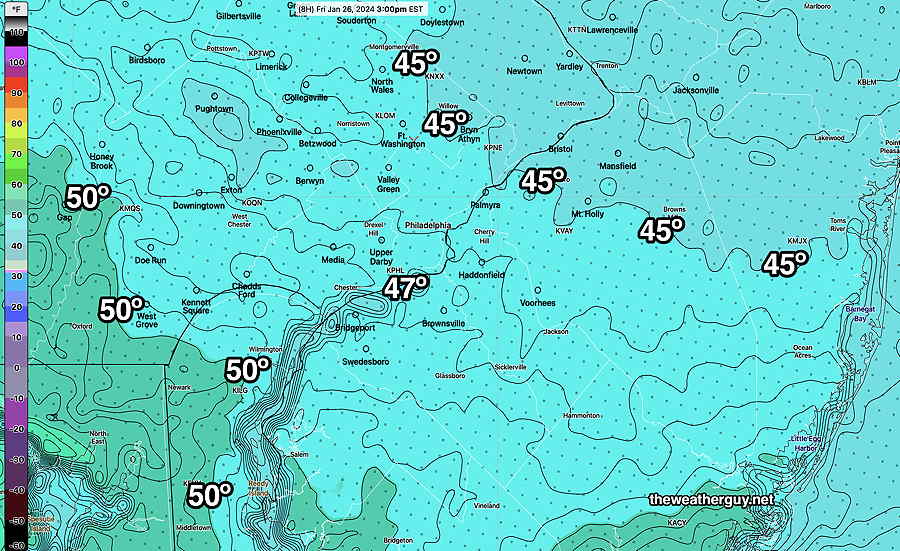
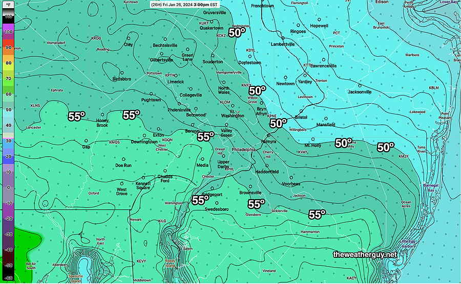
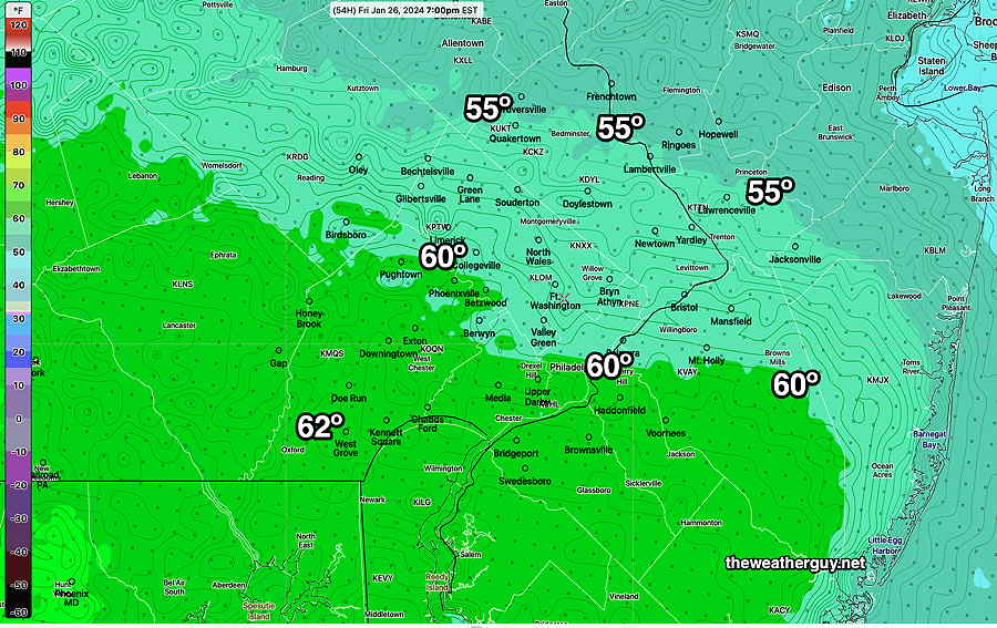
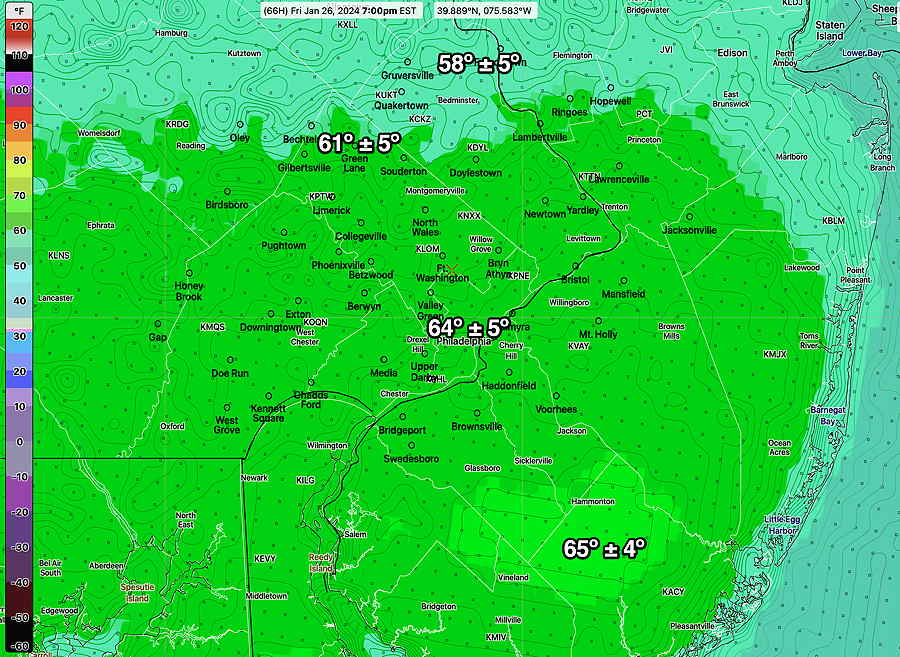
Here are the actual temperatures recorded by the RTMA—
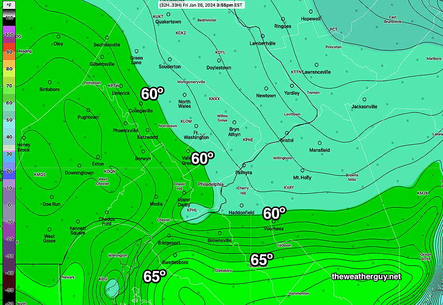
Friday Forecast Change
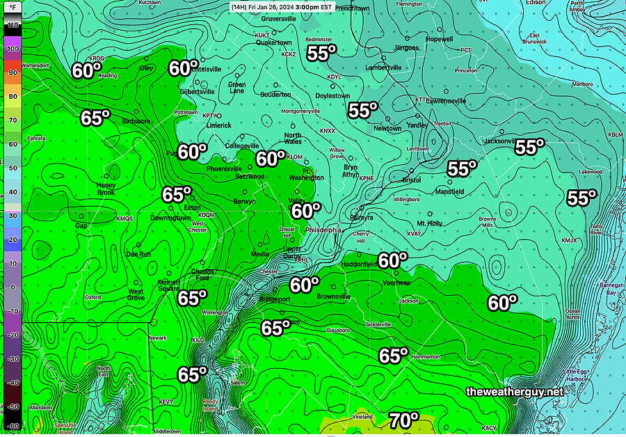
Posted Friday 01/26/24 @ 11:11 AM — It looks like the NAM-NEST forecast will be closer to reality, perhaps a bit too cold. Here’s the latest NAM-NEST (12z)
If we’re going totally with the NAM-NEST model, instead of the clearing and sunshine around noontime (as forecast by the other models), the NAM-NEST keeps us cloudy all day! It even keeps the drizzle going in some areas through the afternoon. This is what happens when one “ignores the NAM”.
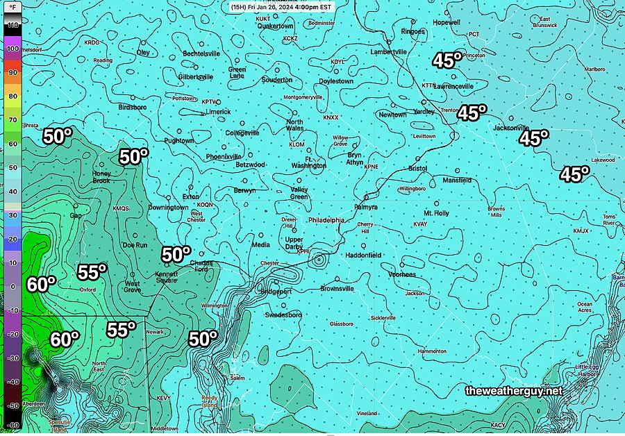
Posted Friday 01/26/24 @ 8:39 AM — A quick mobile update. Well, I just viewed this morning’s (12z) HRRR which just became available after tunneling into my weather data server. It is leaning towards a much cooler day with high temperatures in the low 50s. My guess is later runs of the NBM will show this trend too. Perhaps I should learn to follow my own mantra— “Never ignore the NAM”. (In this case, the NAM-NEST).
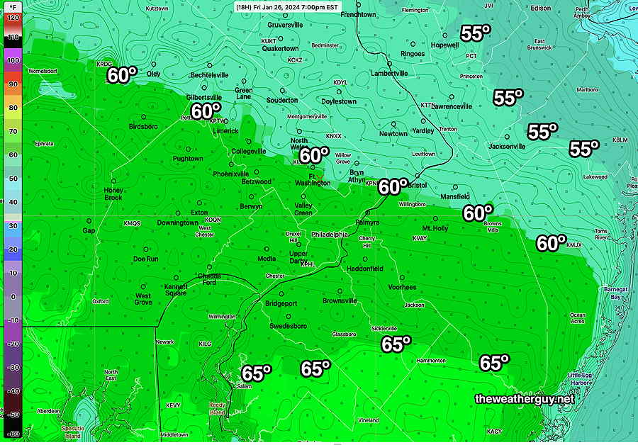
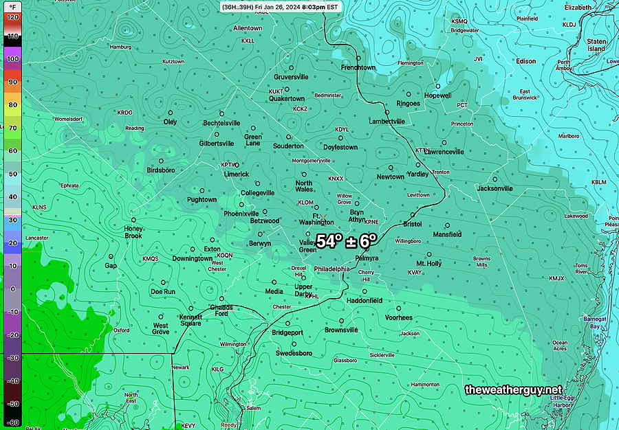
Friday’s Temperatures
Posted Friday 01/26/24 @ 6:56 AM — The models have trended closer to the 60º+ promised earlier in the week. Here’s the latest NBM—
As mentioned, consistent with this forecast has been the HRRR. Also consistent (but often forecasts too warm in this location) is the Canadian HRDPS—
So I’m forced to go with the warmer NBM forecast. It’s designed to do the heavy lifting with these sort of forecasts. BUT…
Just food for thought is the NAM-NEST. It’s still maintaining much colder temperatures. I’ve seen it correct in these situations. If the warm forecast goes bust, we’ve ignored the NAM-NEST—
So How Warm will it be Friday?
Posted Thursday 01/25/24 @ 5:03 PM — That’s a great question. The latest models have a ± 10 degree spread (sd=10º) which is as large as I’ve ever seen in a less than 24 hour forecast.
The latest (18z) GFS keeps us in the 50s as does the NBM and HREF forecast. The NAM-NEST is forecasting the upper 40s for us while the HRRR is consistently forecasting 65º. The HRRR is probably our most advanced model.
Here’s the latest HREF which combines and time lags several different models—
As much as I want it to be 65º on Friday, my experience whenever the NAM-NEST is so cold with warm front passages in winter, means the warm front doesn’t make it through. (It’s different in Spring and Summer, where the NEST can be too cold. )
I’m planning on biking on the Schuylkill Trail Friday whether it’s 48º or 65º. I just hope they’ve dealt with the mud!
Posted Thursday 01/25/24 @ 11:06 AM — I’ve waited to update to review this morning’s models. The forecast for Friday, which has been “up in the air” based on the large spread in model forecasts, has not clarified and it’s not clear that we break out into sunshine by mid to late morning with temperatures in the mid 60s, as forecast consistently by the HRRR!
Basically, it’s not clear whether the warm front will move far enough north of our area on Friday. The warm front is somewhat stationary near us and waves of low pressure will move over us on Thursday into early Friday morning delivering an additional 0.75″ of rain. —
The model blend (NBM )still has us in considerable cloudiness into mid afternoon with a high in the mid 50s and the HREF, an ensemble model based on several models keeps us in the mid 50s with clouds not really breaking until 1-2 PM, earlier in western suburbs.
Here’s this morning’s 12z model blend (NBM) —
In contrast, the latest Canadian RGEM (which does tend to run a bit too warm in our area) is closer to the much warmer HRRR —
Winter warm front passages are notorious for slow northward movement in our area. I’ll keep an eye on it.
Posted Wednesday 01/24/24 @ 8:02 PM — The forecast for the next few days continues to be a challenge and it appears to have changed considerably from yesterday. As described over past posts, the high temperature as forecast by the model blend (NBM) has had huge standard deviations, indicating high spread in the model forecasts and much higher uncertainty in the overall forecast.
Wednesday certainly turned out bit more dismal than expected and if you liked today, you’ll like Thursday which promises to have much more rain, perhaps with a break in the action mid day.
Several things have changed with today’s model guidance—
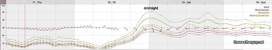
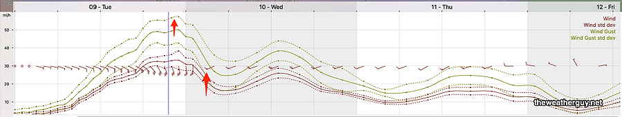
• The gusty winds forecast around midnight are now only forecast by the GFS. The wind gust forecasts from the other models are not impressive.
• The timing of each bolus of rain and each wave along the warm front varies. Some models have the rain ending around daybreak Friday with possible breaks of sun. Other models have rain lingering until at least noontime and remaining cloudy.
• The much promised 60º+ temperatures on Friday are not a certainty and the forecast trend for temperatures stay in the 50s here. Essentially, the warm front may not make it north past Philadelphia.
• The front will return as a weak cold front and temperatures on Saturday look to be lower than whatever we reach on Friday.
It’s a good thing all forecasts aren’t this challenging.
Here’s the model blend (NBM) high temperature forecast. Note that this temperature forecast is the average based on the many models that comprise the NBM.
Statistically, these highs temps are very uncertain with a standard deviation (think of it as “±” ) 7º. We could hit near 70º; we could stay in the 50s.
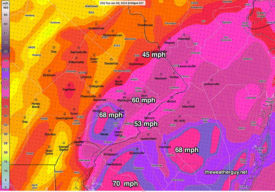
Posted Wednesday 01/24/24 @ 8:24 AM — A warm front will move through tonight around midnight an very windy conditions will develop at that time as a very strong low level jet (about 3000 feet above) moves over us.
Before that time, I’ll have to retract my forecast of cloudy but “dry” conditions today, Wednesday, as some models are cranking out light drizzle or very spotty showers.
I keep hearing on the radio about highs of over 60º; That that will occur on Friday, not Thursday. We’ll only be in the mid 50s at best on Thursday, late afternoon.
The warm front clears our area on Friday and we’ll be in the low 60s by mid to late afternoon. (There’s still an unusually high “spread” in model forecast high temperatures of ± 5.5º, capturing high uncertainty in that high temperature; it could be higher, it could be lower.)
High temperatures on Friday—
Posted Tuesday 01/23/24 @ 7:26 PM — We had more sunshine today (Tuesday) than had been forecast.
Wednesday does appear to be cloudy, but dry until the evening. There’s a large spread (higher than usual uncertainty) in the high temperatures forecast on Wednesday, with the GFS keeping us in the low 40s while the NBM and HRRR has us reaching 46º.
Around midnight Wednesday into Thursday morning, rain will move in with very GUSTY WINDS.
Much of Thursday will have periods light rain and temperatures are expected to reach the low 50s but still with a wide spread in the model forecast highs. (The GFS keeps us only in the mid 40s.)
Friday looks damp and wet early, then cloudy with temperatures in the low 60s!
Saturday looks cloudy but mild and dry. An easterly wind will keep us from being as warm as Friday.
Rain moves in for Sunday.
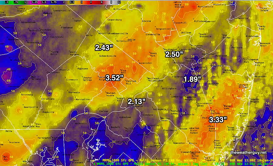
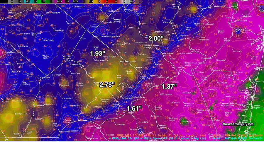
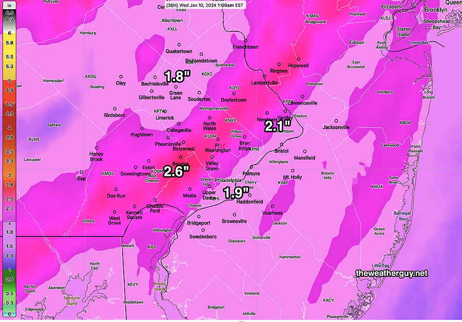
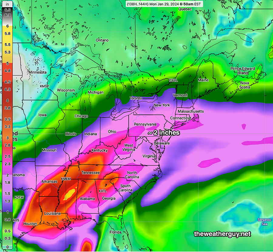
Between Wednesday and Monday morning, we will likely have received another 2 inches of rain—
Just wanted to mention that the large spread in the forecast high temperatures usually indicates large uncertainty in cloud cover and the forecast in general. I expect daily forecast specifics to change.
Posted Monday 01/22/24 @ 4:46 PM — The stream of moisture continues to take shape and poised to move in late Tuesday into Wednesday and especially Thursday into Friday—
Plenty of clouds are expected Tuesday but rain is expected to stay to our north.
Light rain develops before daybreak Wednesday, but the heavy rain probably won’t move in until Thursday into Friday. Another round of rain, possibly late Saturday into Sunday. I expect the exact timing of each system to change.
Over this time period, we may get another 2 inches of rain total!
So we’ll be getting milder weather through Saturday, then a chill down early next week.
The beginning of February may be quite mild.
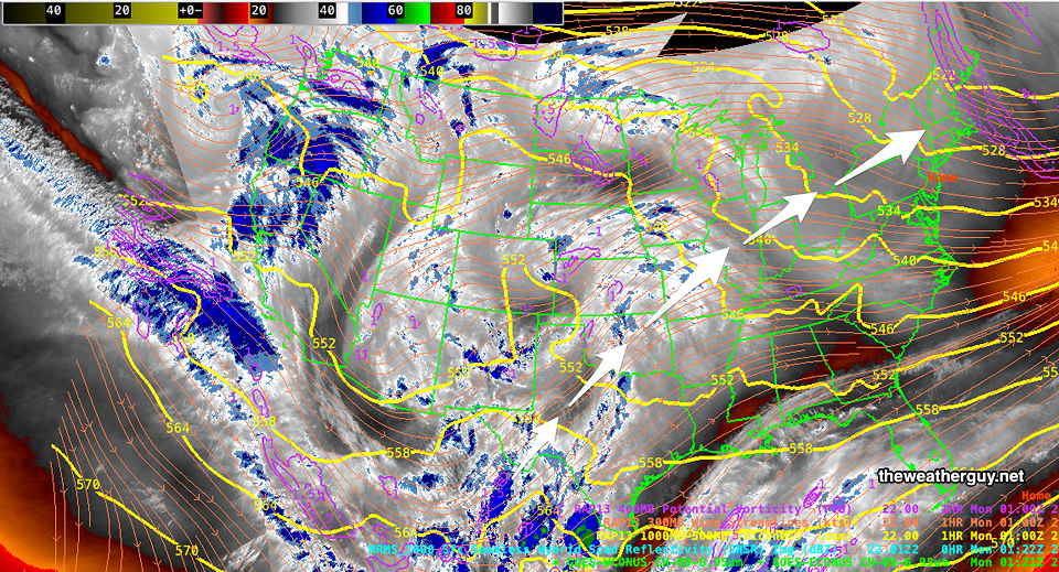
Previously Posted Sun 9:39 PM —
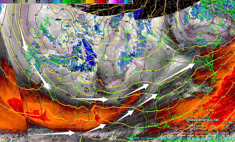
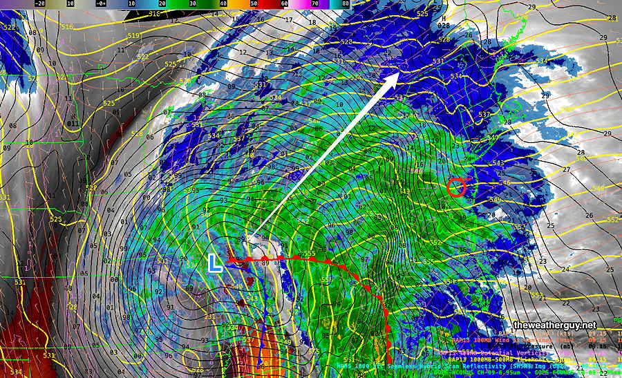
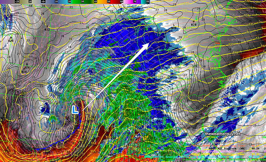
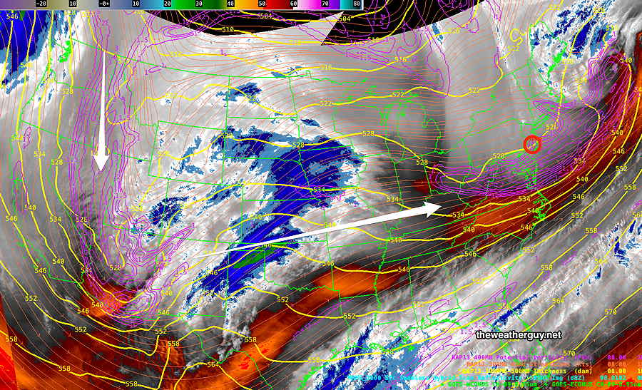
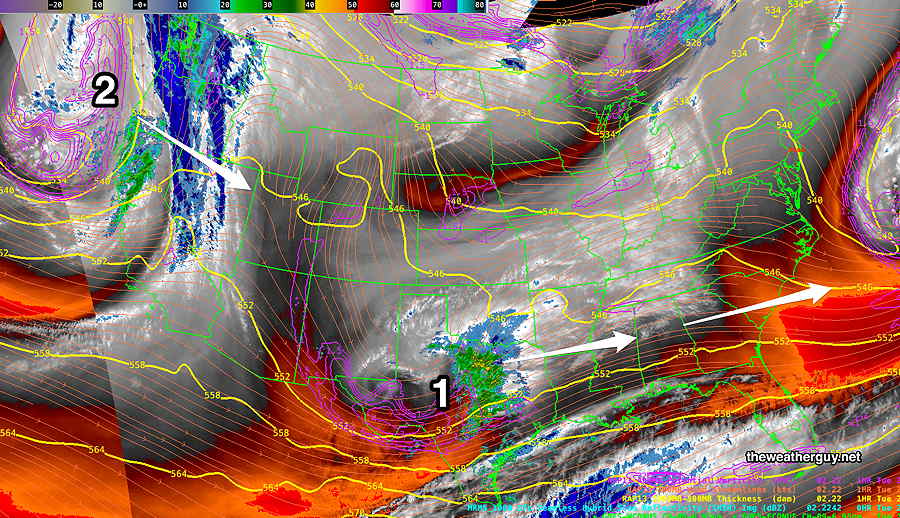
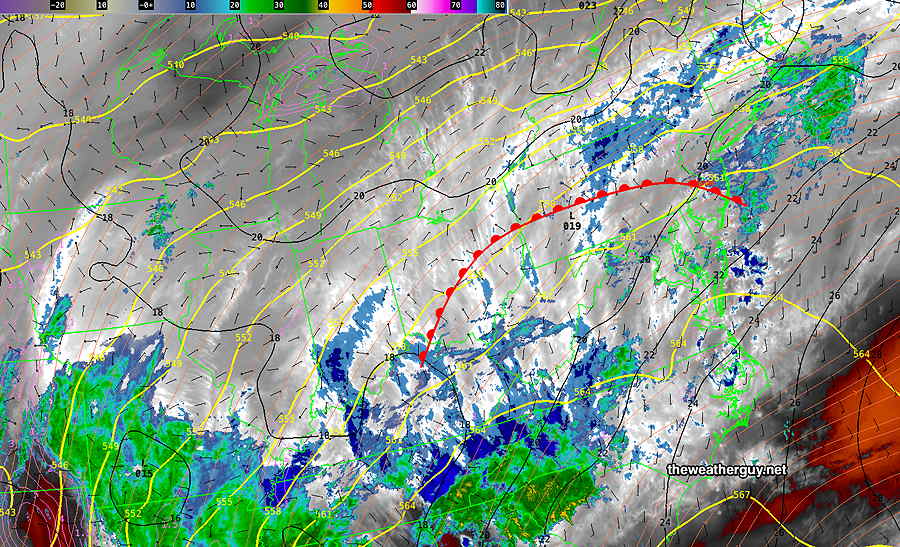
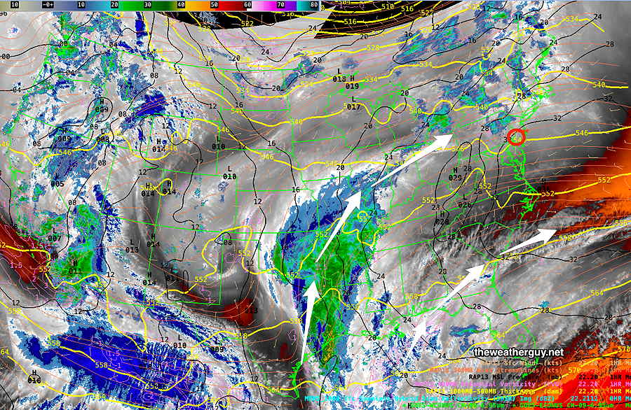
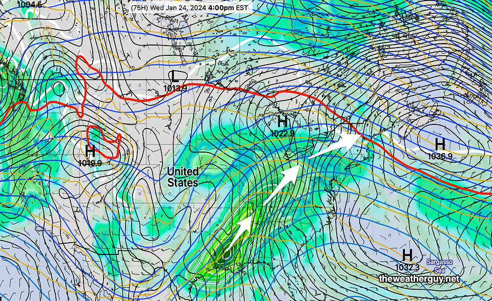
This week will feature a transition from a very cold upper level trough to a building upper level ridge with moisture from a southwesterly flow from the Gulf of Mexico. Here’s the current water vapor image showing the developing moisture conveyor belt from the Gulf—
The NAEFS forecast for Wednesday captures the developing flow of moisture and low pressure systems that will move in from the southwest—
Monday will be the nicest day (sunshine-wise) but also still the coldest. There may be a period of cloudiness during the day Monday as some moisture from the system moves off to our northwest.
Gradual moderating temperatures through the week with rain expected by late Tuesday. Temperatures by Friday may be near 60º but it might be quite wet. An inch or more of rain is possible by Friday. Frozen ground, existing snow cover, saturated frozen ground may result in some flooding, although the exact level of a flooding threat isn’t known just yet.