Thu 10:02 AM Forecast Review — The HREF and HIRESW did well with forecasting yesterday’s frontal passage.
Updated Wed 8 AM highlighted.
A cold front will move through Wednesday between 12:30 and 4 PM. Thunderstorms were originally forecast to develop with this front although the forecast has been for less than 1/4 of an inch of rain to fall.
Fast moving system. Moving through Philadelphia closer to 12:30 to 2 PM (per HIRESW-FV3 shown in 2nd graphic below.) Cloudiness ahead will limit available energy. Strong wind gusts with system. Total rain about 0.25 inches water.
Tonight’s models are just becoming available and the RAP, HRRR and NAM are very unimpressive with the line of storms.
Also just available is the high resolution HIRESW-ARW. It maintains a line of storms about 2 PM with somewhat higher rainfall and higher winds.
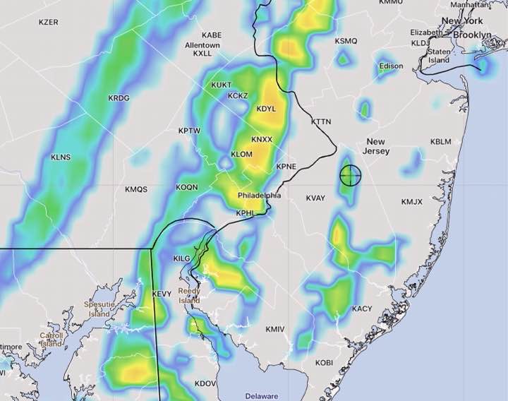
HIRESW-ARW MEM2 Model simulated Radar forecast 2 PM Wednesday
The HIRESW-ARW did well last year with thunderstorm forecasts and we’ll see how it does tomorrow.
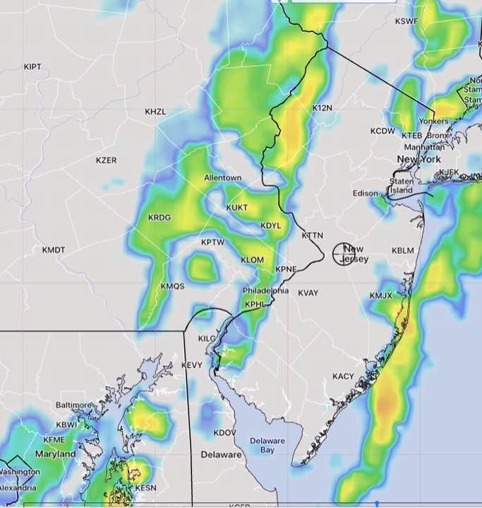
Another model of interest is the new, soon to be released HIRESW–FV3. It has the showers and thunderstorms coming through an hour earlier, at 1 PM—
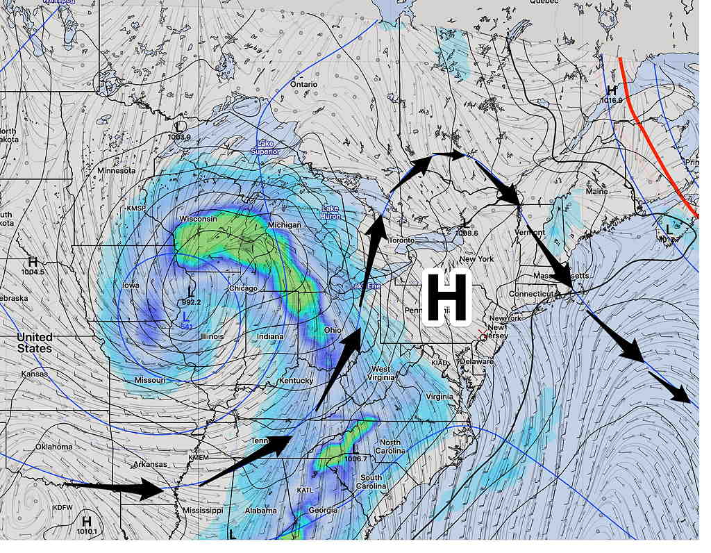
The forecast for the weekend has changed (and improved somewhat) from what I posted yesterday for the weekend outlook . An upper aircyclonic flow around the low pressure system near Cape Cod will bring instability cloudiness for Saturday.
Of some concern about this weekend’s forecast— none of today’s models captured this evening’s showers in central NJ. This suggests a lower confidence forecast for the weekend.
The models have backed off on the light widely scattered sprinkles considerably.
Basically, what we have for the weekend is similar to what we had on Friday,but without the light rain sprinkles. Possibly more sunshine on Sunday.
The low moves further east on Sunday, but a weak trough still associated with the same Cape Cod low brings the chance of some clouds Sunday afternoon.
SREF (Short Range Ensemble Forecast) for Sunday 2 PM (Click on image for a larger view.)
Saturday
Mostly sunny skies in the morning will give way to instability cloudiness late morning and in the afternoon. Like Friday, there may be breaks of sun at times. High temp 57.6º ± 2.4º (NBM model, Blue Bell)
There’s a chance of a light sprinkle late afternoon or early evening.
Sunday
The Cape Cod low moves east, but a weak trough will bring some clouds in the afternoon.
A similar forecast to Saturday— sunshine in the morning giving way to clouds, but milder with little or no chance of sprinkles. High temp 62.5º ± 2.3º (NBM model, Blue Bell)
Sunday may not be as cloudy as as Saturday. Clouds move in about 12-2 PM.
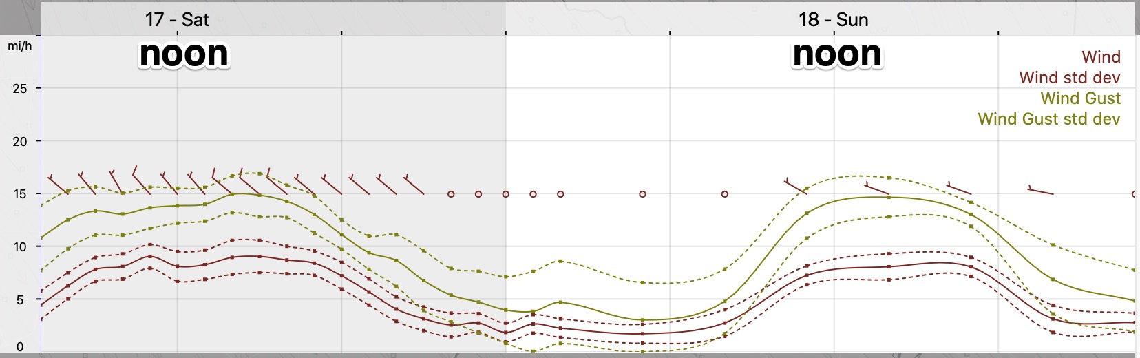
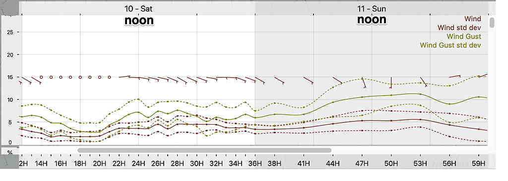
Wind forecast
NBM wind forecast Meteogram Blue Bell PA (Interpretation: Winds from the NW 8-10 mph, gusts to about 15 (NBM) for Saturday. Similar for Sunday (Click on image for a larger view.)
Forecast Updates Highlighted Sat 10:40 PM: Updated Sunday Forecast below
Sat AM Update: No significant change. Low clouds linger this morning. Brightening skies through high level cloudiness Saturday afternoon. No rain. Sunday’s forecast below still remains on track.
As mentioned earlier in the week, the timing of showers this weekend will make a difference in the overall forecast and it was hoped that much of the shower activity will occur during the evening hours. I started preparing this forecast this morning. By this evening, things are less clear for Sunday. More about this below.
The omega block influencing our weather is slowly breaking down, as low pressure in the Midwest slowly moves eastward. The upper level ridge of high pressure will maintain its hold on us for Saturday, acting like a wall against the low pressure advance, but it will get squeezed out of the way by Sunday.
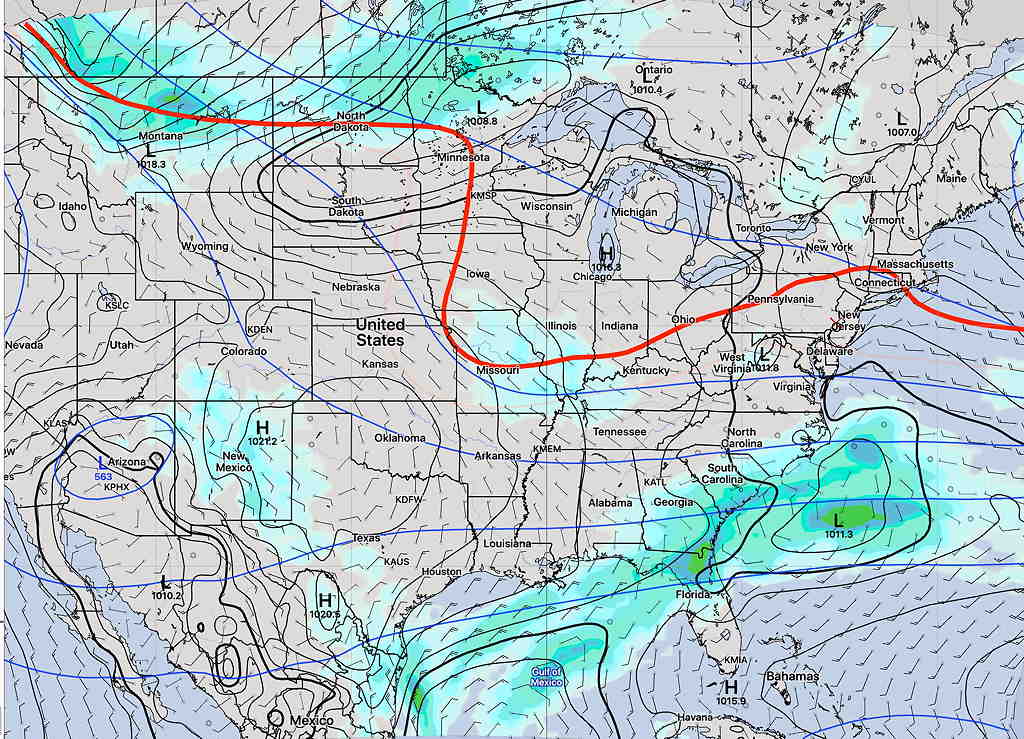
SREF model forecast for Saturday 8 PM showing the upper level high. (Click on image for a larger view.)
Saturday
Showers rotating around the low in the Midwest will move in Friday night but will exit early Saturday morning.
Saturday will be mostly cloudy in the morning as moist air moves from the east. There may be a break in the clouds and some sun Saturday afternoon. High temp 70.8º sd 2.5º (NBM model Blue Bell).
Winds light (see meteogram below)
Sunday
Nonetheless, the precipitation in Virginia (see above graphic) will advance into the Philadelphia region later Saturday night as a warm front. We’ll have showers and maybe some thundershowers late Saturday night.
Sunday will start out cloudy with showers in the early morning, but some sun may break out by noon. Rain ending Sunday about noon to 1:30 PM.
The more sun we get (if any), the more unstable things will get and the Canadian, ICON and to some extent the GFSmaintains the chance of scattered showers and thunderstorms in the afternoon.
There still is a question about the amount of sunshine in the afternoon and possibility of additional showers (the NAM and HRRR maintain significant clouds) but the pre-release version of the new HREF (used for much of the forecast this weekend) has clouds thinning for some sun, similar to today..
(The higher resolution models only forecast out to 48 hours and Sunday afternoon is currently beyond this range.) High Temp 74º ± 3º
Also uncertain is the high temperature. The latest NBM has moved the high temp down to 67º but it has the standard deviation very large at 4.6º, showing the uncertainty in cloud cover and position of the warm front.
A weak cold front moves through Sunday night. Showers and possibly thundershowers move through between 6-9 PM Sunday night. Thunderstorms again in the evening 6-11 PM.
Winds for Saturday and Sunday
NBM wind meteogram (Click on image for a larger view.)
I expect things go clarify with tonight’s models. Check here for updates during the weekend.