Category Archives: Philadelphia Area Weather Forecasts

WEEKEND WEATHER FORECAST

Sunday Forecast Updated Sun @ 10:05 AM, highlighted below
Sunday Forecast Updated Sat @ 8:10 PM, highlighted below
Sunday & Monday Forecast Updated Sat @ 8:15 AM, highlighted below


The forecast overview for this weekend – the upper level ridge that has dominated our weather for the past several weeks has given way to an upper level trough in the wake of Ida.

GFS jet stream trough position Monday at 9 AM. (Click on image for a larger view.)

This upper level trough will likely persist for much of the coming week, meaning cooler temperatures than we’ve had for awhile. In fact, we’ll be close to average temperature-wise over this weekend. (The seasonal average high temperature is 79-80º for this period.)

Saturday

A weak disturbance in the mid-levels of the atmosphere will rotate through early Saturday morning. Saturday morning will start cloudy, but after the the disturbance exits, mostly sunny skies are expected in the afternoon. High 76.8º ± 1.8º (NBM model, Blue Bell)

Sunday

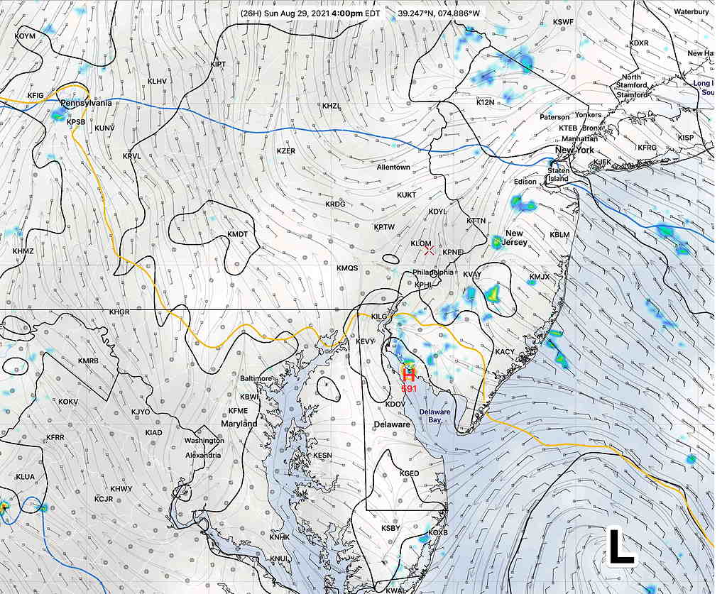
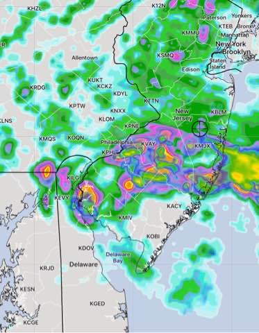
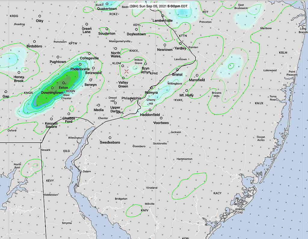
Forecast Update Sun 10:05 AM: Clearly, the models weren’t doing too good yesterday. The showers have moved in even earlier than forecast. I don’t see any indication of this in last night’s models. I’ll have to talk to the weatherguy who was on duty last night. 🙂

Sun 10:14 AM Forecast Review — How does one account for rain occurring now that wasn’t even forecast by the hourly HRRR and RAP 00z model runs just two hours ago? I can’t answer that.

Update: Saturday’s models have increased the cloud cover on Sunday and several models have light showers earlier in the day, as early as 1-3 PM

Update: Latest HREF shows some very light widely scattered sprinkles between 4-6 PM Sunday

HREF Sunday 5 PM precipitation forecast. (Click on image for a larger view.)

A warm front will slowly approach on Sunday, bringing considerable cloudiness for most of the day, but no showers until the evening. It’s not a certainty that we will have any showers at all, and the NBM keeps us dry. High 77.8º ± 2.8º (NBM model, Blue Bell
High 76.8.8º ± 3.9º (NBM model, Blue Bell) ( high spread!)

A weak cold front moves through Sunday evening and night. High pressure builds in for Monday.

Monday

Update — original forecast back on track.

Some light showers with the cold front may linger until about 7 AM Monday. Then clearing for sunny skies.

High pressure builds in for sunny skies. A weak upper disturbance may bring a few fair weather clouds late in the afternoon. High 80.7º ±1.2º (NBM model, Blue Bell)

SUNDAY FORECAST UPDATE

Sun 08:01 PM Forecast Review — The rain stayed along the coastline of Southern NJ today. Instead of moving back as a warm front there are indications that the front will be joined by a cold front in western PA.  This setup will allow the remnants of IDA to approach our area on Wednesday.

Updated Sat 10:30 PM— Tonight’s models show more clouds than previously forecast on Sunday and some sprinkles in the morning. A chance of some heavier showers in the early afternoon, especially from PHL and eastward.


The slowly moving frontal boundary just to our south has spawned a somewhat stationary weak low pressure system off the Delaware/Maryland coastlines.

Sunday will start cloudy, but enough dry air will filter in on Sunday to give us a mix of broken clouds and sunshine by noontime. Some widely scattered showers are possible later Sunday afternoon (mostly in NJ) due to instability but most areas will be dry.

It will be very humid. High 83.0º ± 1.8º NBM, Blue Bell PA

Hurricane Ida’s track looks like it will begin to affect our area late Tuesday through early Thursday.

If and when Hurricane IDA becomes a threat to our area, I’ll have a link to follow the storm’s effects.

WEEKEND WEATHER FORECAST

Update Sat 8:10 AM— Some areas had heavy rain after midnight. For Saturday, the HRRR continues with areas just to the west of Philadelphia being relatively rain-free with most of the rain from PHL into NJ. The NAM-NEST have a more westward extent.

The HREF which blends these models shows the rain today as just that, a blend—

HREF Dark Blue is low clouds. Green/yellow is rain/radar. Green contour lines area standard deviations in rain. (Click for larger image)

No change in Sunday’s forecast below.


Update Fri 10:40 PM — The axis of predicted heavy rain tonight has fallen about >50 miles to the south. Tonight’s HRRR optimistically keeps the rain on Saturday out of the western suburbs.

The NAM-NEST and HIRESW-ARW are not as optimistic—

NAM-NEST Saturday precip

The weather on Saturday may be better than previously forecast.


A frontal boundary is attempting to move to our south Friday evening. The boundary is resulting in showers and thunderstorms as had been expected. These chance of these storms will linger through the evening and night as the front barely makes it south of our area.

Unfortunately, the high pressure system behind the frontal passage will remain to our north as it encounters a firmly entrenched upper air high over the middle and southeastern section of the country.

NAM surface forecast for Saturday at 2 PM Showing the upper High to the northeast and the Bermuda high to our south. The Philadelphia area will be in the convergence zone of moisture and winds. (Click on image for a larger view.)

The NAM-NEST shows maximum moisture convergence and upward vertical velocity about 9 AM Saturday. The NAM-NEST also shows a weak coastal low pressure system forming off the Delaware coast on Saturday, lingering into Sunday.

NAM-NEST moisture convergence and upward vertical velocity 9 AM Saturday. (Click on image for a larger view.)

What does this all mean?

Saturday

Clouds, rain and thunderstorms from Friday night into at least the early afternoon of Saturday with a lower chance later in the afternoon. High 77.9º ± 2.8º NBM Blue Bell PA

Sunday

The low pressure system that forms off the Delaware coast will remain nearly stationary Saturday night into most of Sunday. Considerable cloudiness in the morning. Some bright skies and sun in the afternoon with a chance of showers/thunderstorms on Sunday afternoon. High 82.4º ± 1.8º NBM Blue Bell PA

Update Fri 7:30 PM : I’ve gone with the NBM model for cloud cover on Sunday. Some models have much more cloudiness Sunday afternoon.

If and when Hurricane IDA becomes a threat to our area, I’ll have a link to follow the storm’s effects.