Temperatures hover just above freezing, but precipitation rates have allowed accumulations to occur and the changeover occurred about 4 AM.
The HRRR (High Resolution Rapid Refresh) model shows about 2-3 inches total snow in the immediate PHL area with the snow ending in PHL about 9, maybe 10 AM or so, from west to east. (Areas in central NJ may have more accumulation.).
This weekend will be much more tranquil than last.
A brief highly amplified upper air flow that is brought in by a deep low far offshore will bring cold weather for Friday, but by Saturday, the upper air trough will relax, allowing warm air to slowly move back into our area.
As is often the case, the warm air moves in aloft first, so a mix of clouds and sun are likely for Saturday. High temps 38-43.
For Sunday, high temps are expected to approach 50, but again, some mid-level cloudiness will be likely with the warmer temperatures.
In the long range, a rain storm is likely for Wednesday, followed by very cold weather for the first weekend in February.
The 1 AM runs of the NAM and GFS were similar to the earlier Friday evening runs. The NAM still has a QPF of over 2 inches water, with the GFS somewhat less. 25-30 inches of snow in PHL, maybe more if the temps stay low and the snow:water ratio increases, and with 30+ inch amounts possible west and north of PHL and into inland central NJ.
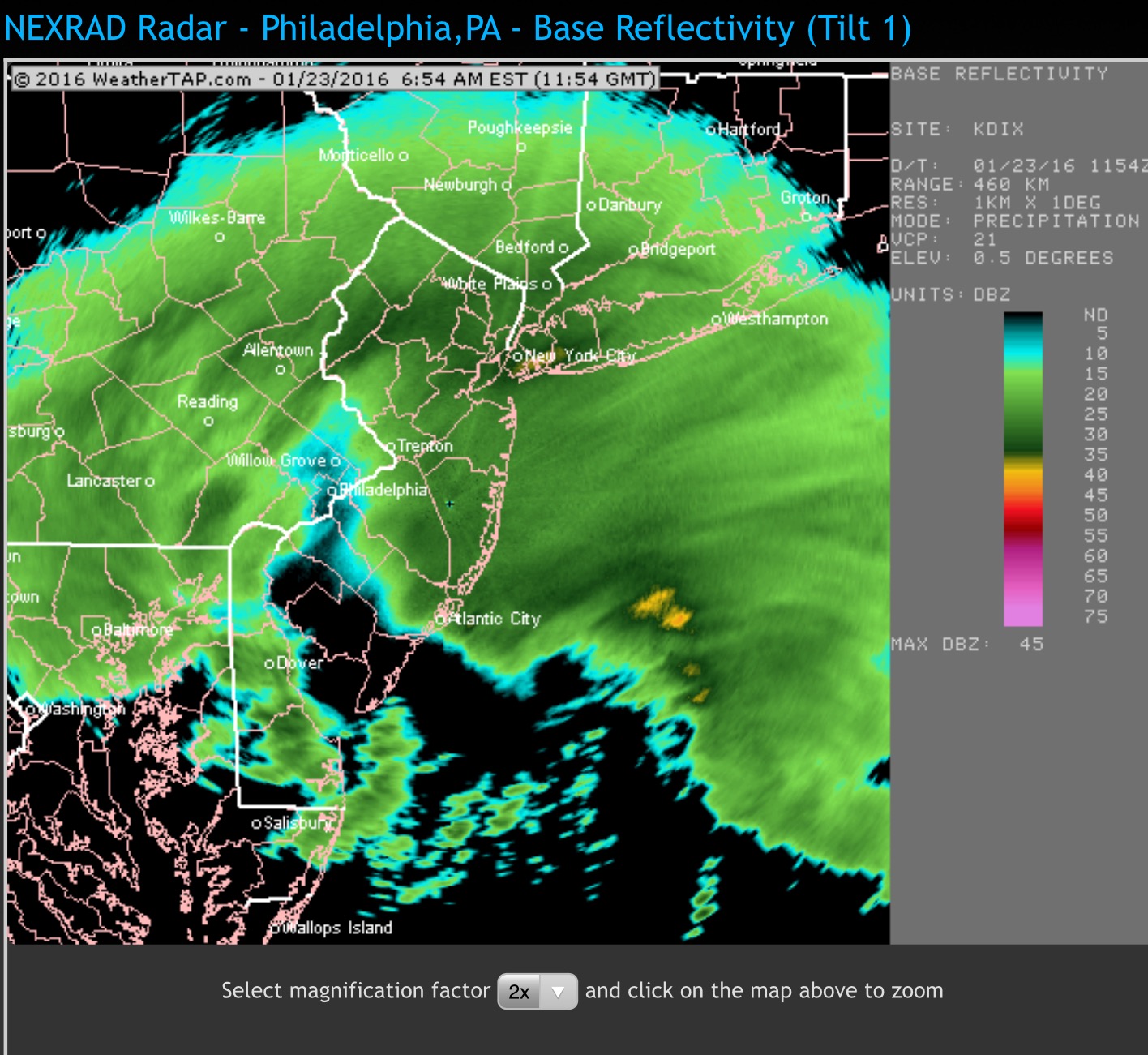
A dry slot is developing over PHL right now (6:45), but the snow will return.
Dry slot on radar (Weathertap.com)
Both models have the snow tapering during the late afternoon and ending during the evening hours tonight (Saturday).
With tempertures running lower in the areas west of I-95, I’m hoping that the snow won’t stick to power lines, reducing the chances of power outages despite the high winds. In areas where the temps get near 30 (southern NJ), sticking heavy snow may be more of a problem with trees and power lines.
I think I’m going to take a break from these forecasts for the rest of the day and enjoy the snow. If things change, I’ll update.