#Philadelphia #weather #PAwx
Friday Forecast Update
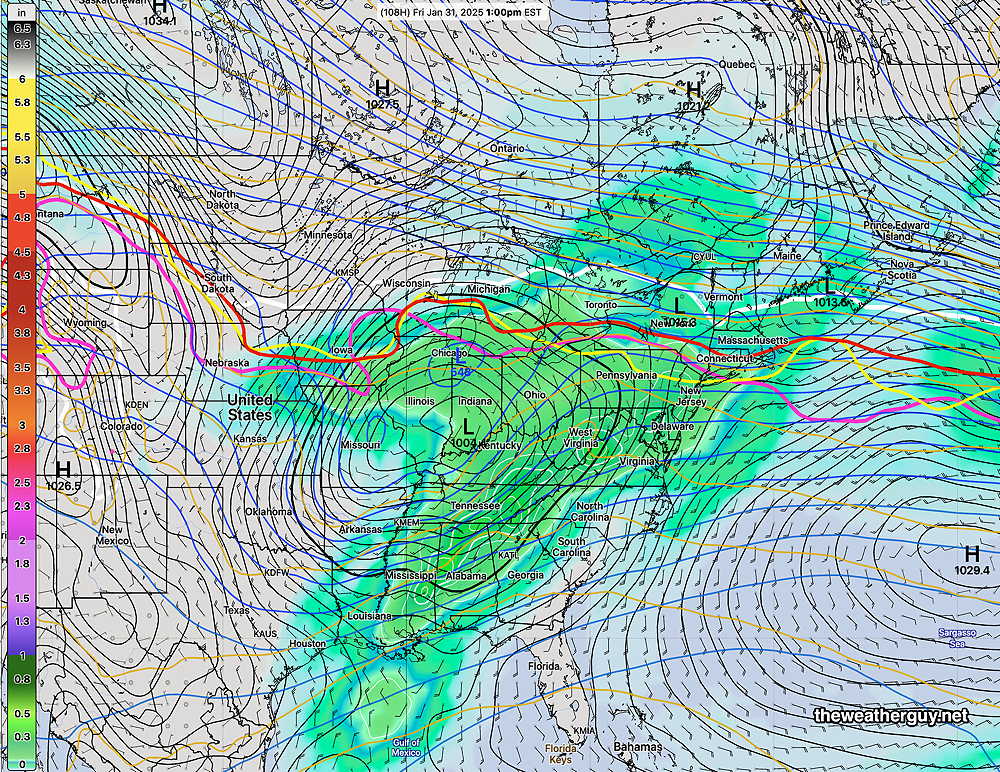
Posted Friday 01/31/25 @ 9:32 AM — A slight shift in the timing of the heavier rain today— late afternoon through this evening, ending after midnight. Total rainfall in the city and surrounding areas is now forecast to be less, closer to 0.30″-0.40″. Heavier rainfall in South Jersey.

The potential mixed precipitation storm I prematurely mentioned last evening has changed timing, from possibly next Saturday to possibly next Thursday. That’s a big change, suggesting the models, including the AI models, don’t yet have a good handle on things. Nonetheless, the setup ingredients appear to be there. Stay tuned.
Friday’s Rain Update
Posted Thursday 01/30/25 @ 6:01 PM — The rainy forecast for Friday hasn’t changed appreciably and rainfall totals are similar to the ECMWF forecast graphic posted yesterday. Rain begins about 3 AM Friday, earlier south and west and continues through about 9 PM Friday evening. It will be windy and gusty at times during the day, especially late afternoon when the heaviest rain is expected to fall.
The weekend looks as follows: Sunny on Saturday and cloudy on Sunday as a disturbance passes to our north.
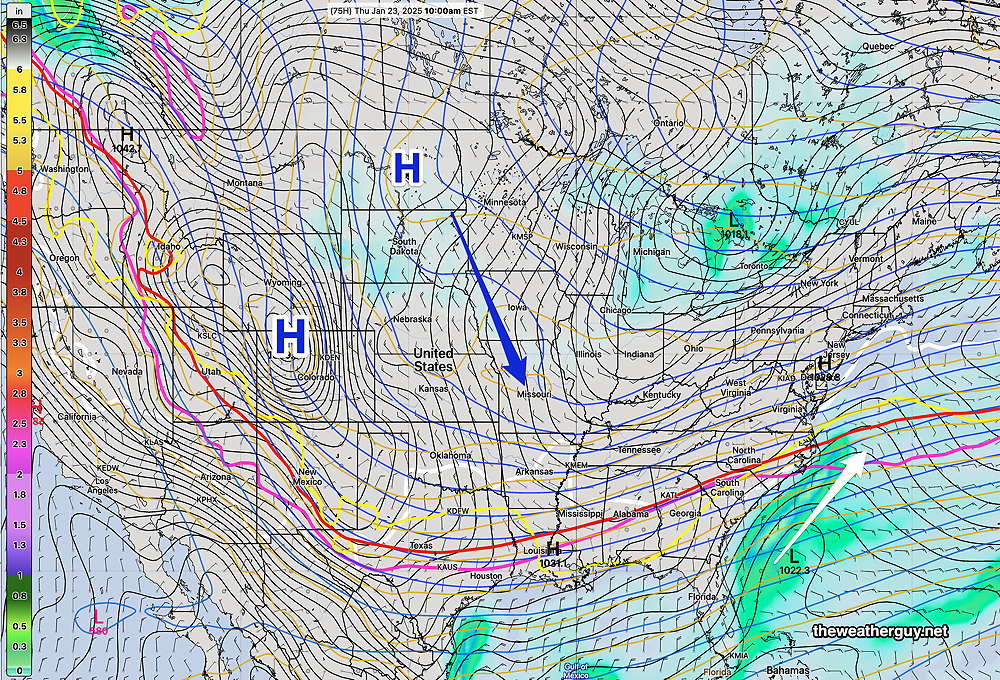
No major storms until NEXT weekend, when things may get interesting, according to the AI models and the ECMWF—

Friday’s Rain
Posted Wednesday 01/29/25 @ 7:42 PM — A storm bringing only rain to our area will move in several hours before daybreak on Friday. It will be rainy all day and the rain will taper off during the evening.
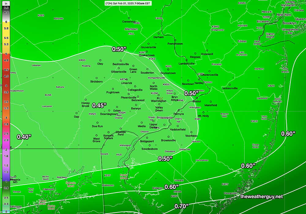
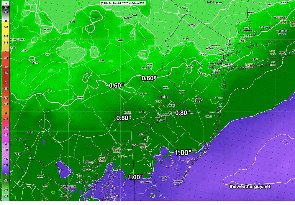
Continuing our ongoing trend towards lower than average rainfall, we’ll only see 0.50″ of rain in the immediate Philadelphia area according to the AI model. Areas not far to our south will receive over an inch, according to the latest models.
Staying with the AI model, here’s its forecast total rainfall for Friday—
The NBM is forecasting heavier rainfall for Friday—
AI Model Looks Quite Good in Simple Experiment
Posted Wednesday 01/29/25 @ 5:47 PM — The temperature reached at Philadelphia airport today was 52º, 53º based on hourly records. ( If 53º was reached, it occurred off-hour and will be posted on the NWS site in a few hours.)
It’s very impressive that the AI model correctly forecast this range a week ago. Today’s NBM forecast was a still a degree so too cool.
Posted Wednesday 01/29/25 @ 9:39 AM —Over the past week, I’ve been conducting a simple observational experiment regarding today’s high temperature forecast. (Also see here.)
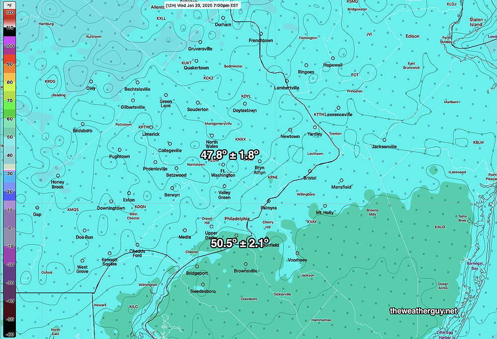
I chose to follow the AI model temperature forecast for today, because it was below freezing here at the time and the majority of the models, including my go-to model for temperatures (the NBM) were forecasting highs in the mid 40s for today, while the ECMWF-AIFS at that time was forecasting mid 50s! Quite a difference.
Incredibly, the regular model forecast have creeped upward towards the 50s and closer to the AI model while the ECMWF has shave off a few degrees to a high of near 53º.
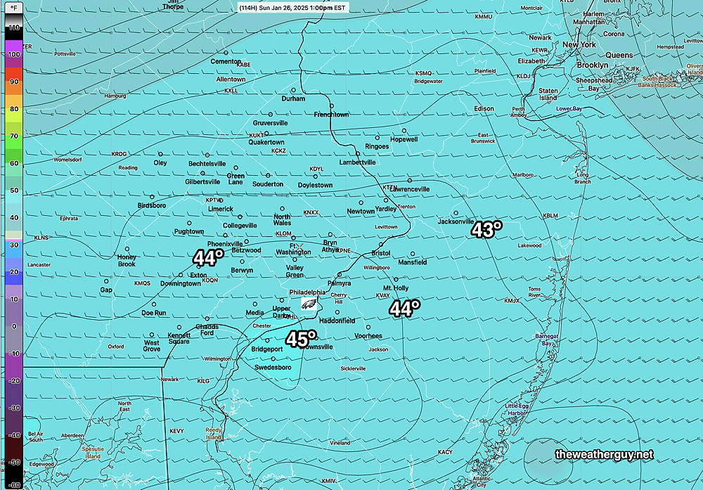
Here’s the latest NBM —
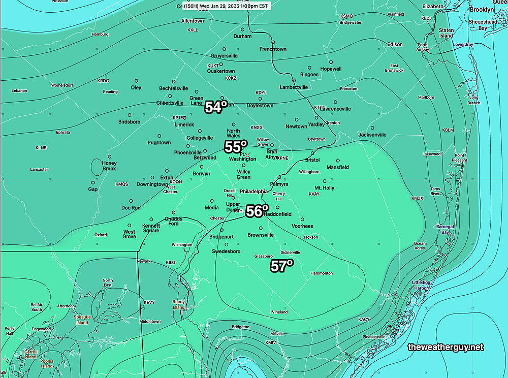
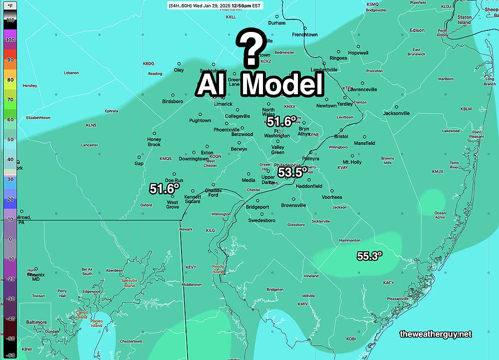
Here’s the latest AI (ECMWF-AIFS) forecast for today—
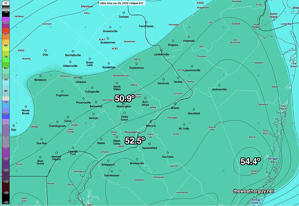
What’s impressive is that the ECMWF-AIFS was forecasting this range of max temperatures almost a week ago! It took the computational models almost a week to approach its forecast.
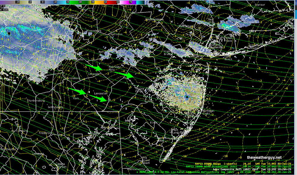
Posted Tuesday 01/28/25 @ 10:53 AM — Radar shows some snow showers to our far northwest. Superimposed RAP model vertical motion (“omega”) shows strong downward motion, likely dissipating these snow showers greatly by the time they get to Philadelphia—
Posted Tuesday 01/28/25 @ 9:17 AM — When I went to bed last night, the forecast for Philadelphia on our news radio station called for “‘”snow showers, possibly reducing visibility” and clouds. Did I miss something with my update yesterday? What were they talking about?
We’ll have a mix of sun and clouds today. Several weak disturbances are in the pipeline for us over the next few days. Snow/rain showers are a slight possibility.
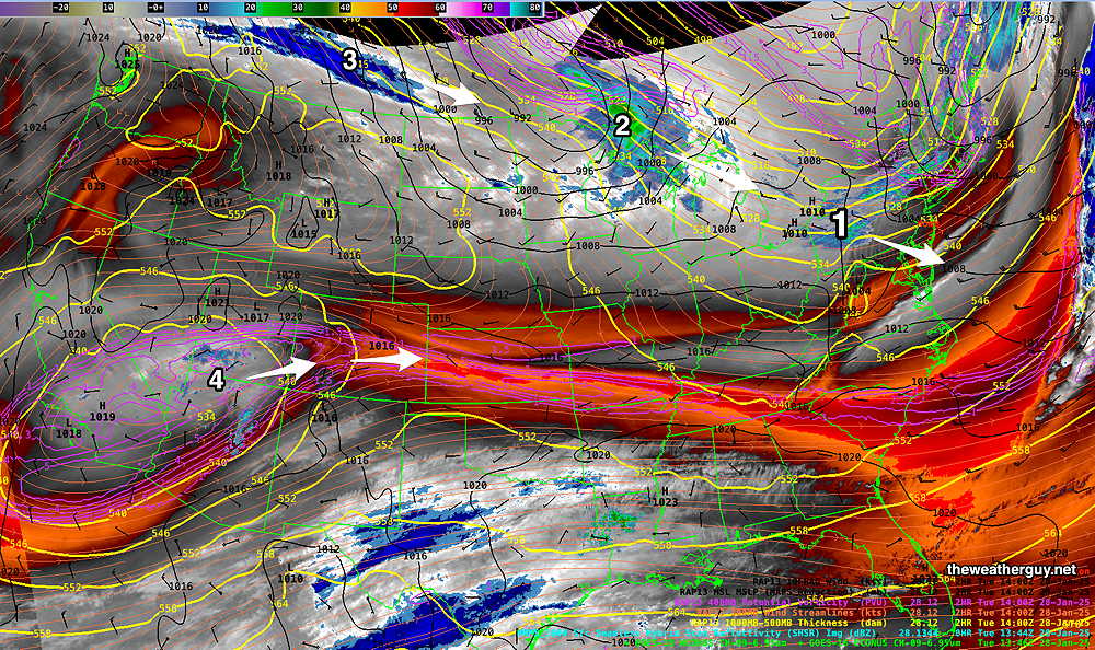
There’s a chance that the storm on Friday may start as a bit of freezing rain or sleet here before a change to all rain. Not a certainty.
Posted Monday 01/27/25 @ 5:55 PM — A slight warmup for Tuesday and Wednesday. The ECMWF-AI model has us in the low 50s on Wednesday. The model blend (NBM), my go-to model for temperatures, now has a forecast high of 48º in Philadelphia with a rather large standard deviation of ± 2.8º.
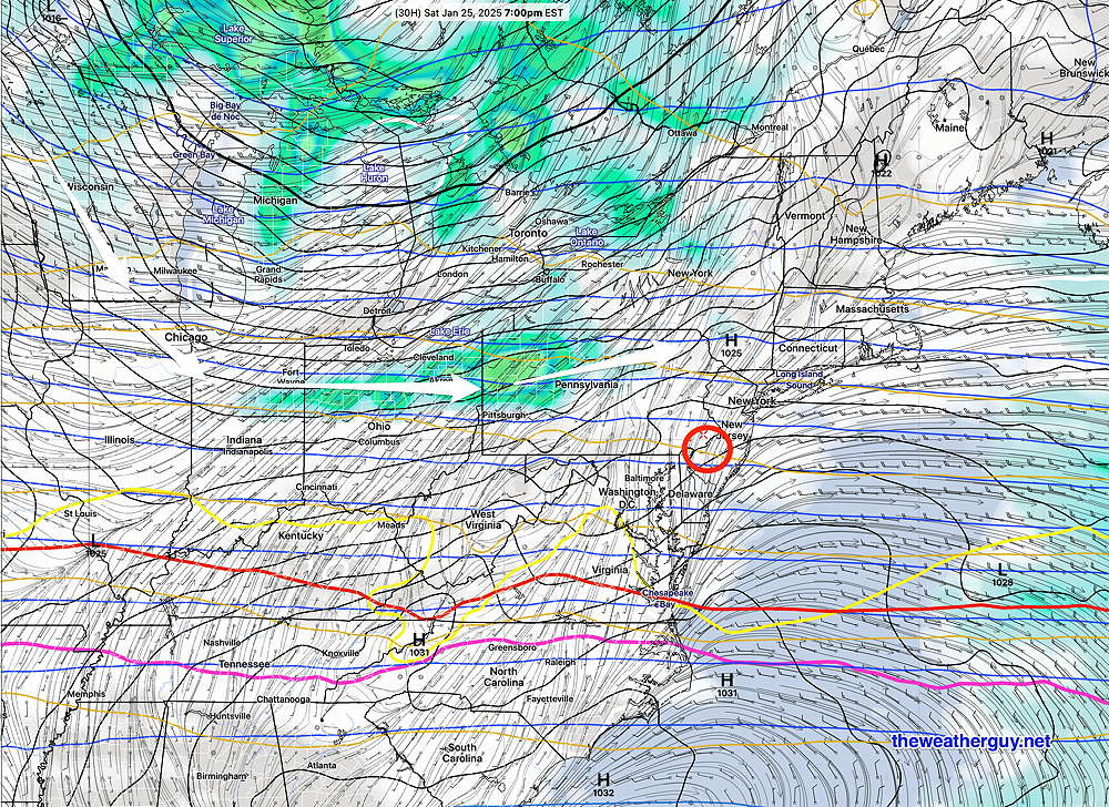
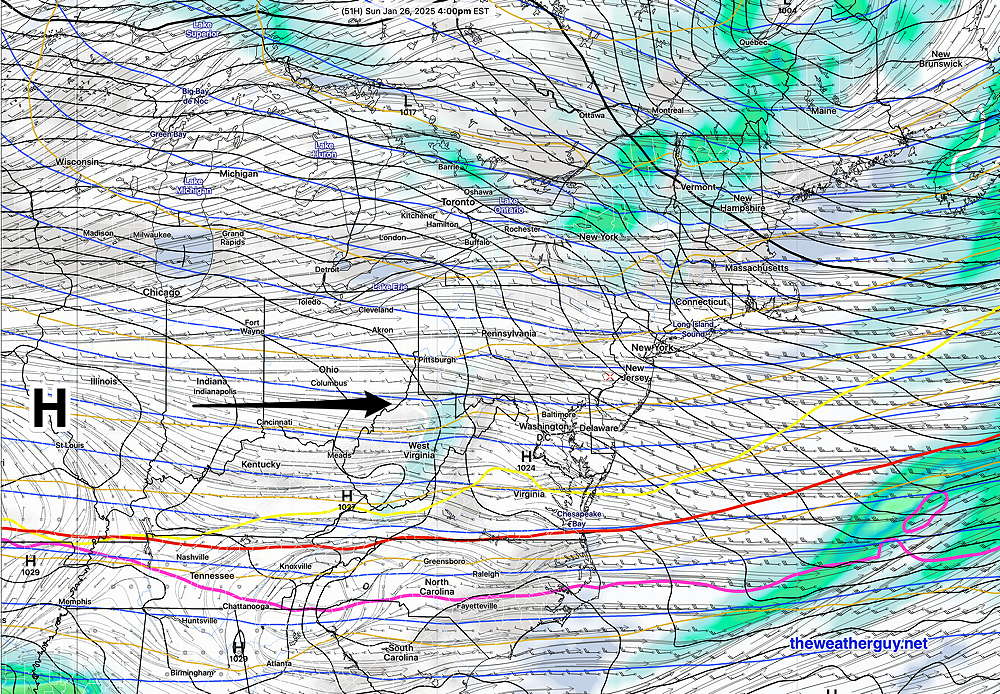
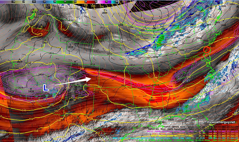
A series of weak fronts and upper air disturbances come through over the next few days, specifically before daybreak Tuesday and Tuesday night. A rain maker is on the way for Friday, although the heaviest rain may move to our north and south.
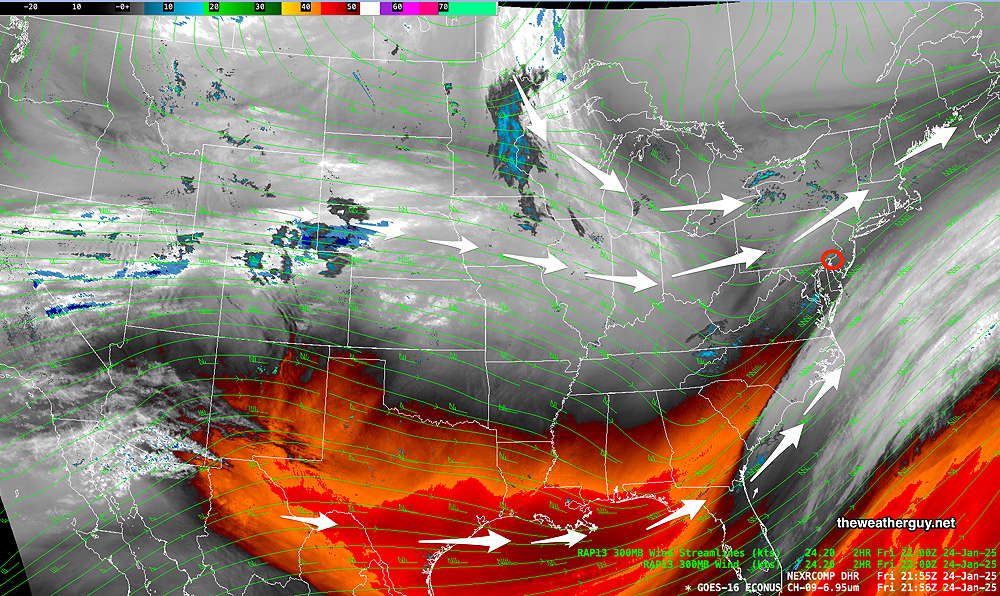
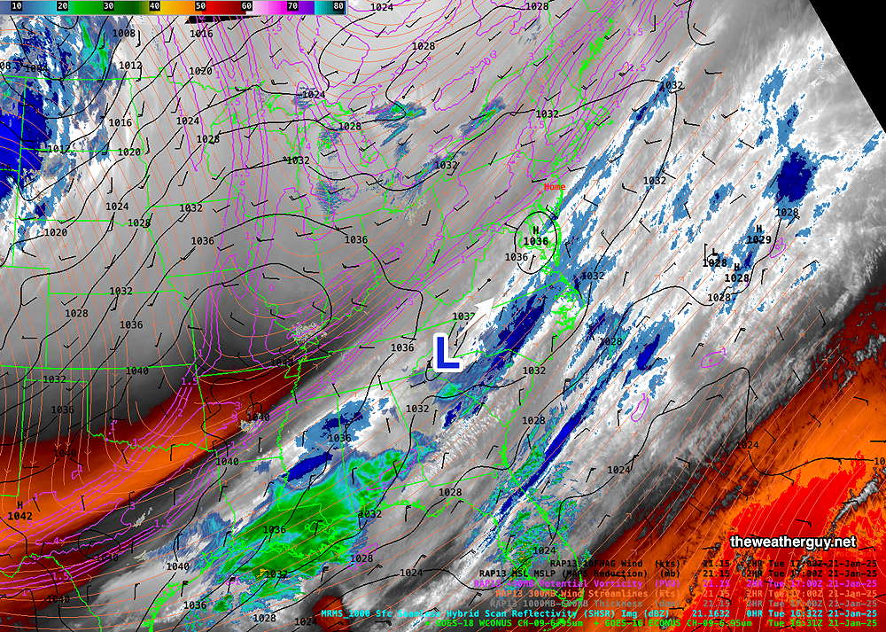
The front and the system bringing rain on Friday are visible on water vapor imagery—
Due to the highly unbalanced political environment on X, I’ve considerably cut back auto-posting there. To receive all forecast postings, I recommend following me on mastodon.social or bluesky.social
Originally Posted Mon 10:45 AM —A split jet flow and a still somewhat chilly northwesterly flow will keep temperatures slightly above average through Wednesday, becoming somewhat colder Thursday, then warming again Friday with rain.
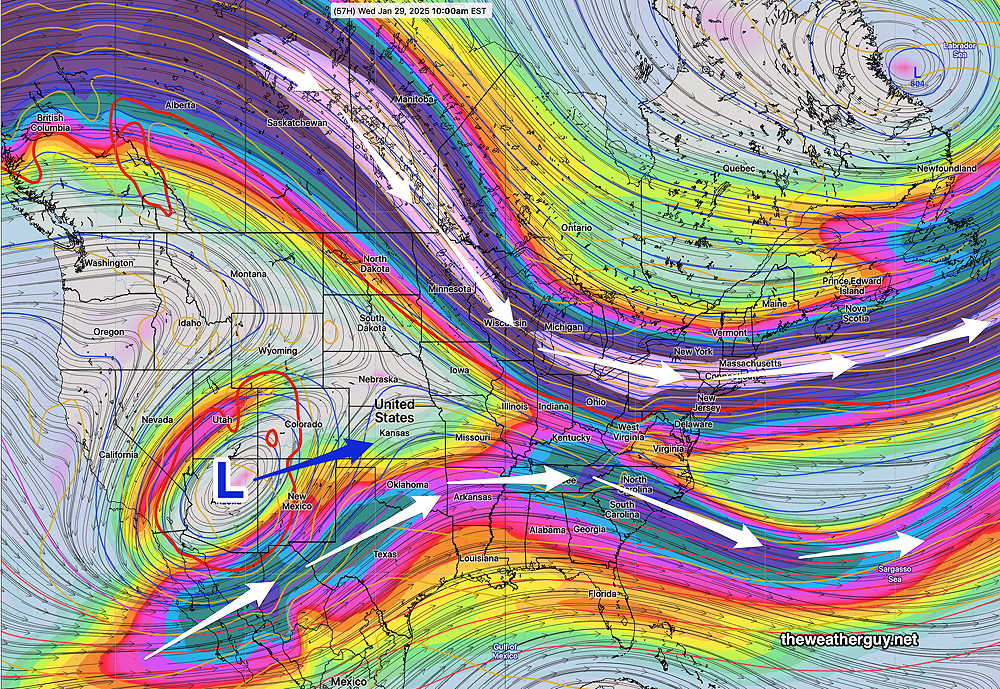
Regular readers here know that over the past week, I’ve been watching the AI version of the ECMWF which has consistently forecast high temperatures on Wednesday to be in the low 50s! Every other model has us in the mid to upper 40s. So this is a little experiment to see if the AI model has any special insights into high temperatures—
It appears we may have some rain on Friday into early Saturday. This feature has been in the forecast for several past days, with each model run moving it earlier. (It was originally forecast for this rain to move in Saturday into Sunday.)
The weekend looks to be dry.
No significant snow storms are on the horizon for us. For that matter, we’re still running a rain/snow deficit and the dry conditions of last Fall have not shown signs of ameliorating to this point.

