Update Sat @ 11:25 AM — It looks like another upper air disturbance will affect southern parts our area this afternoon.

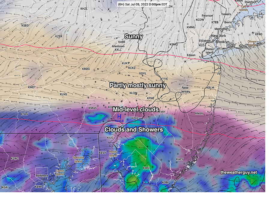
Adding more confusion: this morning’s NAM-NEST shows showers breaking out again about 6 PM around Philadelphia!
Updated Sat 8:46 AM — Last night’s 06z models continue with the general forecast of rain having mostly ended in Philadelphia. Water vapor imagery and current MRMS radar suggest another wave may bring some showers from Philadelphia on southward, but according to the models, precip ends in this area about 11 AM -12 this morning and clouds break/thin for some sunshine by 12-2 PM.
Updated Fri 10:46 PM — Tonight’s early models continue with the rain ending in the immediate PHL area in the morning. In fact, tonight’s NAM-NEST has the rain ending early morning Saturday with sun by late morning. The NAM-NEST is looking very similar to the the earlier Canadian HRDPS below.
Previously Posted Fri 5:10 PM —
There’s been some clarification on the rain and clearing for Saturday. Things are looking better.
Saturday
It appears that most of the immediate Philadelphia area will get rain/showers over the night time hours. The strong rainfall gradient north to south continues. Areas north of Philadelphia will have relatively little rain. Areas south and far south will have heavier rain lasting longer. Rainfall ends as early as 10 AM -12 noon.
The latest NAM-NEST has the most optimistic forecast.
A few pictures are worth a thousand words—
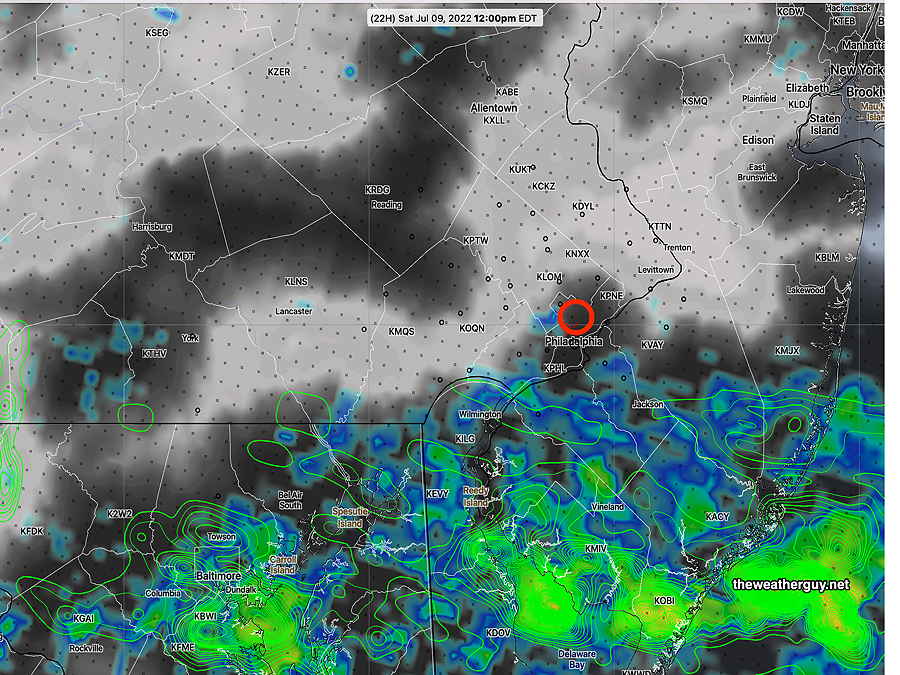
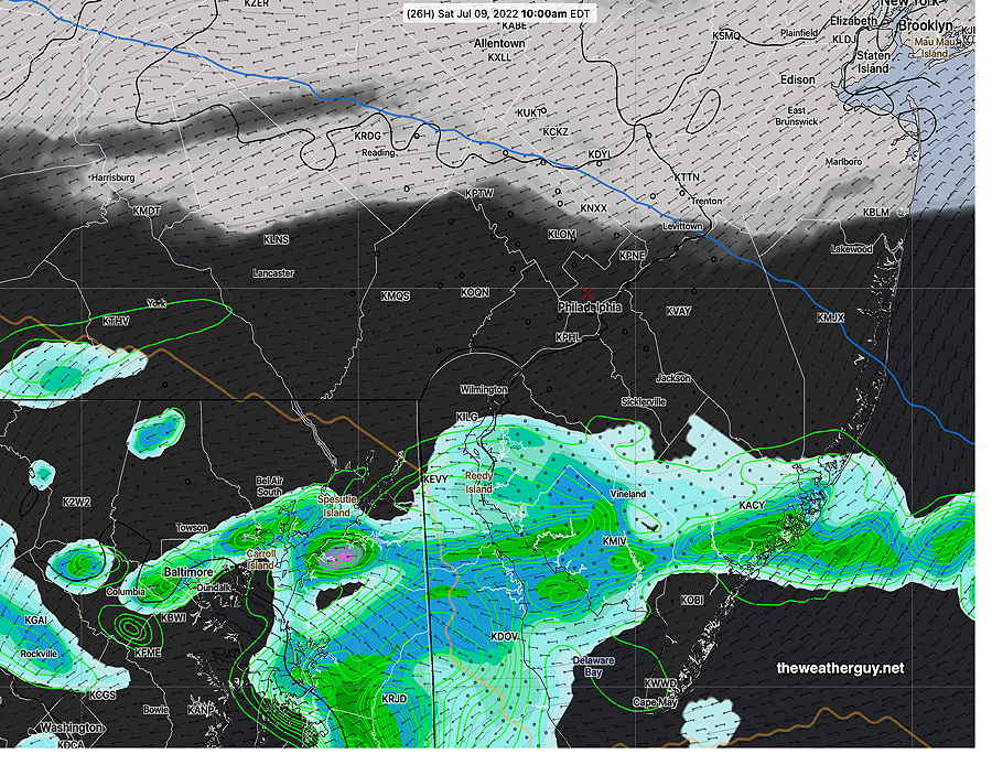
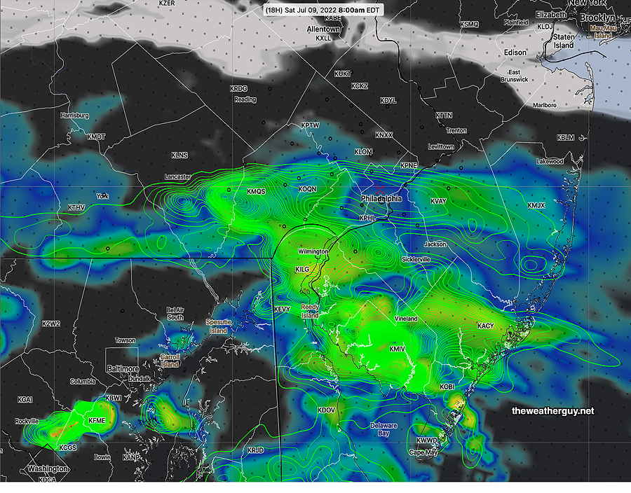
While the rain ends early it remains to be seen how quickly the clouds will break. Northern locations will have earlier sunshine.
High temperature 75.1º ± 2.7º NBM model Blue Bell, PA
Sunday
Sunny. Light easterly winds.
High temperature 81.9º ± 1.3º NBM model Blue Bell, PA

