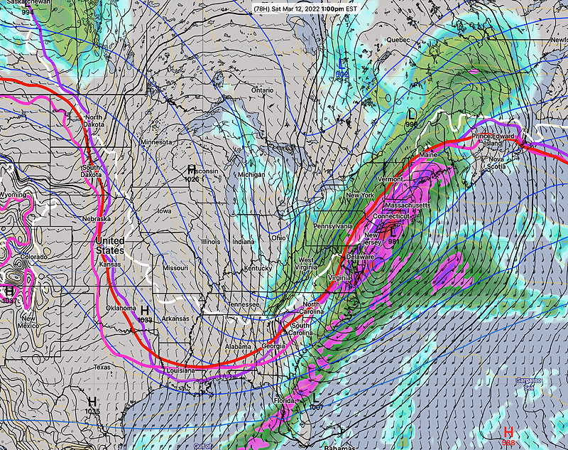
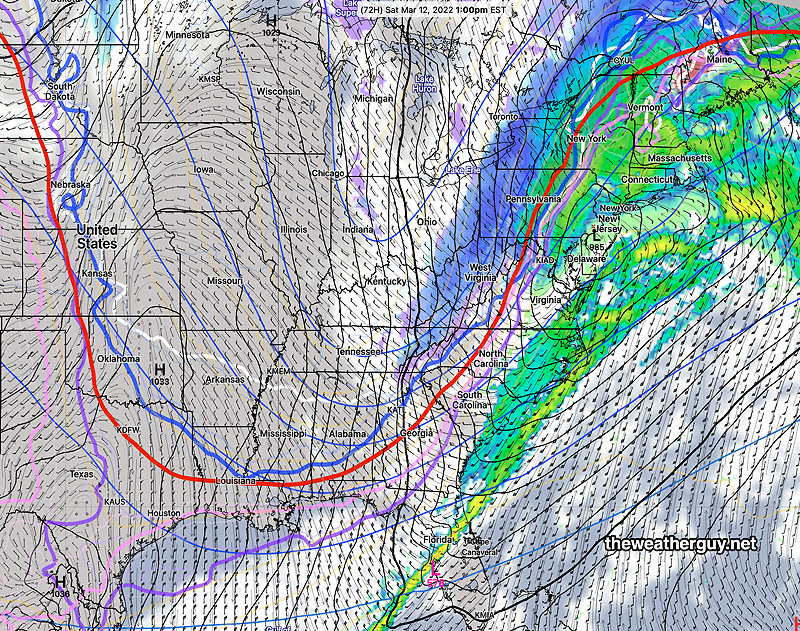
Strong Coastal Storm Saturday
Snow Accumulation looking more likely
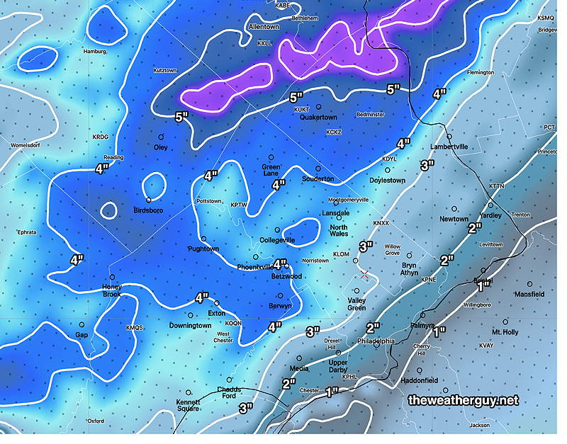
Update Fri @ 10:08 AM — The latest NAM-NEST snow forecast, showing the high snow banding just west of Philadelphia. Exactly where banding will set up is not often very precise.
Show More
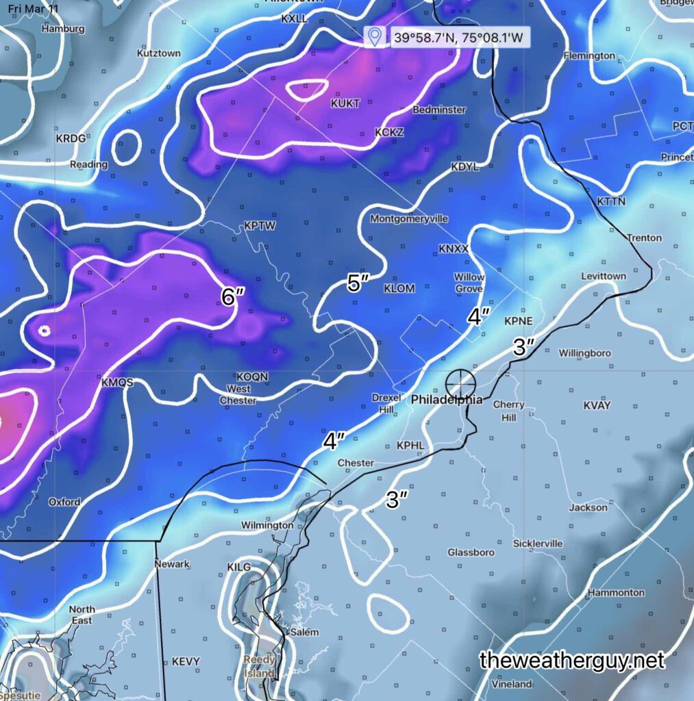
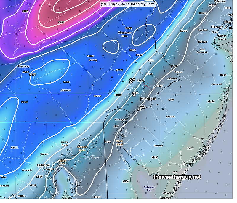
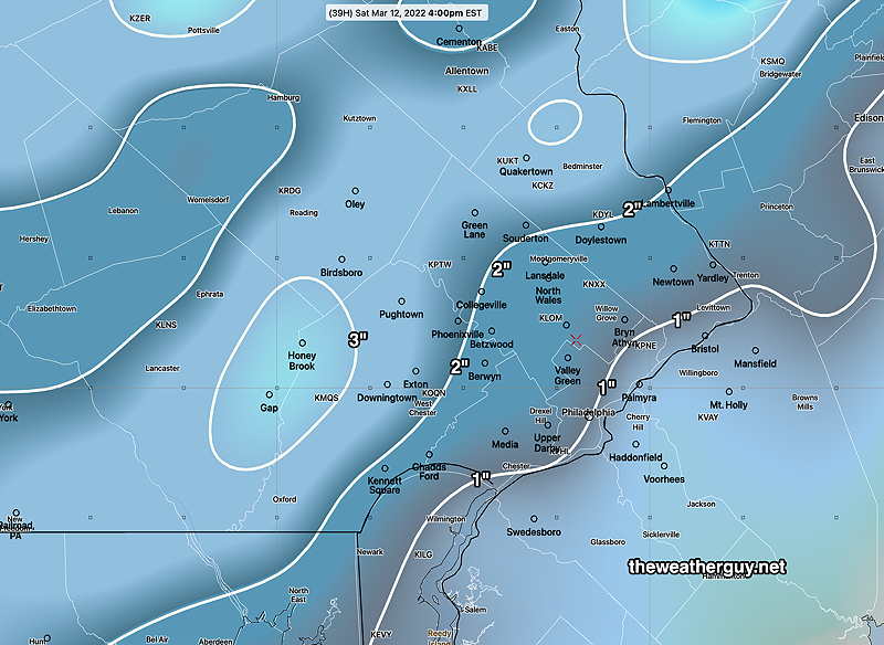
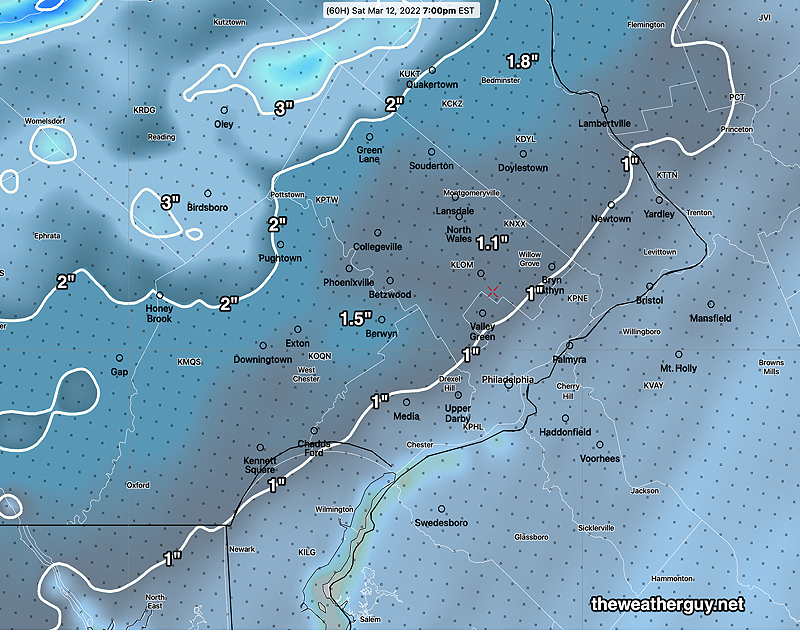
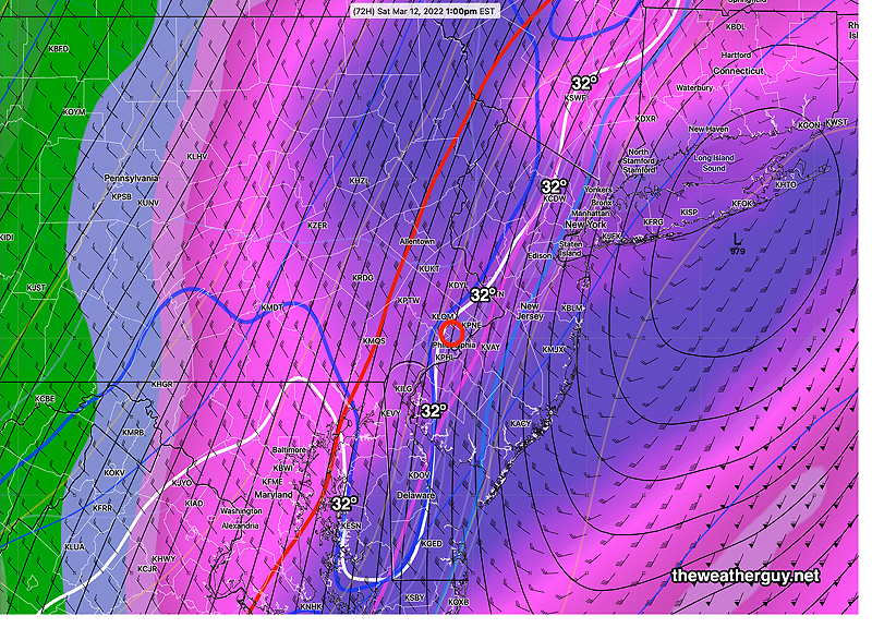
Additional Update Fri @ 9:00 AM — Some of the early morning models just coming in. The model blend (NBM) has moved to a 1.7” snow total as a 50 percentile value. (Half of the models comprising the blend are above this amount, half are below.) One thing to keep in mind is the snow will fall at the height of the day in March, with a strong solar insolation effect through clouds; the sun angle is high this time of year. ) With the ground warm from Friday, I think most of the accumulation will be on grassy surfaces, not dark asphalt roadways. Some of that will be also influenced by the precipitation rate; high rate, more accumulation on roadways. According to the NBM, the rain will start as early as 3 AM and the transition to snow between 11 AM and noon, earlier west of Philadelphia. With the earlier start, it will end about 3-4 PM. Update Fri @ 8:13 AM — Last night’s models have all shifted their forecast towards snow accumulations in the immediate PHL area with Saturday’s storm. The NAM, NAM-NEST, GFS, ECMWF all show at least 1” of snow in the immediate PHL area. Several of the HIRESW models and the HRRR are predicting several inches! The trend has clearly moved towards an earlier start and a colder storm. I will update later this afternoon. Update Thu @ 10:45 PM — Tonight’s models continue with the trend of a faster moving storm with cold air entering earlier. The NAM-NEST has reverted to its earlier accumulating snow forecast of 1-2 inches of snow and the model blend NBM, ECMWF, HRRR and HIRESW also show accumulating snow in similar ranges. The NAM and ICON show only a coating. So uncertainty remains with this storm. Too soon to invoke “never ignore the NAM”. I’ll update tomorrow. Update Thu @ 5:35 PM —This afternoon’s models have trended towards little or no accumulating snow in the general Philadelphia area. The storm is expected to move more rapidly than previously forecast. The actual cold front will move through early, 9-10 AM with heavy rain and with a shift in the winds to the NW. There has also has been a general trend for temperatures to drop below 32º a bit earlier, now sometime between noon and 2 PM. Coinciding with that temperature drop will be a transition from rain, briefly to sleet, and then snow showers before ending about 6 PM. Still expect WINDY conditions. Another change for Sunday— The ECMWF shows an upper air disturbance moving through Sunday afternoon with clouds and some snow showers possible. The GFS just has clouds. Update Thu @ 10:06 AM — Saturday continues to look like a stormy day, with the coastal low forecast to deepen below 970 millibars (that’s hurricane level low pressure) by the time it gets to Maine. Rain should begin about 6 AM Saturday morning. Right now, just a moderate rain is expected during the morning hours (less than 0.5″ water). The big issue will be wind and rapidly falling temperatures, with highs near 50º early morning falling below freezing by 2 PM and into the 20s by evening. A changeover to some snow is expected between 1 and 2 PM. There’s a lot of model uncertainty regarding any snow accumulation with the SREF showing a mean snowfall (Blue Bell) of 2 inches but the range is anywhere from zero, a grassy coating, to over 2 inches. The RGEM and GFS are showing little to no accumulation. Too early to predict now, but rapid icing is possible on some surfaces. Snow flurries end about 6 PM. Here’s the latest NAM-NEST snow accumulation forecast which is on the high side of things— High winds of 20 mph sustained with gusts to over 30 mph. The only good thing about the winds is that it might dry surfaces before too much icing occurs. Sunday, first day of Daylight Saving Time, looks sunny and unseasonably cold. Windy. High just 37-38º Previously Posted Wed 8:17 PM — Generally moderating temperatures expected Thursday through early Saturday. A very strong coastal storm is expected to develop and move northeastward on Saturday, as much colder air moves down causing a dip in the jet flow. The general forecast path of this storm has trended somewhat closer to the coast over the past several days, with a mostly rain event as warmer air will move in with the system. As the system moves away, there is a possibility that there will be change to snow as very cold air moves in behind the low. Very WINDY conditions developing. The ECMWF and GEFS models are in pretty good agreement with the speed and path, but the ECMWF and GEFS have a more eastern track than the NAM — Zooming in, this time with the latest GEFS which like the ECMWF also has a colder eastern track, we can see that it’s predicting a drop to freezing about 1 PM with a changeover to snow shortly thereafter. (I should mention that the latest ICON model is very different. Not sure if it’s significant.) Warmer temperatures preceding the storm along with high sun angle (it’s March) suggests low ability for snow to accumulate, especially on roadways. But there will be a rapid drop in temperatures to the 20s by evening and some areas will ice up. Cold weather for Sunday. Stay tuned.
