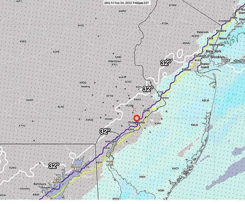
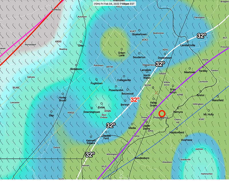
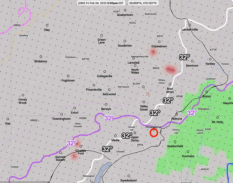
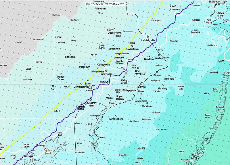
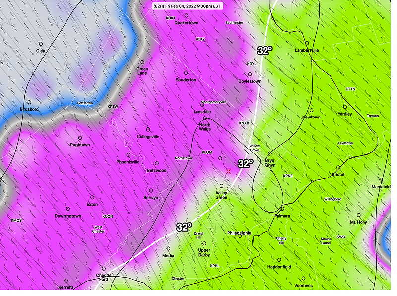
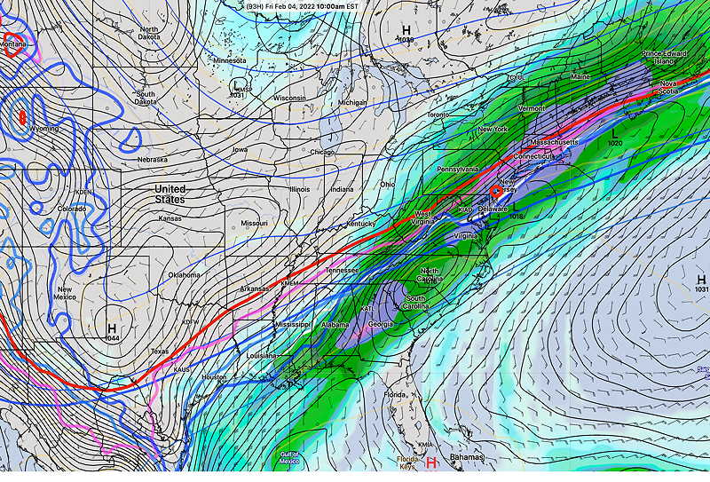
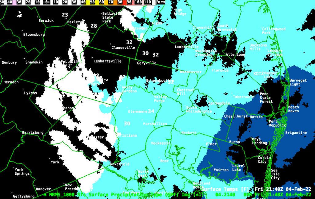
Update Fri @ 4:54 PM — I sure hope my forecast is correct. The temperature is dropping. The latest MRMS shows the back end of the precipitation near upper Montgomery County is changing to snow. Most areas still rain or what’s called “cold stratiform rain”
Update Fri @ 3:34 PM —
“All this rain, I hope it doesn’t turn to snow”
It won’t, at least around here. I’m sticking with the NBM and Canadian RGEM models which clearly show the precipitation departs before the cold air comes in—
Show More
I can see why there were forecasts for a change to sleet and snow. Many models had showed it a few days ago. Even today’s ECMWF shows the possibility.— Prior to this, the ECMWF data was limited to subscription only, on the order of > $10,000 US annually. Update Thu @ 4:48 PM — The NAM and GFS has joined the other models in forecasting virtually no mixed/frozen precipitation in our immediate Philadelphia area Friday. This is comparable to the forecast first made by the Canadian RGEM model and our own NBM over two days ago. Basically, the bulk of the moisture and precipitation leaves before the cold air comes in. While the NAM-NEST below shows temperatures dropping below freezing here around 5 PM, the latest RGEM has it an hour or so later. Update Thu @ 7:15 AM — Last night’s models continue with the dichotomy in the thermal profiles for Friday with the GFS and NAM having the change to sleet->freezing rain->snow Friday afternoon around Philadelphia and immediate surrounding counties, while the Canadian RGEM and NBM continue with a delayed entry of the cold air until early evening after the precipitation has effectively ended. Some transition is possible in the Allentown area, but not the immediate PHL area. I continue to lean towards the RGEM and NBM forecast which means little if any transition and little or no accumulation in the evening. Icy conditions possible later evening from pooled water freezing on roadways and sidewalks. I’ll keep an eye on it. Update Wed @ 5:55 PM — This morning’s and afternoon’s models haven’t changed much regarding the possible transition to sleet/snow on Friday. While there are several models (GFS, NAM, HREF) that have temperatures dropping below freezing as early as 1 -3 PM in Philadelphia with a change to sleet->freezing rain->snow Friday afternoon, the NBM and Canadian RGEM keep temperatures above freezing until early Friday evening with most of the precipitation having ended. Little or no accumulation with this scenario in the Philadelphia area/ immediate suburbs, although icy conditions possible from remaining wet surfaces freezing over after 8 PM. I’m leaning towards this Canadian RGEM/NBM forecast. I’ll keep an eye on it. Update Wed @ 8:57 AM — This morning’s model blend (NBM model) continues to back away from any significant sleet or snow following the cold front passage Friday. The NBM keeps the surface temperatures above freezing until after 7 PM. The thermal profiles show a dusting/coating of snow northwest suburbs and a brief frozen mix as temperatures drop. Again little, if any, accumulation. Update Tue @ 4:36 PM —Today’s GFS and GEFS continue with a change to mixed precipitation Friday afternoon, following the cold front passage. However, this is beginning to look like the event from a few weeks ago (Jan 17th) where rain was supposed to changeover to snow, but we got almost nothing. At the time, the Canadian GEM and NAM were forecasting little to no accumulation and they turned out to be correct. Despite the GFS/GEFS continued colder forecast, today’s Canadian GEM has a couple of hours of mixed precip (sleet/wet snow) late Friday afternoon in the northwest suburbs with little accumulation. I’m leaning towards this. So I think you can forget about any meaningful snow/sleet accumulation Friday. Previously Posted Mon 8:15 PM — An interesting scenario is setting up for late Thursday into Friday. First, we’ll be getting a brief January thaw in February this Thursday with temperatures reaching the low 50s. Unfortunately, there will be considerable cloudiness with this warmup before heavy rains move in Thursday night. As much as 2 inches of rain are possible from late Thursday into Friday morning. That’s where things get interesting. A frontal boundary will slowly move through Friday morning and surface temperatures will drop. A second area of low pressure may form along the front and move up bringing a transition to a mix of wet snow or accumulating snow. There’s a wide range of possibilities and uncertainty with this setup. Stay tuned. 