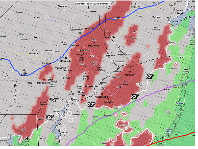
Update Sun @ 9:12 AM — Regarding the coastal storm passing to our east Monday evening, this morning’s HRRR, NAM-NEST and HIRESW have some light freezing rain moving in Monday morning during the rush hour, well in advance of the main low pressure center.
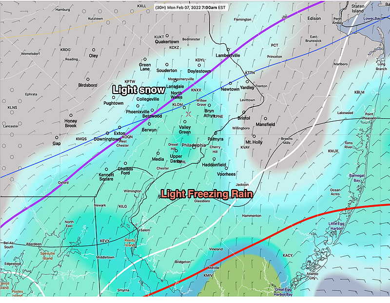
This morning’s 12z HRRR forecast for Monday at 9 AM. Freezing rain in red. (Click on image for a larger view.)Today’s 06zECMWF forecast for Monday 7 AM, showing light freezing rain north of the 32º (white) contour and and light snow north of the (purple) 1000-850 mb thickness line. The ECMWF suggest that this starts before daybreak. (Click on image for a larger view.)
The main low is still expected to pass to our east with the edge of the precipitation shield being rain in our area later Monday afternoon and evening.
Update Sat @ 10:48 PM — Tonight’s models continue to show Monday evening’s coastal storm barely brushing the Philadelphia area during the early evening. Thermal profiles are trending warmer—too warm for snow.
Update Sat @ 9:48 AM — No significant change in this weekend’s forecast.
The coastal system expected to move near us later Monday night into Tuesday morning is still expected to brush us with precipitation.
Temperatures in the immediate PHL area will be marginally too warm, so any precipitation will fall as wet snow/ rain mix at best; moisture extending beyond the immediate Philadelphia area may fall as snow flurries or light snow showers. While there is currently good agreement with the models, the trend over the past two days has been to be slightly closer to the coast. I’ll keep an eye on it.
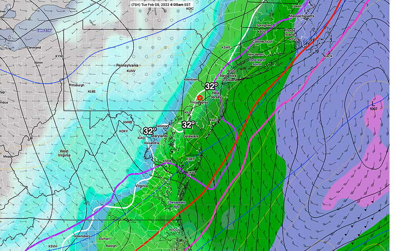
GEFS mode forecast 4 AM Tuesday (Click on image for a larger view.)
Cold high pressure will build in behind the rain that moved away almost on schedule as forecast. A straight forward forecast for the weekend.
Fair and very cold, with windy conditions, especially in the afternoon. High temperature 29.1º ± 0.9º. Wind chills will be in the teens. NBM model, Blue Bell.
Previously Posted Fri 7:52 PM —
Sunday
Sunny, occasional fair weather clouds. Much less windy. High temperature 33.0º ± 2.2º. NBM model, Blue Bell.
Looking Ahead…
Of interest is a low pressure system that will move off the coast Monday night into Tuesday morning. Most models have it missing us, possibly brushing the southern NJ shore with snow showers/flurries for us. I’ll keep an eye on it.
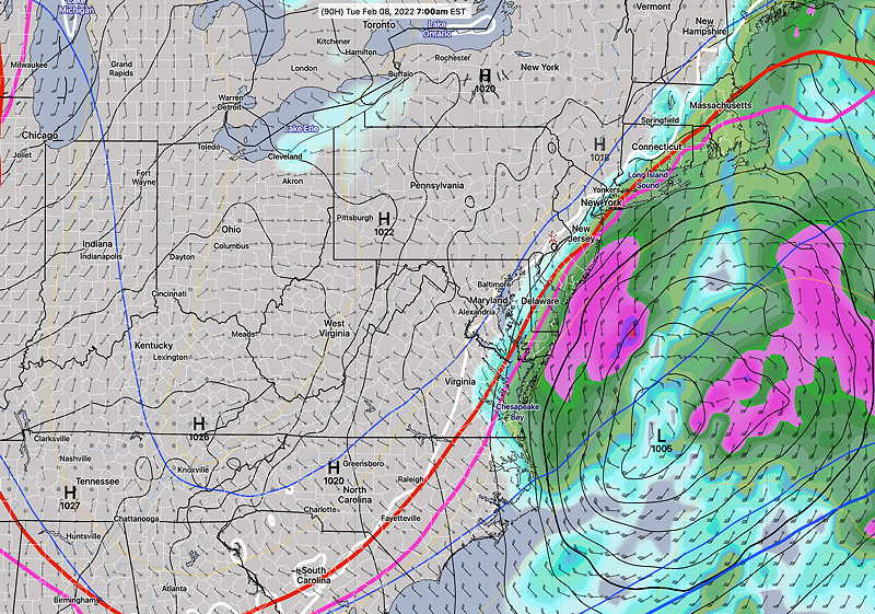
This afternoon’s ECMWF 18z forecast for Tues 7 AM (Click on image for a larger view.)