#Philadelphia #weather #PAwx
There’s almost no reason for a weather forecast for this weekend and certainly not a reason for many updates. You’ve heard the details on the radio or TV.
Sprawling dominant high pressure and a persistent upper air ridge will give us sunny skies and increasingly warm temperatures. I don’t see any rain here in the Philadelphia area until the end of October, possibly on Halloween, according to the NAEFS and into November according to the GFS AI model.
During this downtime, I’ve been exploring programming downloads and post processing of some the the experimental AI models.
Regular readers here have seen that the ECMWF-AIFS was quite impressive with its forecast of Helene and Milton.
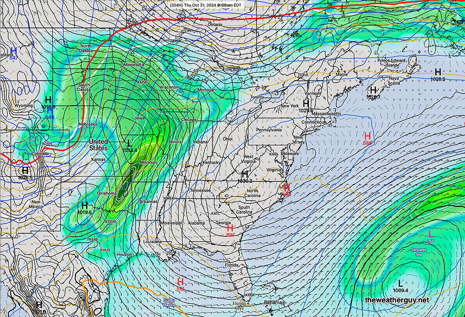
NOAA also has what they call an experimental “machine learning model” which is a combined effort with Google (Graphcast) and uses the weather database of the ECMWF. It compares current conditions to a weather database going back to the late 70s with several parameters at 13 vertical atmospheric levels to create a forecast.
Over the past week or so, I’ve been working on programming the download and post processing of what’s called the Experimental Graphcast-GFS model. (Weather model downloads are much more complex than simply “click here” for the model.)
Here’s its forecast for October 31st at 8 AM, showing the first area of rain on the map for awhile. Notice that the rain is blocked to our west by high pressure.