#Philadelphia #weather #PAwx
Friday Forecast
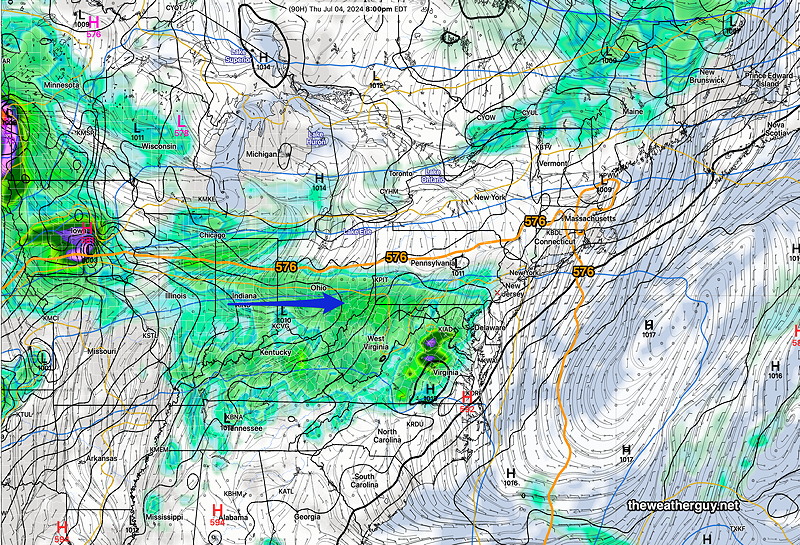
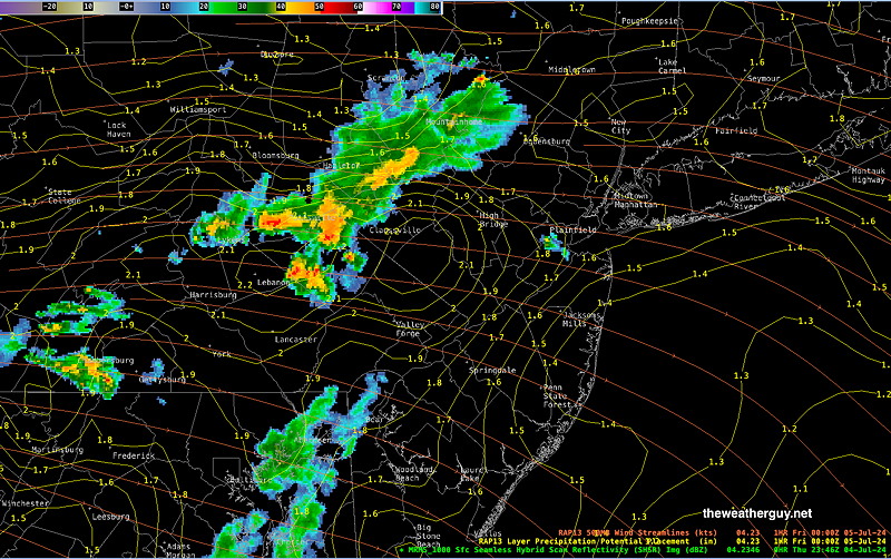
Posted Thursday 07/04/24 @ 7:56 PM — Friday will be similar to Thursday, but somewhat hotter. Highs in the mid 90s and humid. Unlike today, the greatest chance of showers and thunderstorms will be far northwest, north and northeast of us, possibly affecting the north Jersey shore.
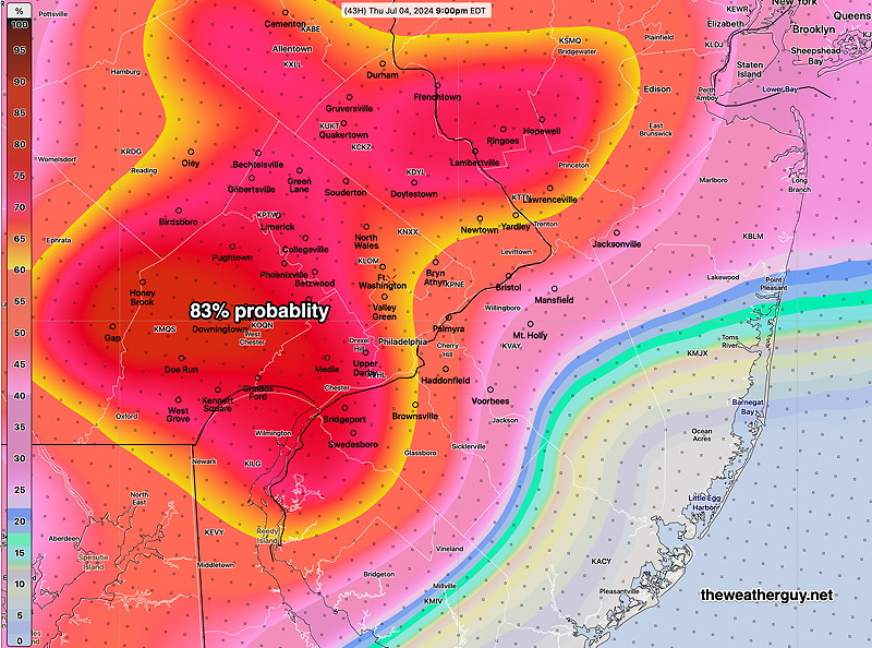
Here’s the 7:45 PM MRMS radar, which seems pretty close to this morning’s HRDPS forecast posted below.
4th of July Forecast
Posted Thursday 07/04/24 @ 12:42 PM —
No significant change in the forecast posted just below, based on this morning’s models.
Posted Thursday 07/04/24 @ 9:28 AM —
A mix of sun and occasional cloudiness for most of today. Cloudiness should be mostly thin, high cirrus cloud type.
Uncertainty remains regarding any thunderstorms – timing and location. The model trend over the past 12 hours has been a slight increase in the chance of widely scattered thunderstorms as early as 2 PM. Most likely location is far west of the city.
The latest ECMWF just available has some heavier showers/thundershower just south of the city during the evening hours. The HRDPS sort of captures the ECMWF and NOAA models with its precip forecast—
I’ll do a quick update later this morning
July 4th Weekend – Thursday – Sunday
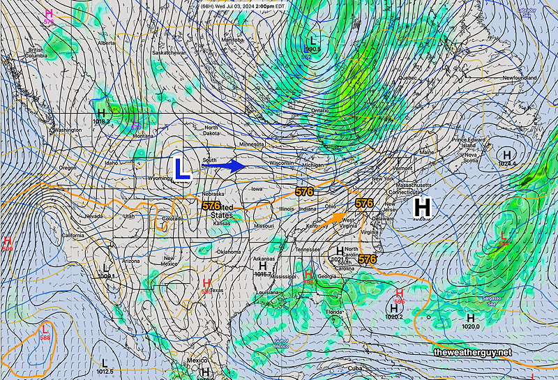
Posted Wednesday 07/03/24 @ 7:41 PM —
The latest GFS model is similar to the Canadian model and has a few showers and thunderstorms moving into the Philadelphia area Thursday evening. Any showers and storms will be scattered.
Unfortunately, an unsettled pattern develops for Friday and Saturday with a chance of of somewhat more widespread showers and thunderstorms, especially late afternoon and evening, but there’s some possibility throughout period. Otherwise sunshine with periods of cloudiness.
The greatest chance of thunderstorms in the immediate Philadelphia region will be late afternoon Saturday afternoon and evening.
All days appear to be hot with highs in the low 90s!
Dew points in the uncomfortable 70s through Saturday. Dew points drop on Sunday, so it will feel somewhat cooler. Sunday will be dry.
Posted Wednesday 07/03/24 @ 5:46 PM —
The Canadian models just became available after my recent post. They lean more toward some thunderstorm activity later in the evening, even into NJ. I’ve been impressed with the Canadian model’s thunderstorm predictions.
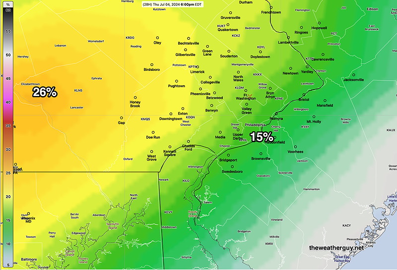
Posted Wednesday 07/03/24 @ 5:21 PM —
The trend for July 4th is hot and steamy with thunderstorms possible western areas. Temperatures will be in the 91-92º range (± 1.4º) for both Philadelphia and Blue Bell locations.
Dew points are forecast to be in the uncomfortable 70s, creating a heat index in the upper 90s—
It’s still a tough call about potential thunderstorms Thursday late afternoon into evening. They can’t be ruled out, especially west of the city—
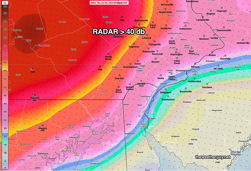
The HREF gives an indirect probability of thunderstorms through its probability of radar echoes greater than 40 db at 6 PM —
So the best we can say for tomorrow right now is that the further east of the city you are, the less chance of showers/thunderstorms in the early evening.
Look for an update tomorrow morning.
Posted Wednesday 07/03/24 @ 8:24 AM —
As updated last night, the latest models are showing an increased chance of thunderstorms moving further into the Philadelphia area than previously thought. Most of the activity should remain west of our area, but there is now a significant probability of some scattered showers and thunderstorms moving in as early as the afternoon and more likely in the evening hours.
Posted Tuesday 07/02/24 @ 9:57 PM —
Tonight’s HRRR shows some showers moving in Thursday afternoon, somewhat negating my earlier outlook. This may change again.
Posted Tuesday 07/02/24 @ 8:46 PM —
Thursday is looking hot again with temperatures at or just above 90º in the city, upper 80s surrounding areas.
There’s been a consistent forecast of showers/thunderstorms that barely make it into Philadelphia during the evening hours. Indeed, most models keep any showers and storms just to our west. This forecast continues to hold with the latest models, so fireworks displays in city and immediate surrounding areas. Western suburbs may see some showers/storms. It’s going to be close, so I’ll continue to monitor it.
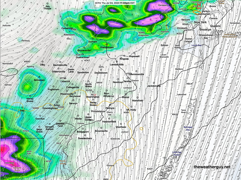
Here’s the latest NAM-NEST, showing the eastward extent of the showers/storms at 11 PM Thursday evening—
Monday through July 4th
Originally Posted Mon 8:20 AM —High pressure builds in for Monday and Tuesday with beautiful weather. By Wednesday, the high is offshore and a southerly flow of much warmer (hotter) air moves in late Wednesday—
By Thursday, July 4th, the heat dome has moved up past us and moisture associated with the low to our west is on our doorstep—