#Philadelphia #weather #PAwx
Monday Night into Tuesday Outlook
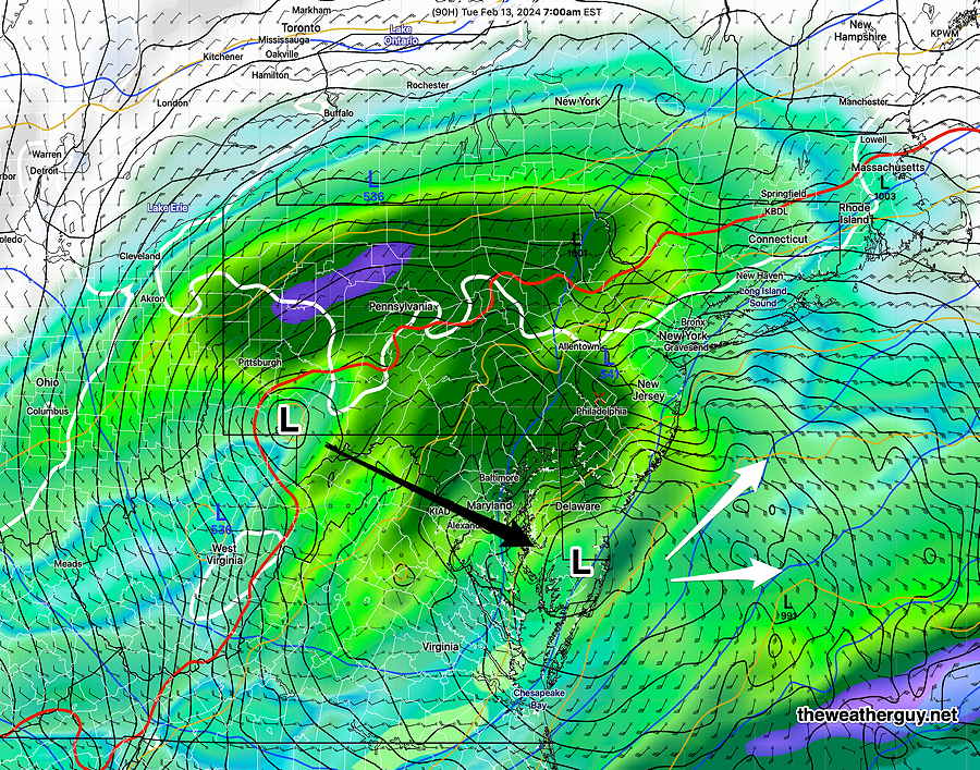
Posted Saturday 02/10/24 @ 10:16 PM — The storm for late Monday night into Tuesday will be a forecasting challenge. A secondary low will form off of the Delmarva coast, perhaps bringing in more cold air aloft. 1.1″ of water will fall, initially in the form of rain, mixing with and changing to wet snow, then tapering off during Tuesday afternoon. The changeover to snow or a wet mix near the city will occur between 5 and 8 AM Tuesday morning.
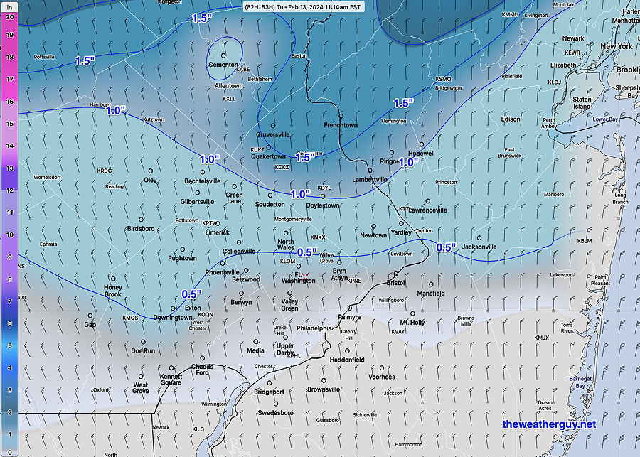
Here’s tonight’s NAM snow depth forecast by Tuesday afternoon—
Posted Saturday 02/10/24 @ 10:33 AM — Many models are showing highs today in the 60-62º range, but the GFS and HREF continue to keep us in the mid to upper 50s.
Here’s the latest NBM—

As for the ‘snow’ for Tuesday morning, little accumulating snow is expected. The latest GFS captures it well—
Updated Fri 9:12 PM — Tonight’s early models are trending a bit more towards some widely scattered light sprinkles during the day Saturday and a few heavier showers early evening with the cold front. The NBM shows low 60s in NJ.
Previously Posted Fri 6:05 PM —
The blocked pattern giving us this past week’s fair weather and now increasingly warm weather will become a thing of the past by late Monday. But first things first.
A slow moving cold front will approach Saturday, preceded by clouds and the chance of light widely scattered sprinkles in mostly far western and northern suburbs. (An area of very light showers may move in during the early evening Saturday just ahead of the cold front. )
Most of the showers are expected to stay to our north and to our south on Saturday. Current water vapor shows the setup—

On Sunday, the front stalls to our south and moisture moving to our south will spill up towards us in the form of cloudiness. No rain expeacted.
The moisture plume to our south will be the launch pad of a developing storm for late Monday into Tuesday morning.
Saturday
Cloudy. Showers mostly north west and south of our area as described above. The latest NBM has temperatures close to 60º, despite the cloudiness. The Canadian HRDPS, which tends to run warm, has us up to 60º while the GFS has us only in the mid 50s. Windy during the evening hours.
NBM high temperatures: Blue Bell, PA 59º Philadelphia, PA 60º
slightly above average uncertainty (based on standard deviation): ± 2.0º
Sunday
Cloudy, cooler, but still temps above average.
NBM high temperatures: Blue Bell, PA 49º Philadelphia, PA 51º
slightly above average uncertainty (based on standard deviation): ± 2.1º
Monday into Tuesday Outlook
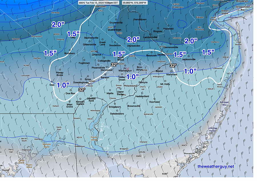
Another rainstorm, begins towards midnight Monday and changes to wet snow from northwest to southeast into the city. A heavy 1.4″ of water falling (rain) with about 0.5″- 1.5″ (preliminary estimate) wet snow accumulation upper Montgomery, western Chester and northern Bucks counties.
Forecasts have trended to show increased intensification of this low pressure system. Current lack of cold air will be a major factor in snow totals. The latest GFS shows secondary coastal low formation. Stay tuned for updates.