Philadelphia area Forecast including Labor Day
#weather #paweather #wx #pawx #philadelphia #phillywx
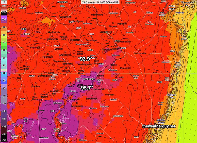
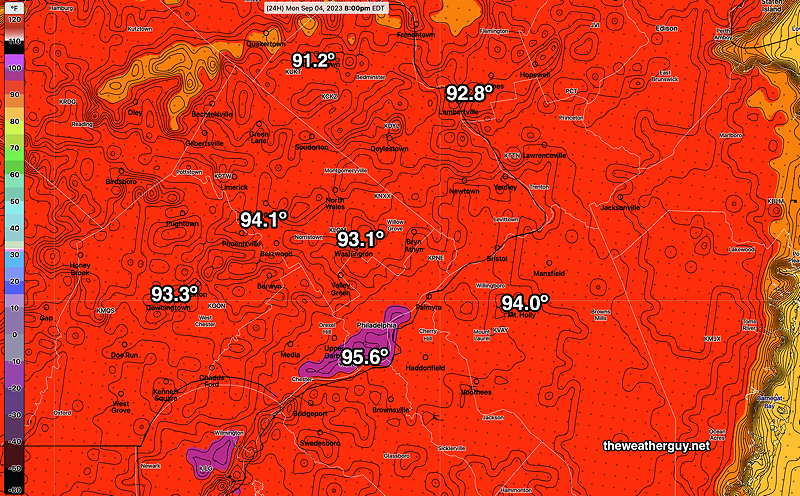
Monday- Heat Wave Continues
Updated Sun 09/03 @ 9:36 PM — High temperatures Sunday were 1º shy of last night’s NBM forecast (within the forecast standard deviation). The heat wave cranks up a notch on Monday.
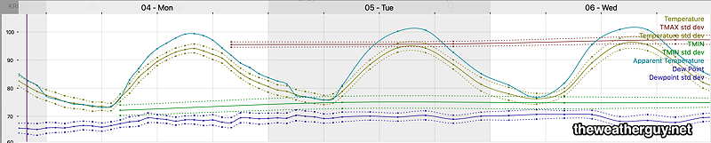
The latest NBM forecast (00z) just became available and it’s consistent with past forecasts—
High temperatures are forecast to rise about 1º each day through Wednesday and possibly Thursday. Here’s the NBM forecast for KPHL—
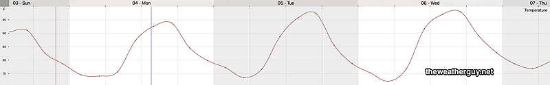
Here’s the latest ECMWF forecast temperature meteogram for Philadelphia Airport—
Update Sat 9/02 11:12 PM — The forecast remains on track for Sunday and Monday. I’m raising the expected high temperatures for Sunday. Monday’s forecast highs still look right.
Sunday
High temperature 91º ( NBM model— location Blue Bell, PA)
High temperature 93º ( NBM model— location Philadelphia, PA)
Monday
High temperature 94º ( NBM model— location Blue Bell, PA)
High temperature 96º ( NBM model— location Philadelphia, PA)
Previously Posted Fri 5:21 PM —
This is a fairly simple forecast and the details haven’t significantly changed over past days.
Following a delightful Saturday, the “heat dome” that has made the weather headlines this summer will expand eastward and northward, affecting our area starting Sunday.
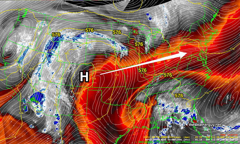
Expect unseasonably hot weather from Sunday through at least Thursday. On the positive side of things, dew points over the weekend will NOT be oppressive.
Saturday
Sunny and beautiful!
High temperature 82º ( NBM model— location Blue Bell, PA)
High temperature 83º ( NBM model— location Philadelphia, PA)
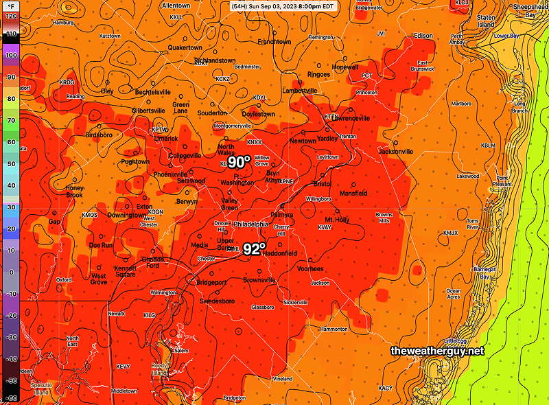
Sunday
Sunny and unseasonably hot, but with comfortable humidity.
High temperature 90º ( NBM model— location Blue Bell, PA)
High temperature 92º ( NBM model— location Philadelphia, PA)
Monday
Sunny and quite hot. Increased humidity with dew points in the mid 60s.
High temperature 94º ( NBM model— location Blue Bell, PA)
High temperature 96º ( NBM model— location Philadelphia, PA)